One of the many reasons I love going to France is because when we’re there my husband reminisces about his youth. On our last trip, he drove us from Saint-Raphaël to the Forêt Domaniale de l’Estérel by memory, his eyes lighting up and his speech accelerating every time we passed a familiar landmark.

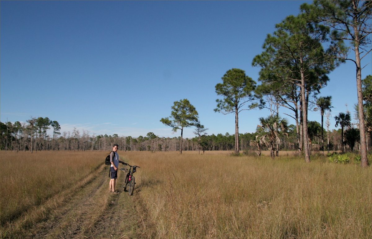
The trees in the foreground are maritime pine.
Carefully avoiding cyclists, we took the aptly titled Route De La Corniche through the towns of Boulouris and Agay. “Very little has changed,” my husband said, and I pictured him and his buddy following the same route on scooters, making ribald jokes and challenging themselves to appear adult.

The 4.3 mile (7km) Cap Roux Loop begins at Sainte-Baume and takes about three hours to complete. Ollie and Belle-maman took the paved circuit at the base of the mountain, which is an ideal walk for those who want to enjoy the beautiful surroundings, but don’t want to do the loop.

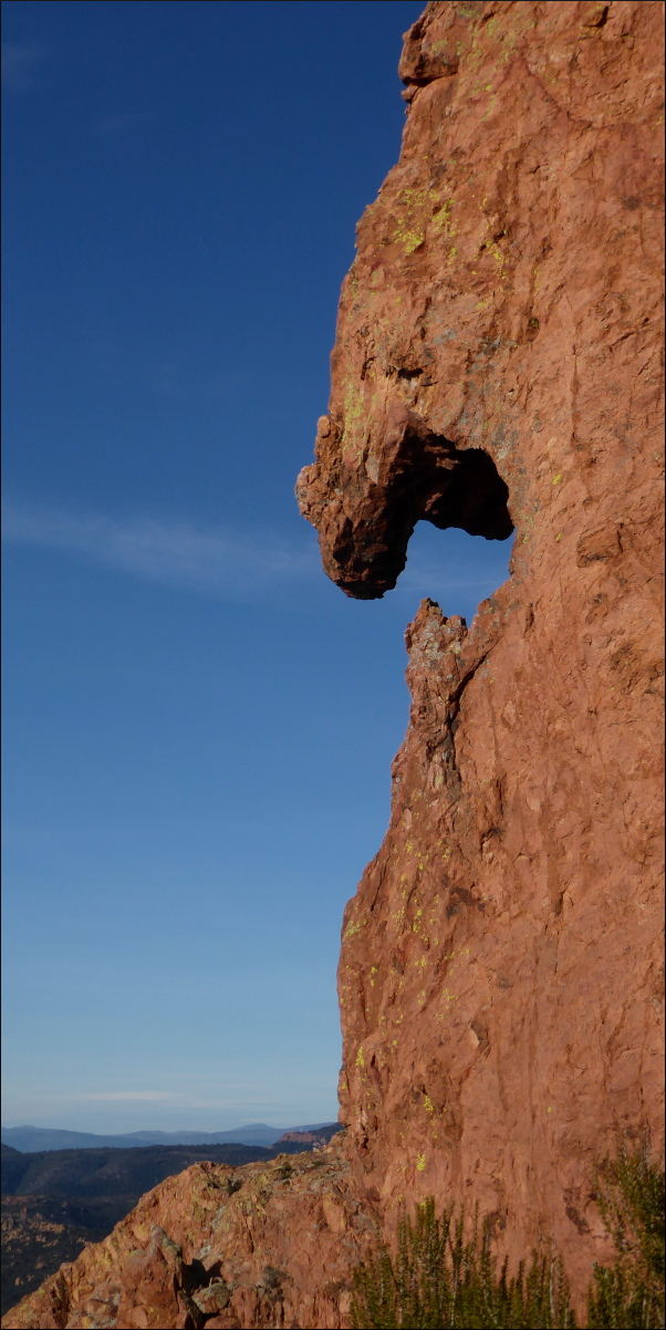
As we began the climb, three things became immediately apparent: the trail is rocky, the rocks are red, and we were not alone.

Despite arriving early there were already many people on the trail. We were a varied assemblage. One woman appeared to perhaps have taken a wrong turn on her way to the shopping mall, dressed in brogues, tight jeans, a leather jacket and a cross-body shoulder purse with spaghetti strap. And several times we overtook a man dressed in head-to-toe spandex that brought into sharp relief his many rippling muscles, who stopped frequently to pose for photographs on top of large rocks.

The rocks were created by volcanism, which is the reason they’re red. They’re called “porphyry,” and silica crystals embedded in them twinkle when you hold them up to the light.

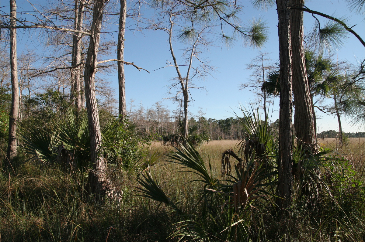
I couldn’t find many French websites about the trail, but those I did find noted the many short, gnarly, native cork oaks (chênes-lièges) that punctuate the landscape.

Not all parts of the trail were equally rocky, but it was necessary to always keep one eye on the ground underfoot to avoid stumbling, although the wee kiddies that whizzed past us had no such concern. I envied them their nimble, little feet and low center of gravity.
We had a picnic lunch of nectar of the gods, I kid you not. Memories of the mini-feuilletées at Boulangerie La Fournée in Saint-Raphaël are causing me to drool as I write this.

The site where we picnicked.
At the pinnacle (2,014 feet/614 m), there is a magnificent view of Cannes with the French Alps in the background.

And a plaque with a large map (aka “viewpoint indicator”).

The trail ascends on the east and descends on the west. On our way down, the ribbon-like trails in the forested mountains across the way reminded us that the region had been managed by the Church up until the French Revolution.

It was fun to imagine what it must have been like to be a monk following one of those trails, perhaps collecting medicinal herbs along the way.

Shortly before the trail ends, hikers participate in a custom whereby they pick up a rock and throw it onto a giant mound of rocks created by all the hikers who came before.

At this point the other hikers headed for the parking lot, but we chose to climb another six stories to see the ruined chapel of La Sainte-Baume and the “Grotte Chapelle,” or “Cave Chapel.” I marveled at the ability of the keystones to maintain the arched structure of the doorways, and wondered what the monks looked for when they peered out of the embrasure-like windows.

Can you spot the ruined chapel?
Just outside the chapel was a mossy landing that was home to some fabulous ferns. The batteries on our camera had run out by this time, or we would have snapped some photos. Likewise, we would have liked to have snapped some photos of the adjoining cave chapel and the interesting assortment of religious tokens left behind by Christian hikers over the last sixty or seventy years.

The trail to the ruins was steep and narrow and required the use of a metal rope to haul yourself up near the top, but it was worth the effort!
Resources Consulted:
Boulangerie La Fournée
Cap Roux, Saint-Raphaël Tourisme
Cap Roux Loop, Saint-Raphaël Tourisme
Corniche, Wikipedia
Esterel, Wikipedia
Massif de l’Esterel, Trip Advisor
Randonnée : Les balcons du Cap Roux (Estérel)
Pic du Cap Roux, Michelin Travel
Une forêt… de l’Estérel, Office National des Forêts