Trail bike trails

Memorial Day on Mount Shasta, May 2019

Mount Shasta jumped to the top of our list of places to explore when we stumbled across Bubba Suess’s blog, “Hike Mt Shasta”. “Hike Mt Shasta” seems to cover anything you could possibly want to know about exploring the Mount Shasta region. We decided to make the trip on the next long weekend, which happened to be Memorial Day.

To break the trip up a little, we stopped in Redding, site of the historic Carr Fire. Redding burned for over a month between July and August 2018, with 100-foot-wide fire tornadoes that generated gases reaching temperatures of 2,700 degrees and winds up to 165 mph. One of the areas to sustain the most damage was Whiskeytown National Recreational Area.

By May 2019, Whiskeytown’s Oak Bottom Campground had reopened with a warning on its website that “The Carr Fire has increased risks to visitors; falling trees, broken and hanging limbs, burned out stump holes, abandoned mine features, and loose rocks remain in much of the burned area. Remember to watch the ground you walk on, as well as above you.”

Despite the warning and 81 F (27 C) heat, the campground was booked full. The sites were small, but folk were courteous and quiet.

Being new to California, bear lockers were new to us

Oliver at the camp site

Shortly after setting up, the sky turned pink. Checking the weather, we learned that a giant storm was gathering, with the possibility of hail and tornadoes, 8 miles (13 km) to the west of us in Redding.

Mallards with a purpose

The hail pinged off the tent in a rather exciting way, but the storm was short-lived, and by morning the rain had dried up.

Whiskeytown Lake is actually a reservoir, created in 1963 to divert water from the Trinity River basin to the Sacramento River, named for the village of Whiskeytown, which, ironically, was inundated as a result of the reservoir.

A tour of the lake was a tour of Carr Fire burn scars — of charred land returning to life.

CA-299 highway is visible on the left in this photo

I was impressed by how well these Canada Geese blended in with the shadow of the overhanging bank. From a distance the camouflaging effect caused them to almost disappear.

Judge Francis Carr Power House

I regret that we didn’t stop to take photos along the I-5. The highway to Mt Shasta is a great, green corridor following an old railway line through sweeping canyons thick with pine trees. And the 170 million year old, 6000-feet tall granite spires known as Castle Crags are a sight to behold, even when viewed from the highway. Castle Crags State Park is definitely on our list of places to explore.

Railway towns dot the route. Dunsmuir is one such. It was originally called Pusher after the pusher locomotives that pushed freight trains over the steep mountains to the north of Dunsmuir. The town was later renamed Dunsmuir after a Canadian coal baron, in exchange for money to build a municipal fountain (San Francisco Chronicle).

We soaked in the scenery over a beer at Dunsmuir Brewery Works, a popular spot with lots of outdoor seating and a good selection of craft brews.

campsite setting

In Mount Shasta we stayed at Reynolds Resort on Lake Siskiyou. There were so few campers that it felt like we had the park to ourselves.

We spent all our time cycling on and around the Lake Siskiyou Trail. Wagon Creek Arm Bridge was out, making it impossible to make the full circuit, despite valiant attempts to portage our bikes through the freezing cold water.

In the distance Mount Shastina towers over Lake Siskiyou Bridge. Mount Shastina is the the highest of Mount Shasta’s four cones.

Some requisite facts about Mount Shasta: The United States Geological Survey rates it as a very high-threat volcano; its last eruption was in 1786; it erupts every 600 years; it is about 593,000 years old; it is made up of four overlapping volcanic cones named Shastina, Misery, Hotlum and Sargents Ridge.

Despite being Memorial Day weekend, there was hardly any traffic on the trail.

It was the perfect ride for taking in the scenery — paved paths and double-track dirt trails with almost no ascent.

The only part of the trail that presented any challenge was the Chalet Trail alternate route (seen above), which was way too narrow for my liking at about a foot (30 cm) wide in some places.

Lake Siskiyou Bridge

Our terminus on the other side of the absent Wagon Creek Arm Bridge.

On our way home we stopped at Shasta Dam, the eighth-tallest dam in the United States, built between 1935 and 1945. The gift shop had an excellent selection of reference books!

Shasta Dam

RESOURCES CONSULTED
The 4 Eruption Cones of Mount Shasta, Hike Mt Shasta by Bubba Souss (12 January 2018) – includes diagrams
Border to Border: Essential road trip stops along I-5, Roadtrippers (13 May 2016)
Castle Crags State Park, California Department of Parks and Recreation
Dunsmuir Brewery Works
Feature Detail Report for: Whiskeytown Lake, USGS
Hike Mt Shasta, Bubba Suess
Judge Francis Carr Powerplant, Bureau of Reclamation Projects and Facilities
Lake Siskiyou Camp Resort
Lake Siskiyou Trail Loop – includes directions and map
Little Town of Dunsmuir is Big on Trains, San Francisco Chronicle (13 July 2016)
Oak Bottom Campground, Recreation.gov
Reynolds Resorts
Soaking up Shasta setting/Railroad towns, vintage hotels and hot springs in northern woods, SFGate (3 September 2016)
Things to do in Redding (Tripadvisor)
Visit Redding
Whiskeytown National Recreation Area, National Park Service
Work on the Chalet Trail, Mount Shasta Trail Association

La Gloria Road and the Bold Cow, Apr 2019

Cycling La Gloria Road to the summit of Gabilan Mountain Range (it’s highest peak is 3,455’/1,053 m), in San Benito County, is one of my favorite California adventures to date. On the way, we stopped at CalFire Bear Valley Station (famous for its helicopter), near the turn off to La Gloria Road, to ask for advice regarding where to park.

The friendly firefighters said we’re welcome to park at the fire station when they know they won’t need to leave the station, which requires them to lock the gate to the parking lot and helipad. But they did have to leave the station that day, and so recommended finding a place to park on the side of La Gloria Road. I was glad we did, because the initial ascent up La Gloria Road is pretty steep.

The 1 1/2 lane, graded dirt road has been in use for over a hundred years. It had recently been graded, but there was already some washboarding, as well as tree roots, rocks and snakes to avoid – all of which added some fun, technical challenges to the ride.

Gopher snake (Pituophis catenifer catenifer)? It was about 4′ (1.2 m) long.

The road was perfectly quiet. Over the course of five hours, we saw a handful of trucks – the inhabitants all smiled and waved, and gave us plenty of clearance – and an SUV with fishing rods poking out of the back.

Flame skimmer (Libellula saturata)?

The ride to the summit was easy and the ascent gradual, but the ride back required some skill. The biggest challenge was remaining in control on the bends, where it was easy to skid out of control in the loose dirt.

We had carefully selected a sunny, spring day for the ride. It was 20°C (70°F) with a gentle breeze, and as we approached the summit, the cooling effect of Monterey Bay added a freshness to the air that we could feel in our lungs.

Golden poppy (Eschscholzia californica), California’s state flower.

The landscape was breathtaking – pristine, unusual, diverse. At the summit, a meadow stretched across the horizon. And it. smelled. heavenly! Every so often a breeze would waft a fragrance resembling Old Spice cologne across our noses!

It was past peak wildflower season in California, and yet sections of this meadow were blanketed with flowers.

But perhaps the most memorable part of the ride was an encounter with a cow. As a kid, my brothers and I would fall over laughing at my dad’s animal noises. His cow-noise was the best. Far from sounding like the consonant+vowel phoneme pair kids growing up in Australia in the 1980s were introduced to in their first few days of school – i.e., “moo” – my dad’s cow vocalization tapped into a phoneme rarely used in the English language. His cow-noise is a very French-sounding “mœ.”

Gauthier had just left to scope out some more of the road, when a little, black cow head appeared above the grassy trench where we were picnicking. Naturally I greeted it with my most charming “mœ.” “Hello cute, cow fellow,” I hoped to communicate, “You have the most lovely pasture. I hope you don’t mind us sharing it with you.”

The cow came closer, and we talked some more. I should say, I talked some more; the cow was silent. I’m not usually so gregarious, but it made constant eye contact, which I took to be a sign of encouragement. Then all of a sudden hoof beats, like the sound of powerfully undulating helicopter blades, approached from the distance.

The herd slowed to an amble as they neared the fence separating Oliver (who was far more interested in where Gauthier had gone than the cows), and I, and our new cow friends from them. Their vocalizations possessed a tone of authority. “What’s going on here?” they seemed to demand. “Mœ,” I said to them – and barely attracted their attention. So I opened up my diaphragm and let out a long, deep “mœ.” To see their heads whip around in unison and stare, you’d think they’d never heard a human say “mœ” before. I let out a couple more assertive “mœs,” intended to communicate that “we are all friends here,” and the herd collectively decided to depart, and trotted away.

The wire fence offered new insight into the character of our new friend. “Now why was the herd on one side of the fence, and this cow and her companions on the other?” I wondered to myself. I looked around. The fence was definitely intended to restrict the cows’ movement to a fenced-off enclosure. “A bold and artful escapee and her nervous followers,” I reasoned.

What the cow was musing – or mœsing – I cannot say, but apparently her thoughts led her to the conclusion that it would be safe to advance farther. As she rounded the top of the trench, her shiny black coat came into focus, as well as an alarming quantity of offal attached to her rear end, and a host of flies.

When we were finally face-to-face, she paused for a moment, then broke eye contact and looked over my shoulder towards the road. Then with a swish of her tail, as if to say, “See ya later,” she continued walking. After pausing again to give her companions – who had avoided me by taking a long, arced route across the trench – time to catch up, she turned left towards Soledad and sauntered down the road.

Resources Consulted:
AA Roads Forum, Topic: La Gloria Road
Commonly Encountered California Snakes, CaliforniaHerps.com
Flame Skimmer, International Union for Conservation of Nature’s Red List of Threatened Species
Gabilan Range, Revolvy
Santa Cruz County Amphibians and Reptile

A Wintry Ride on Old Haul Road, Jan 2019

It was a quiet ride along Pescadero Road (a minor road that follows the serpentine path of Pescadero Creek) to Old Haul Road. We passed working farms, cow pastures and cottages. As we passed the last farm before entering the thick, shady redwood forest surrounding Loma Mar (population 113), the temperature dropped abruptly, an interesting characteristic of this region, which is made up of hundreds of micro-climates.

After a while, we turned off Pescadero Creek Road onto Wurr Road…

and crossed Pescadero Creek.

Pescadero Creek

Wurr Road has a steel stringer bridge with a timber deck, built in 1962, around the time the State started buying back land from farmers and lumber companies.

Wurr Road Bridge

We stopped on the bridge for a little while and took in our surroundings. A cloud of smoke escaped from the chimney pipe of a nearby timber frame cabin and blew towards the coast, a fisher held his rod over the creek in search of trout and salmon as fishers must have done for centuries (pescadero means “fishing place”), and Pescadero Creek moved slowly over prehistoric river rocks, fallen trees, fish and fishermen’s feet on its journey back to the ocean.

Pescadero Creek County Park is San Mateo County’s largest park at 5,700 acres. It is one of three parks in the Pescadero Creek Park Complex, which also includes Sam McDonald County Park and Memorial County Park. Click here to be directed to a Parks Department brochure and map.

Wurr Road

Pescadero Creek County Park has miles of trails. Old Haul Road is one of them. The County website describes it as a multi-use route for hikers, bicyclists and equestrians that intersects with many of the other trails within the park.

Wurr Road

The website advises that visitors should be aware that Old Haul Road is the main access road for maintenance crews, and should expect to meet the occasional heavy truck and tractors along the way.

The website also explains that much of the road follows the route of a narrow gauge railroad line that hauled logs to the various mills that once flourished in the Santa Cruz Mountains. “Even today you can find rusty choker cables used to skid and lift logs on to flatcars,” it says.

An information board at the trail head (just past a small parking lot) offers the following information: “Pescadero Creek County Park shares its eastern border with Portola Redwoods State Park; trails also connect to Big Basin Redwoods State park. The ranger station in Memorial County Park serves as headquarters for all three parks. The park sits atop a deposit of natural gas and crude oil, which pools in Tarwater Creek and seeps into Jones Gulch Creek. Trees in the park include coast redwood, Santa Cruz cypress, tanoak, and knobcone pine. Visitors may see black-tailed deer and occasional coyote and mountain lions.”

As a beginner mountain biker, the 5.7 mile (9.2 km) trail was an absolute blast to ride. Having finally figured out how to use my gears effectively, the intermittent humps, none higher than 369 feet (112 m) and cumulatively totaling about 1350 feet (411 m), were a thrill to ride over.

The only other people we saw were a group of boys accompanied by an adult, all on mountain bikes, and a ranger in a pickup truck. One of the young mountain bikers made me laugh when he yelled at the top of his lungs, “I-can’t-ride-any-more!” I thought to myself, “If his little lungs can create sounds that are capable of reaching that decibel, he’ll be alright.”

Gliophorus psittacinus (parrot mushroom)?

Galerina Marginata (Autumn Galerina)?

A terrible photo, but an exciting find: a turret spider’s burrow! We find them easily now. When spiderlings leave their mother’s burrow, they don’t venture far (because they’re small and dehydrate easily), so it’s common to find a large turret surrounded by several smaller ones. We’ve seen up to a dozen!

The banana slug… not a relative of the banana spider. They grow up to 10 inches (25 cm) long! The hole in the side of its body (they’re hermaphrodites) is called a Pneumostome. Also called a breathing pore, it allows air to enter the animal’s single lung,

Donkeys!

Resources Consulted:
California banana slugs: Fun Facts About Our Vibrant, Terrestrial Molluscs, Golden Gates Natural Parks Conservancy
California Fungi—Gliophorus psittacinus, MykoWeb
“Five Common Mushrooms that can Poison Your Pet,” by By Dr. Tina Wismer for VetStreet
Old Haul Road, Bay Area Mountain Bike Rides
Old Haul Road, County of San Mateo Parks Department
Pescadero Creek (Wikipedia)
Turret Spider, Friends of Edgewood
“Turret Spiders Launch Surprise Attacks From Tiny Towers,” by Josh Cassidy for KQED Science
Wurr Road Bridge, Bridgehunter.com Historic and Notable Bridges of the U.S.

Cycling Monterey Wine Country, Jan 2019

In his indefatigable quest to find flat routes that my battered but trusty three-speed could handle, my husband discovered River Road, a quiet, paved road through Monterey wine country. As it turned out, the new bike was ready before we had a chance to explore River Road, so River Road became the location of my maiden voyage on the Monocog.

Early one brisk January morning, we traveled through Salinas River Valley – the “Silicon Valley” of agriculture – and found a convenient place to park on an expansive patch of dirt at the juncture of a fork in the road.

As we unloaded the bikes – flipped them upside down, attaching front wheels with the flick of a lever and screwing in pedals with a few turns of a wrench – a sudden and steady stream of vehicles in the same condition as my three-speed drove past. “An early shift getting off of work?” I wondered.

Facing Gabilan Mountains

To the left were the Gabilan Mountains (Pinnacles National Park was just visible in the distance), and to the right were the Santa Lucia Mountains, the eastern boundary of Big Sur.

Pinnacles National Park viewed from River Road

We were alone except for the fog, which, having engulfed much of the Santa Lucia, seemed to have paused for a glass of pinot noir.

Salinas River Valley is Monterey County’s primary wine growing region. The following information was taken from the Arroyo Seco Winegrowers website.

Positioned north-to-south, the Salinas River Valley is a direct and unobstructed corridor from the ocean, beginning at Monterey Bay. The geography of the corridor creates a “Thermal Rainbow”: as one moves south away from Monterey Bay the temperature rises dramatically. The effect is heightened by a very deep underwater canyon similar in size and scope to the Grand Canyon. It impacts the saturation and penetration of fog as well as the strength of winds that sweep through the valley. The result of this rare geographic condition is extreme cooling and regional temperature variances, all of which contribute to the uniqueness of Monterey County as a grape growing region.

Gradually vineyards replaced farms.

And the sun rose higher in the sky and burned off all the fog.

Dirt trails skirted the paved road

The ascent was negligible, but made for a fun ride back to the car.

On the way home we drove south on Aroyo Seco Road to Greenfield before turning around and stopping at Fourth Street Tap House in Gonzales where there are 28 beers on tap and everyone loves dogs.

Resources Consulted:
Arroyo Seco Rd, Cycling California
Aroyo Seco AVA, Aroyo Seco Wine Growers
Cycling the Arroyo Seco-Indians Road, Xasáuan Today
On A Mission Recap, Huckleberry Bicycles

A Mostly Flat Route in Nor Cal, May 2018

Start point: 36°40’21N 121°15’08W elev 257m
U-turn point: 36°31’04N 121°08’15W elev 415m
Total ascension (2 ways): 316m (1,037′)


Our bikes, which had taken us over the rounded hills of England’s South Downs, up and down the plateaus of Cornwall, and through French forests and Florida swamps, were not quite up to the task of taking us over the steep hills of California’s mountain ranges, where mountain biking was born. So we set to building new bikes. Until then, we sought out the flattest routes we could find.

On a sunny, still day in May, we took scenic Highway 25 in Paicines, near Hollister, San Benito County, all the way to the entrance of Pinnacles National Monument. It was a 15 mile (8 km) ride one way, and was mostly flat except for a single section that accounted for most of the ascent, which was a bit of a challenge on a three speed.

Highway 25 is also known as Airline Highway. Sections of the road are so flat and so straight that we wondered if the road had once served as a landing strip, but some cursory online research offered another explanation. Steve Johnson, of the Road Pickle blog, explained that “before the advent of radio communications, airplane pilots used the highway as a visual aid.”

The road follows the San Andreas fault. It was a very surreal experience to be straddling two tectonic plates.

The many folded hills looked like arms nestling grazing cattle.

The scenery is so beautiful that the road is eligible for State Scenic Highway designation.

If you go, you won’t regret stopping at Eva Mae’s Café . Although they don’t allow dogs inside the café, they insisted on bringing a table outside for us. The hospitality and the food were both excellent.

Resources Consulted:
“California Scenic Highway Mapping System,” Department of Transportation
“California State Route 25; the Airline Highway,” Sure, Why Not
“Earth Science: Chapter 7 – Faults, Earthquakes, and Landscapes,” Geology Cafe
“Eva Mae’s Café,” Facebook
“Fault line and fault zone illustrated for the San Andreas Fault in the Santa Cruz Mountains near San Jose, California,” Geology Cafe
“Immaculate Conception Church,” Mapquest
“Maps – Pinnacles National Park,” National Park Service
“Pinnacles National Park, California,” National Park Service
Road Pickle: The Adventures of Sash and Steve
“The San Andreas Fault,” Geology.com
State Route 25 (Wikipedia)
“Where’s the San Andreas Fault,” USGS website

Landing in Concord, Aug 2017

In August of 2017, we relocated to the San Francisco Bay Area. Not yet certain of where we would be working, we took the most affordable Airbnb we could find, which happened to be in Concord, in the foothills of Mount Diablo, the tallest mountain peak in the Bay Area at 3,849 ft (1,173 m) with one of the largest viewsheds in the Western United States. Apart from it’s geographic significance, it has religious significance to many Native Americans, and early Christian settlers told of miracles happening there. Mount Diablo State Park labels offer a lot of information about the hill’s significance.

Mount Diablo is in the far background of this picture, taken in Concord Community Park, which has some of the boldest, cheekiest squirrels Ollie or I have ever seen.

The huge size of the suburban roads and houses, and the brightness of the sun, which made the colors of the California landscape vivid, especially the reds and yellows of the parched hillsides, came as a shock after a year spent in the U.K.

This picture was taken in Concord Community Park, which is watered by a sprinkler system every night.

We were struck by the shape of these [valley oak? coastal live oak?] acorns. I’ve got one preserved at home, and it’s about 2 inches (5 cm) long.

No longer able to rely on public transportation, our bicycles became our main mode of transportation until we found a car. Riding on the street posed challenges as bike lanes don’t connect to one another and drivers in Concord don’t offer cyclists the courtesy that drivers in other regions of the Bay Area do. But Concord has something very special – the Contra Costa Canal Trail, which connects to the California State Riding and Hiking Trail.

Ollie is just discernable in the shadow.

Quoting from the East Bay Parks Regional District website: “The CA State Riding and Hiking Trail connects Martinez to Lime Ridge Open Space in Concord, beginning at the Carquinez Regional Shoreline. The trail passes over the Franklin Hills and connects with the John Muir Historical Site. It passes through the residential areas and parks of Martinez before entering Pleasant Hill where it shares a paved, multi-use trail with the Contra Costa Canal Trail. It follows the Canal Trail past Walnut Creek’s Larkey Park and Heather Farm Park then crosses Lime Ridge Open Space, residential areas and Newhall Community Park in Concord. The trail then continues southwest towards Lime Ridge and will eventually connect to Mt. Diablo State Park.”

This is the section of the Contra Costa Canal Trail that took us from our Airbnb, near Concord Community Park, to Rivendell Bicycle Works.

One of the many great things about the Contra Costa Trail is that it nearly intersects with BART stations in Concord and Walnut Creek. One of the first things we did upon arriving in Concord was to take the Trail to Rivendell Bicycle Works in Walnut Creek, home to one of our heroes, Grant Peterson. We were mildly star-struck when he adjusted my brakes on the spot. Not only does Rivendell design, manufacture and sell really cool lugged steel frame construction bikes, but it also sells tons of hard-to-find bike parts and accessories. We stocked up on “unracer” patches and other goodies.

Another fun trip to take is the Contra Costa Trail from Concord to the Walnut Creek BART Station, then the BART from Walnut Creek Station to Civic Center/UN Plaza Station, and then ride from the Civic Center/UN Plaza Station to Golden Gate Park. BART staff are super friendly and more than happy to help. But if you’ve never been to San Francisco before, take heed that the Civic Center/UN Plaza Station is an epicenter of San Francisco’s homelessness problem.

One day when we were cycling around Concord, we were surprised to stumble upon an Eichler neighborhood.

Joe Eichler was a post-WWII building developer who valued “correct” architectural aesthetic over making a large profit. He is one of the America’s most famous building developers. Most people assume he designed the Eichler homes (myself amongst them), but they were in fact originally designed by Anshen & Allen.

Eichler homes were affordably-priced, mass-produced, modern works of art consisting of 3 bedrooms/2 baths, blank front facades, flat or peaked rooves, rear and side walls of floor-to-ceiling glass, kitchens open to the family room, wood siding and post-and-beam ceilings, radiant-heat concrete floors, and atriums, spanning 650 to 1,500 square feet with enclosed backyards.

“The use of Anshen & Allens’ ‘concentric circle’ or ‘bull’s-eye’ site plan, which featured cul-de-sac streets that reduced vehicular traffic, created varied views of the houses and more privacy” (“Design for Living: Eichler Homes,” by Jerry Ditto, Lanning Stern, 1995).

Eichler homes sell for a pretty penny today, but originally targeted middle class families.

Significantly, Joe Eichler, a product of the frontier ideology of individualism and equality associated with California, sold to non-whites, facing down complaints from white home-owners.

Nearby there was an example of a far more modest Post-WWII, flat-roofed development.

We loved our stay in Concord. If you’re looking for a place to stay in the Bay Area, and don’t need to be close to San Francisco, consider Concord. It was a fantastic introduction to the California countryside, and only a 60 minute BART ride away from San Francisco. By the way, Mike Gianni’s Airbnb is amazing (look for my review posted in October 2017).

Resources Consulted:
Airbnb, Luxury 37′ Triple Slide Motorhome in Concord
Anshen & Allen (Wikipedia)
Bay Area Rapid Transit (BART), About
California Department of Parks and Recreation, Mount Diablo State Park
California State Riding and Hiking Trail (list of trails)
City of Concord California, Parks
Ditto, Jerry, Lanning Stern, Marvin Wax, Joseph L. Eichler, Joseph L. Eichler, and Joseph L. Eichler. 1995. Eichler homes: design for living. San Francisco: Chronicle Books.
East Bay Regional Park District, California Riding and Hiking Trial
Grant Peterson (Wikipedia)
List of summits of the San Francisco Bay Area (Wikipedia)
Lugged steel frame construction (Wikipedia)
Mount Diablo (Wikipedia)
Review of “Just Ride” by Grant Peterson in the New York Times, 27 July 2012
Rivendell Bicycle Works
UC Berkeley Environmental Deisgn Archives, Oakland & Imada
University of California Oak Woodland Management, California’s Oak Woodland Species

Bonjour Morvan, Aug 2017

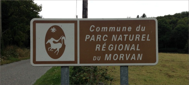
While in Burgundy, we also stopped at the Parc naturel regional du Morvan. Quoting from Wikipedia: “parcs natural regional (regional natural parks or PNRs) are public establishments in France between local authorities and the French national government covering an inhabited rural area of outstanding beauty, in order to protect the scenery and heritage as well as setting up sustainable economic development in the area.”

The Parc du Morvan is the site of Mont Beuvray, where the fortified city of Bibracte once stood, and where the Roman armies of Julius Caesar defeated the Gauls at the Battle of Bibracte in 58 BCE.

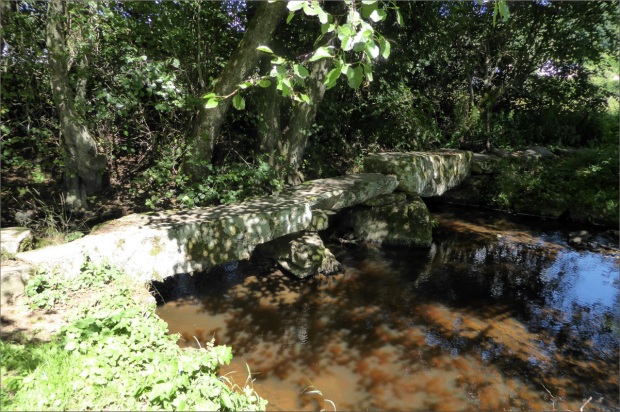
Do the monoliths used to erect this bridge date back to Bribracte? We’d like to think so.

A northerly extension of the Massif Central, it’s trees are frequently cut, so the forest is always young and the trees relatively small compared to other forests, such as the Fontainebleau.

The Parc du Morvan is also the site of the largest mountain biking venue of the French Cycling Federation (FFC), La Grande Traversee du Morvan. We saw only one other cyclist. He had a paper map attached to his handlebars, which I thought was pretty clever as the many intersecting trails, paths and roadways that zigzag the park can be difficult to navigate. We found this map to be useful (scroll down the page to find it) because it lets you select trails based on difficulty.

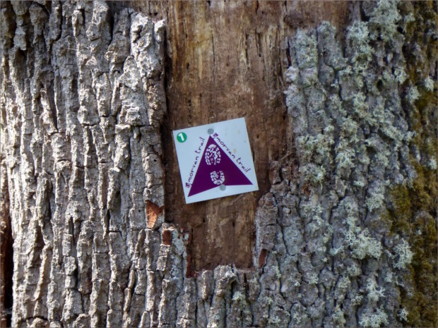
This is a marker for a hiking trail. Cycling trail markers have an illustration of a bicycle that consists of a circle next to an inverted triangle next to another circle.

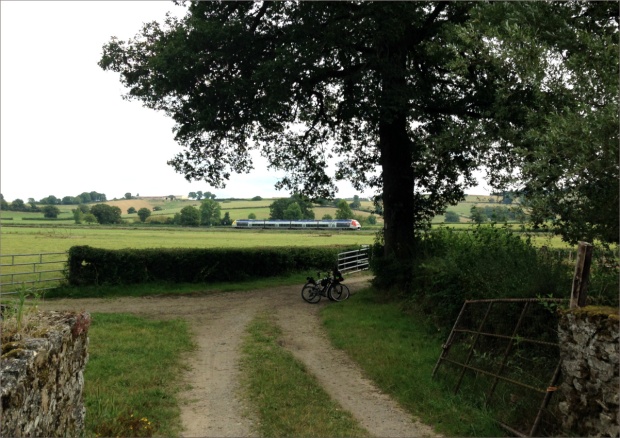
The ride took us over gentle slopes…

and a variety of paved and unpaved terrains.

Resources Consulted
Map of the Grande Traversee du Morvan (scroll down the page to find the map)
Bibracte (Wikipedia)
Comite Regional du Tourisme de Bourgogne-France-Comte, The Great Morvan Crossing on a Mountain Bike
Comite Regional du Tourisme de Bourgogne-France-Comte, The Morvan Lakes
Le Morvan par Bernard LeComte
Michelin Voyages, Parc Naturel Regional du Morvan
Regional Nature Parks of France (Wikipedia)

Bonjour Canal de Bourgogne, Aug 2017

The Canal de Bourgogne is a hop, skip and a jump away from the small, agricultural town of Soussey-sur-Brionne, where my spouse has family. The Canal was originally conceived of in 1605, but construction didn’t began until 1775, and was completed in 1832. It spans 150 miles (242 km) and connects the Atlantic Ocean to the Mediterranean Sea.

Lock near Pouilly en Auxois.

We traveled a very small section of the Canal, limiting our journeys to day-trips around Pouilly-en-Auxois. However, we saw quite a few cyclists, generally in couples, loaded down with enough gear to last several days.

I found the lock-houses (“maisons d’ecluse” in French) fascinating. Although they’re no longer inhabited by lock-keepers (“gardiens d’ecluse”), their location, abutting the trail wherever there is a lock, were vivid reminders of the days when movement through the Canal was hand- and horse-powered. The structure of each lock-house was consistent, but each bore the stamp of their owner in their color schemes and embellishments. All were beautifully maintained.

Lockhouse near Vandenesse.

Some antique agricultural equipment on display outside the Vandenesse lock-house. I used to work at Vizcaya Museum and Gardens, former residence of James Deering (1859–1925), heir to Deering Harvester Company (which became International Harvester Company), so seeing this old Deering equipment was quite a thrill. James Deering had a close relationship with the French, and was even awarded the French Legion of Honor.

Motorized vehicles are prohibited on the trail, but that doesn’t stop locals, young and old alike, from using it to zip from one village to the next on motorized scooters.

Chateauneuf-en-Auxois in the background, with the canal and canal boats in the foreground, make this an unmistakably French scene.

An old and weathered Cardinal butterfly (Argynnis Pandora) enjoying his last days.

Oliver says the grass along the Canal de Bourgogne is some of the best in the world!

Resources Consulted:
Bourgogne-Franche-Compte Tourisme: Chateauneuf-en-Auxois
Canal de Bourgogne (Wikipedia)
I Love Walking in France: Walking the Burgundy Canal
Travelling the Canals and Rivers of Europe: Pouilly en Auxois to Pouillenay
Trip Suggest: Discover Creancey in France!

Bonjour Villentrois, Aug 2017

For many generations, my spouse’s family has had a home in Villentrois (population 645) near Valençay, at the northern tip of the Indre departement. In the past, the town was famous for its mushrooms, which blanket the landscape in November. Mushrooms are also grown in deep caves cut out of the Tuffeau limestone hills. My spouse’s family home has such a cave. They keep you lovely and cool in the summer. Tuffeau limestone is also used to patch neighboring Loire Valley castles, the most famous of which is probably Chambord.

We cycled trails, wrought by tractors, that skirted the boundaries of farms and intersected major roadways, and dirt roads cut by lumber companies, patched with ceramic shards, that disappeared in the shadow of Forêt de Brouard. We avoided major roadways as the roads are small and drivers speed and are unused to cyclists. Small restaurants – none more authentic in France – quenched our hunger. Only one word of caution: check the weather forecast before you leave, as there aren’t very many places to take shelter during rainstorms.

Veuil has a cluster of restaurants that are worth risking a drenching for. We arrived late to Le P’Tit Veuil with a ferocious storm close on our heals, but they did not hesitate to welcome us in, and fed us with such alacrity that I have had to reconsider my definition of hospitality!

The dark area is the Forêt de Brouard. We got caught in a rainstorm while in the forest. The best shelter we could find was a young tree that slowed the passage of the rain, but in no way prevented it from reaching us. The storm lasted about thirty minutes! It was a fantastic ride, though.

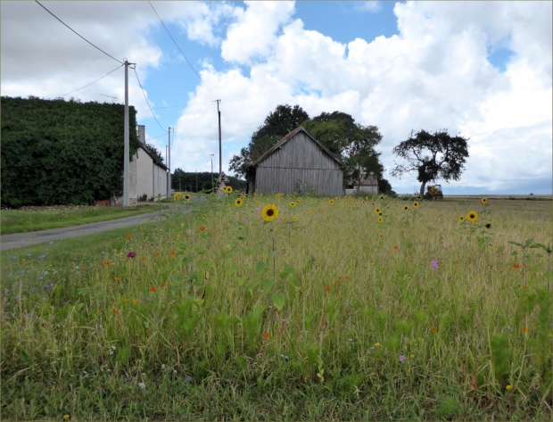
Sunflowers, or “tournesols” in French.

A house built with blocks of Tuffeau limestone.

This trail in the Forêt de Brouard was on the delimitation between two departments. The concept of “departement” is similar to “county” in English, but the jurisdiction of departements is wider than that of counties (“comte” in French), which are usually part of departements.

The entrance to a nest of European hornets. Wikipedia says they’re docile unless engaged in contest with another wasp, or defending their nest. They were unbothered by us.

Classic Valencay cheese, made with goats’ milk, little flattened pyramids of heaven.

Route Departemental (D33), road from Lucay-le-Male to Villentrois. The glass insulators on the power lines were old in the 1960s. When my spouse was a child, these funny, old insulators imprinted themselves in his memory so that they will forever be associated with Villentrois.

Resources Consulted:
A Gardener in France: Troglodyte flower show in central France
European Hornet (Wikipedia)
Cheese.com, Valencay

Bike Camping on an Undulating Plateau, Jul 2017

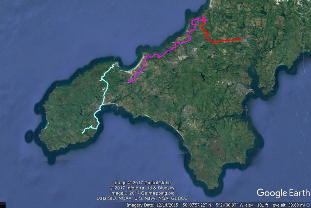
The route: Truro to St. Agnes, St. Agnes to Lelant Saltings, Lelant Saltings to St. Ives (by train), St. Ives to Lamorna via Penzance

Cycling Cornwall is not for the faint of heart. Arriving by train in Truro, the county capital, and stepping off the platform, we quickly learned what a twenty degree incline looks like. “An undulating plateau at three hundred feet” is how one local told us his secondary school teachers had taught him to regard Cornwall’s geography. “You notice the contradiction in terms?” he said, “A plateau by definition can’t undulate.” Cornwall has many plateaus atop many undulations, he explained, which we can attest to.

Truro to St. Agnes

Truro to St. Agnes was the only muddy leg of the trip.

On the way to St. Agnes

On the way to St. Agnes

Having missed a turn, we found ourselves at the end of a dirt road and confronted by three boys assembled under a tree who forthrightly informed us that “You’re on private property.” Thankfully their dad popped his head out of a door with an injunction to the boys to “Show them how to get back onto the trail.” A hidden bridge brought us here.

St. Agnes stone city marker.

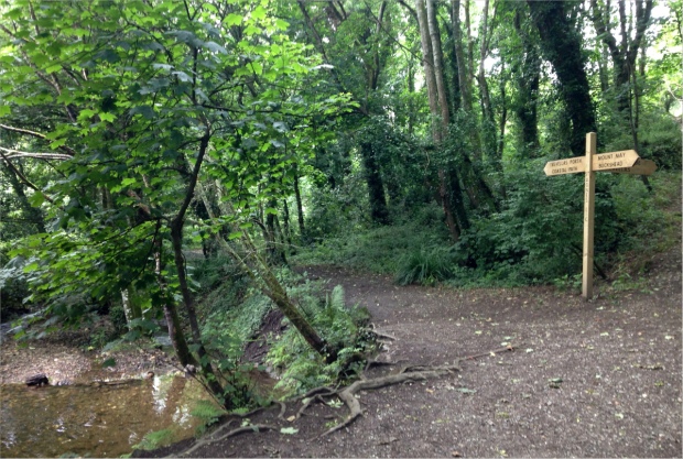
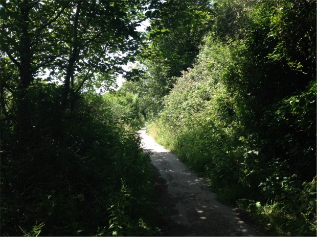
St Agnes was our first stop. We camped overnight at Trevellas Manor Farm Campsite, owned and operated by the Trevellas family since the 1840s. Every year the family undertakes a new improvement project, and this year it was renovating the toilet and shower facilities. They were fantastic. To get to the campsite, we followed a trail overgrown with foxgloves. Looking up the trail, the sky was a blue disc.

The overgrown trail to the Travellas Manor Farm Campsite

Foxgloves!

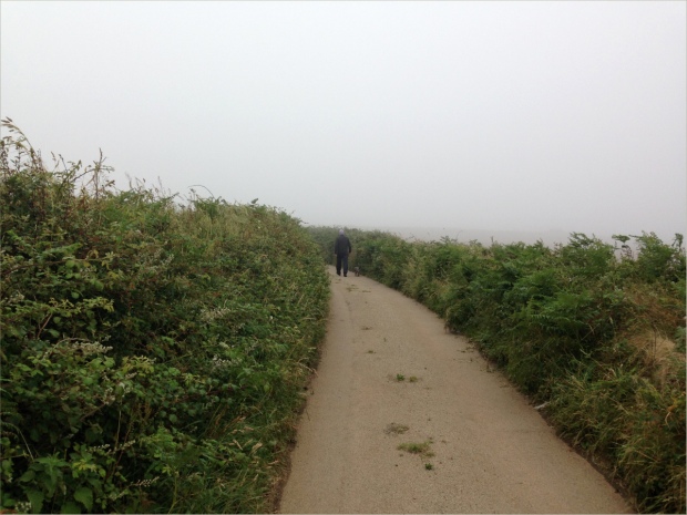
Shortly after setting up our tent, which the landlord thoughtfully located next to a westerly hedge to protect us from the wind, we were inundated with fog as thick as pea soup, as the saying goes. A dusk walk into town was somewhat treacherous. We took a narrow road, which we mistook for a minor road. As cars raced past us we were invisible in the falling light and the fog, which caused Gauthier to instruct me to “Be prepared to jump into the bushes,” by which he meant “Be prepared to leap into the thorny brambles that thickly cover the steeply inclined shoulder of the road.” Dinner at The Taphouse consisted of fresh crab, rocket salad with bell-shaped tomatoes, steaming ciabatta bread, and berries and meringue for dessert. It was worth the perilous journey into town.

Walking from the Travellas campsite to the narrow, but not so minor, road into town.

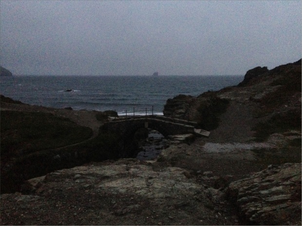
On the way back we followed a trail through the Blue Hills Tin Works. The site is now more famous for motorsport races than its rich industrial history. We stopped at Trevellas-Porth Beach. Crumbling smelt stacks poked out of the earth amidst ferns and flowering bushes, and a little stream flowed quietly under cracked stone bridges to meet waves that crashed onto a pebble beach. A hundred or so feet out to sea were shadowy sea stacks like the hands of a giant, rocky time keeper.

A Blue Hills Tin stream

Blue Hills Tin Works

Blue Hill Tin Works

Blue Hill Tin Works

Next we headed for St. Ives. The roads undulated with the curvaceous landscape, past coastal towns with names like Porthtowan and Portreath. Many a hill we walked our bikes up, panting. But there was always a pub to quench our thirst when we reached the top. We cheated a bit nearing the end of the day and took the train from Lelant Saltings Train Station to St. Ives.

On one of those plateaus. Near Portreath, on our way to St. Ives.

On the way to St. Ives

On the way to St. Ives

St. Agnes to Leland Saltings

St. Ives was bustling, and Ollie in his basket was a major attraction. I don’t know whether it was talking to so many strangers or the ride, but I was absolutely exhausted by the time we got to Ayr Park, the campsite where we were to spend the night. And hungry! So imagine our dismay when we discovered at 8:30 pm that restaurants in St. Ives close at 9 pm. For half an hour we searched in vain for a restaurant that would take dogs. Then we bumped into The Sloop, an inn dating back to 1312 with the only kitchen in town that stays open until 10 pm. And they took dogs!

St. Ives

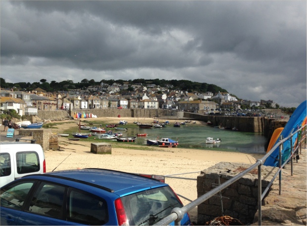
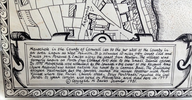
The next day we rode just south of Penzance via Mousehole (pronounced “moozle”) to Boleigh Farm, a working dairy farm with a fenced off field for campers. One of the farmers pronounced Gauthier’s name right on the first try, dispelling any doubts we had about the connection between the cultures of Cornwall and Brittany.

St. Ives to Lamorna via Penzance

On our way to Lamorna.

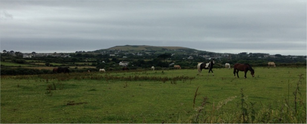
Moors!

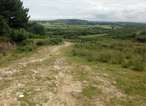
A very old, crumbled down stone fence on the moors.

A seagull with a view!

Boleigh Farm where the campsite was separated from cow paddocks by a three-rail fence and a hedge.

Dinner at the Lamorna Wink, in breath-taking Larmorna Valley, was phenomenal. A modest river flows down the valley, surrounded by enormous ferns and other plants we had only ever imagined could exist in pacific temperate rain forests, and were certainly not a feature of any other place we had visited in England.

Lamorna Cove

On day four we caught a train from Penzance back to London, vowing to return to Penzance as often as possible. And next time, to shop at the fish market! Before we left Cornwall, we had “cream tea,” which consists of tea and hot scones spread with jam and clotted cream… served the Cornish way with the cream on top of the jam.

Mousehole

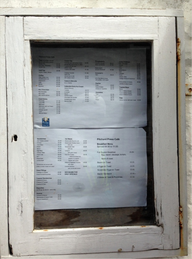
Apologies for the low res image, but this is where we had cream tea. Our waiter was unlike any waiter we’d ever had before. In appearance and accent he resembled a sailor. I was uncertain how to address him at first, but he was friendly, funny and knowledgeable, equally at ease talking about scones, pilchards and local history.