Architecture

Landing in Concord, Aug 2017

In August of 2017, we relocated to the San Francisco Bay Area. Not yet certain of where we would be working, we took the most affordable Airbnb we could find, which happened to be in Concord, in the foothills of Mount Diablo, the tallest mountain peak in the Bay Area at 3,849 ft (1,173 m) with one of the largest viewsheds in the Western United States. Apart from it’s geographic significance, it has religious significance to many Native Americans, and early Christian settlers told of miracles happening there. Mount Diablo State Park labels offer a lot of information about the hill’s significance.

Mount Diablo is in the far background of this picture, taken in Concord Community Park, which has some of the boldest, cheekiest squirrels Ollie or I have ever seen.

The huge size of the suburban roads and houses, and the brightness of the sun, which made the colors of the California landscape vivid, especially the reds and yellows of the parched hillsides, came as a shock after a year spent in the U.K.

This picture was taken in Concord Community Park, which is watered by a sprinkler system every night.

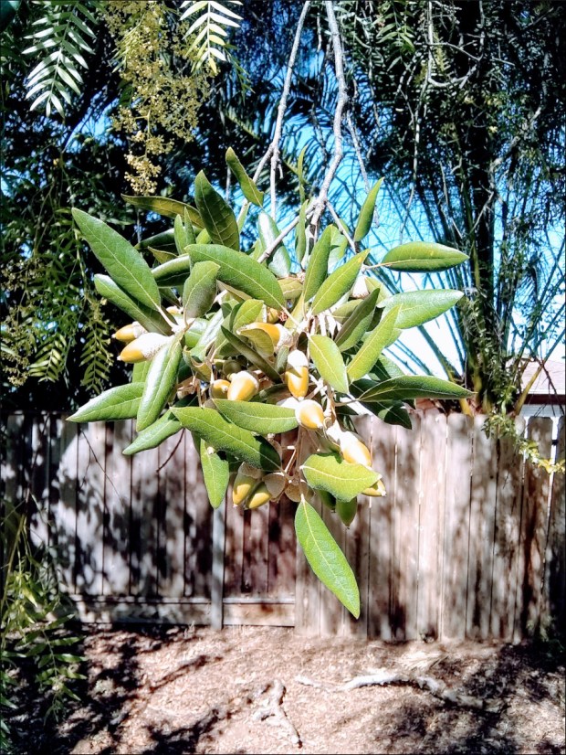
We were struck by the shape of these [valley oak? coastal live oak?] acorns. I’ve got one preserved at home, and it’s about 2 inches (5 cm) long.

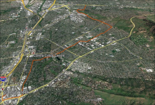
No longer able to rely on public transportation, our bicycles became our main mode of transportation until we found a car. Riding on the street posed challenges as bike lanes don’t connect to one another and drivers in Concord don’t offer cyclists the courtesy that drivers in other regions of the Bay Area do. But Concord has something very special – the Contra Costa Canal Trail, which connects to the California State Riding and Hiking Trail.

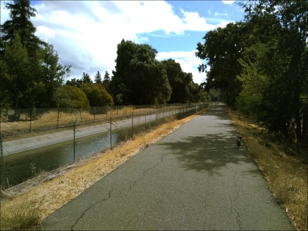
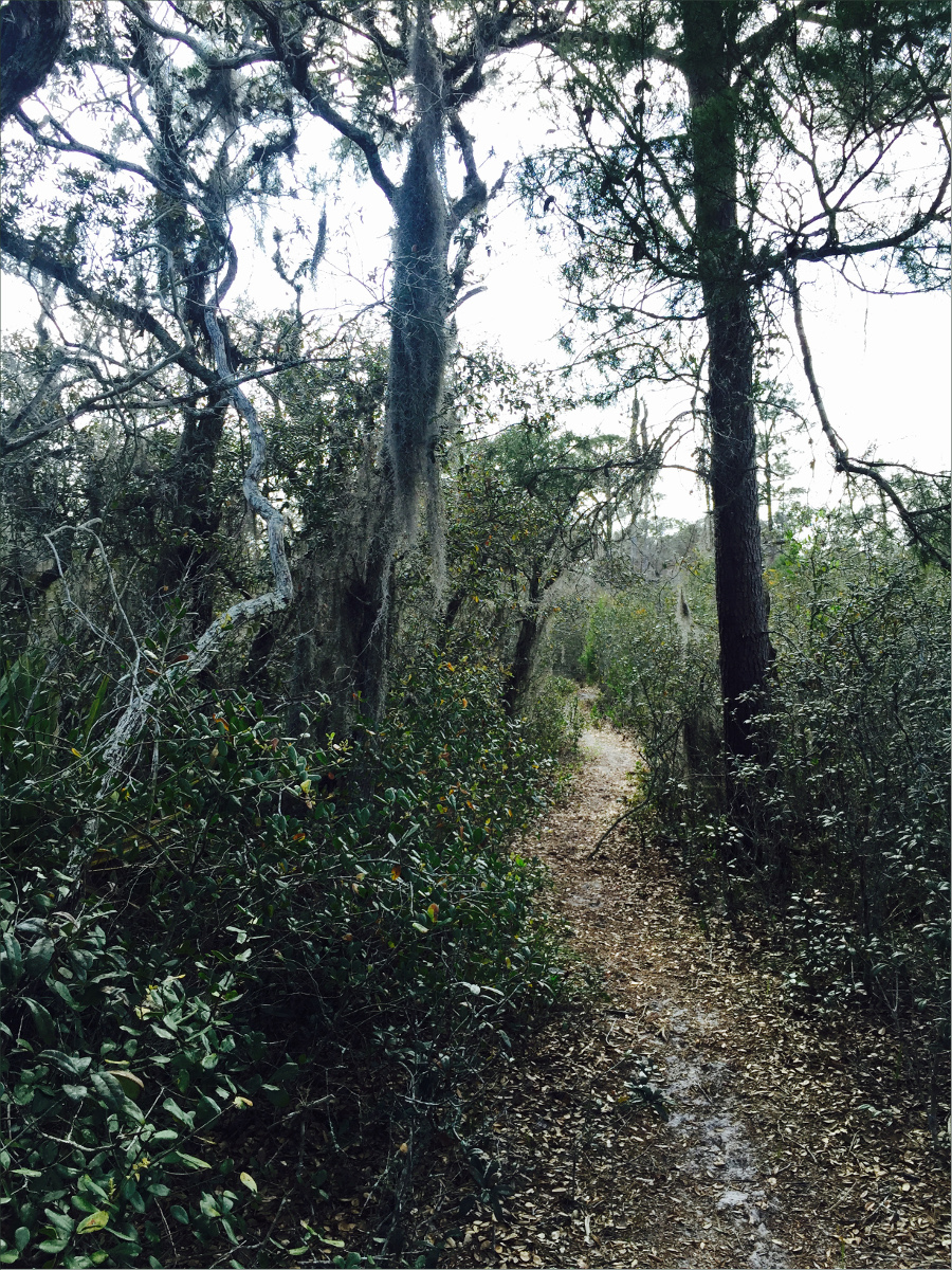
Ollie is just discernable in the shadow.

Quoting from the East Bay Parks Regional District website: “The CA State Riding and Hiking Trail connects Martinez to Lime Ridge Open Space in Concord, beginning at the Carquinez Regional Shoreline. The trail passes over the Franklin Hills and connects with the John Muir Historical Site. It passes through the residential areas and parks of Martinez before entering Pleasant Hill where it shares a paved, multi-use trail with the Contra Costa Canal Trail. It follows the Canal Trail past Walnut Creek’s Larkey Park and Heather Farm Park then crosses Lime Ridge Open Space, residential areas and Newhall Community Park in Concord. The trail then continues southwest towards Lime Ridge and will eventually connect to Mt. Diablo State Park.”

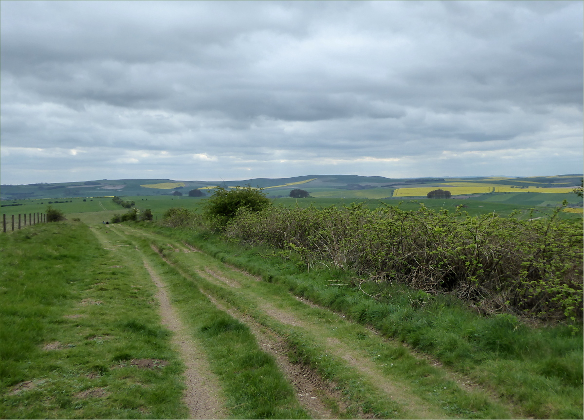
This is the section of the Contra Costa Canal Trail that took us from our Airbnb, near Concord Community Park, to Rivendell Bicycle Works.

One of the many great things about the Contra Costa Trail is that it nearly intersects with BART stations in Concord and Walnut Creek. One of the first things we did upon arriving in Concord was to take the Trail to Rivendell Bicycle Works in Walnut Creek, home to one of our heroes, Grant Peterson. We were mildly star-struck when he adjusted my brakes on the spot. Not only does Rivendell design, manufacture and sell really cool lugged steel frame construction bikes, but it also sells tons of hard-to-find bike parts and accessories. We stocked up on “unracer” patches and other goodies.

Another fun trip to take is the Contra Costa Trail from Concord to the Walnut Creek BART Station, then the BART from Walnut Creek Station to Civic Center/UN Plaza Station, and then ride from the Civic Center/UN Plaza Station to Golden Gate Park. BART staff are super friendly and more than happy to help. But if you’ve never been to San Francisco before, take heed that the Civic Center/UN Plaza Station is an epicenter of San Francisco’s homelessness problem.

One day when we were cycling around Concord, we were surprised to stumble upon an Eichler neighborhood.

Joe Eichler was a post-WWII building developer who valued “correct” architectural aesthetic over making a large profit. He is one of the America’s most famous building developers. Most people assume he designed the Eichler homes (myself amongst them), but they were in fact originally designed by Anshen & Allen.

Eichler homes were affordably-priced, mass-produced, modern works of art consisting of 3 bedrooms/2 baths, blank front facades, flat or peaked rooves, rear and side walls of floor-to-ceiling glass, kitchens open to the family room, wood siding and post-and-beam ceilings, radiant-heat concrete floors, and atriums, spanning 650 to 1,500 square feet with enclosed backyards.

“The use of Anshen & Allens’ ‘concentric circle’ or ‘bull’s-eye’ site plan, which featured cul-de-sac streets that reduced vehicular traffic, created varied views of the houses and more privacy” (“Design for Living: Eichler Homes,” by Jerry Ditto, Lanning Stern, 1995).

Eichler homes sell for a pretty penny today, but originally targeted middle class families.

Significantly, Joe Eichler, a product of the frontier ideology of individualism and equality associated with California, sold to non-whites, facing down complaints from white home-owners.

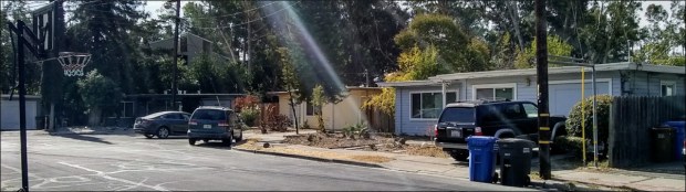
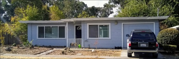
Nearby there was an example of a far more modest Post-WWII, flat-roofed development.

We loved our stay in Concord. If you’re looking for a place to stay in the Bay Area, and don’t need to be close to San Francisco, consider Concord. It was a fantastic introduction to the California countryside, and only a 60 minute BART ride away from San Francisco. By the way, Mike Gianni’s Airbnb is amazing (look for my review posted in October 2017).

Resources Consulted:
Airbnb, Luxury 37′ Triple Slide Motorhome in Concord
Anshen & Allen (Wikipedia)
Bay Area Rapid Transit (BART), About
California Department of Parks and Recreation, Mount Diablo State Park
California State Riding and Hiking Trail (list of trails)
City of Concord California, Parks
Ditto, Jerry, Lanning Stern, Marvin Wax, Joseph L. Eichler, Joseph L. Eichler, and Joseph L. Eichler. 1995. Eichler homes: design for living. San Francisco: Chronicle Books.
East Bay Regional Park District, California Riding and Hiking Trial
Grant Peterson (Wikipedia)
List of summits of the San Francisco Bay Area (Wikipedia)
Lugged steel frame construction (Wikipedia)
Mount Diablo (Wikipedia)
Review of “Just Ride” by Grant Peterson in the New York Times, 27 July 2012
Rivendell Bicycle Works
UC Berkeley Environmental Deisgn Archives, Oakland & Imada
University of California Oak Woodland Management, California’s Oak Woodland Species

Cycling The Ridgeway Trail – Day 1, Apr 2017

902 ft maximum height
National Trails The Ridgeway Trip Planner

We spent a lot of time at the public library when we first moved to the UK, and one day we checked out a travel guide about the ancient Ridgeway trail, Britain’s 5,000 year-old road. Captivated by visions of neolithic pilgrims, Roman soldiers, Viking and Saxon invaders, drovers and traders, we promised ourselves we would cycle it as soon as the weather warmed up.

Originally a complex of braided tracks along the 400-mile chalk crest of the North Wessex Downs and The Chilterns, some as much as a mile wide, with subsidiary ways diverging and coming together, today the exact course and width of the tracks is defined by earth banks, thorn hedges and barbed-wire fences. This change occurred over two-hundred years ago during the local Enclosure Acts of 1750, which saw common land transferred into private hands.

In 1972 the 87-mile central section was approved as The Ridgeway National Trail. Most of the remainder has been way-marked, however, and is shown on Ordinance Survey maps under different names. Some local landowners objected to the Trail, so in 1987 the Countryside Commission charged all local highway authorities with ensuring that every footpath be unblocked by the year 2000. Lawsuits were filed and today access to the Trail is unfettered.

Spectacular, bright-yellow fields of rapeseed were in bloom everywhere.

Spectacular, bright-yellow fields of rapeseed were in bloom everywhere.

The streets were eerily quiet on Good Friday morning when we cycled to Paddington Station via Hyde Park to catch the 0927 to Swindon. We were glad we’d made bike reservations as space for bikes is limited on GWR trains and some cyclists were turned away.

We had a thorough ride itinerary that considered routes, weather, accommodations and food for both ourselves and Ollie. Our route avoided car traffic as I can’t enjoy cycling with cars whizzing by. The plan: day one we would cycle Swindon to Avebury and back to Swindon (25 miles), day two we would cycle Swindon to Wantage (25 miles), and day three we would cycle Wantage to Reading (25 miles) where we would take the train back to London.

We used four mapping websites: 1) Sustrans provides a map of the National Cycle Network, or NCN, which is a series of safe, traffic-free paths and quiet on-road cycling and walking routes that connect to every major town and city in the United Kingdom; 2) CycleStreets caters to the needs of both confident and less confident cyclists and provides an exceptional map of bridleways and footpaths, some of which are all but hidden from the naked eye; 3) Walk4Life, originally government funded, provides trail characteristics, such as surface (flat, firm), barriers and hazards; and 4) GoogleEarth street-view helped us visualize the route.

Ollie patrols the perimeter at Three Trees farm shop.

Ollie patrols the perimeter at Three Trees farm shop.

We packed light. We carried 12kg, including Ollie and a thermos full of tea: Ollie – 5kg, Ollie’s bag – 800g, tea thermos and water – 2kg, change of clothes – 1.5kg, bike lock and tools – 1kg, food – 1.5kg. We used front racks rather than panniers as front racks distribute weight more evenly. Packing light was important because my bike has only three speeds.

The M40 pedestrian/cycle overpass.

The M4 pedestrian/cycle overpass.

NCN 45 connects to the Ridgeway and is well-marked and easy to find from Swindon Station. It’s a 30 to 40 minute cycle from the station to the trail. If you plan on taking this route, note that this section of NCN 45 follows both footpaths and minor roads, so pay attention to signposts.

We stopped at Three Trees farm shop, where we snacked on delicious scotch eggs and Belgian buns and picked up some Wiltshire blend tea. From Three Trees we took the NCN 45 northwest to some minor roads that took us through scenery out of a story book until we reached a track that led up the side of the down.

The track was paved for about three miles and then turned into a multiplicity of dirt-based surfaces for the duration of the ride to Avebury, which was to be our destination before heading back to Swindon for the night. We stopped several times to inflate or deflate our tires to adjust to trail conditions. There were few other cyclists, but many hikers. The trail is intersected by roads, so it is easy to ride or hike small sections.

Birdsong followed us throughout the trip as we passed through Marlborough Downs before reaching Avebury.

“In 2012 the Marlborough Downs farmers formed a unique partnership and began to work together to make space for nature on their farms. Originally government funded, the partnership involves over 30 farms covering 25,000 acres of Wiltshire countryside.”

“One of the most important geological sites in Britain. Natural events have created valleys with spectacular quantities of sarsen stones, which now support rare and unusual lichens. The remains of settlements, field systems, burial mounds, ancient tracks and the widespread working of sarsen stones show that people have worked and lived in this downland landscape for over 7,000 years. The reserve is part of the Avebury World Heritage Site.”


What we found most striking about the chalk grasslands of Fyfield Down were the giant, yellow-flowered broom bushes and the large, silicious sandstone boulders (i.e., sarsen stones) that were transported to the area through glacial action during the ice age.

Fairly significant sections of the trail are sadly deeply rutted by motor vehicle traffic, which is very detrimental to walkers and cyclists alike, as well as being ugly and unnatural-looking, although it does provide an outstanding opportunity to practice some technical riding. Riding the rutted parts in sustained rain, with puddles and mud, would be hellish, so it’s important to pay attention to the weather forecast.

It’s also uphill for a good third of the way. The combination of ruts, ascents and an 18 mph wind in our face made the ride challenging, but it was totally worth it.

Ridgeway trail terminates a few miles before Avebury in a gigantic mound complete with standing stones. The sarsen stones were dragged from the surrounding hills in the late Stone Age. We found it interesting that whereas henges with defensive purposes have ditches with external banks, Avebury Henge, like Stonehenge, has an inside ditch. We also found it interesting to note how well protected the Henge was from the wind, situated as it is in a valley.

Standing inside the bank, looking at the massive stones, contemplating the incredible amount of labor needed to create such a monument was awe-inspiring. English Heritage points out that henges such as Avebury’s “bear witness to the existence over many hundreds of years of a great civilisation in this part of Wessex. […] The sheer amount of labour required to excavate the huge ditches, to gather, transport and erect the massive stones, and to raise the strange mound of Silbury Hill, indicates the availability of a substantial population, and the quality of the work, particularly in the latter stages, shows their considerable skills.”

Apparently, by the 1930s many of the stones had fallen over and the site been disfigured by buildings. English Heritage explains that “the appearance of the site today owes much to Alexander Keiller, heir to a fortune made from the famous Keiller marmalade, who bought the site and cleared away buildings and re-erected many stones in the late 1930s.” I found out a little more about Alexander Keiller’s role from some documents stored at The National Archives.

In addition to exploring the Henge, we ate at the Red Lion where we were entertained with stories about thatch rooves and hidden rooms by a retired historic building conservation consultant, and admired St. James Church, the earliest parts of which date from 1,000 CE.

Lichen covered gravestones.

We did not have enough time to do Avebury justice. That would have taken at least four hours. Also, bringing a dog placed limits on what we could do. We would have liked to visit the 16th-century manor house (you can actually touch the furniture and lie on the beds!) and the Alexander Keiller Museum.

With the wind at our backs and a mostly downward journey, the trip back to Swindon was swift and fairly painless. It would be a lie to say we weren’t suffering a bit by the time we arrived at our hotel around 7pm. Among other aches and pains, I had somehow acquired a sunburn on my lips. We stayed at TravelLodge. It was clean, quiet, well-located, had a bar and 24 hour restaurant and, most importantly, accepted dogs and bikes.

Swindon is an interesting city rich in railway heritage. Swindon’s rail workers received health care that became a model for the NHS, and access to personal enrichment programs that included xylophone lessons. It also had the UK’s first lending library. Today it is home to Oxford University’s Bodleian Library book depository, which contains 153 miles of bookshelves. It also has the English Heritage National Monument Record Centre and the headquarters of the The National Trust. And apparently you can see iconic punk-rock bands, such as the U.K. Subs, play live at local dive-bars for £8 (if only we’d known this sooner)!

To read more about our experience cycling the Ridgeway Trial, see our posts for Day 2 and Day 3.

Resources Consulted
Atlas Obscura: Found A Hidden Stone Square Inside the World’s Largest Megalithic Stone Circles
Friends of the Ridgeway: The Ancient Ridgeway
Fylde Ramblers Walking Holidays: The Ridgeway, 4th April to 10th April 2013
History of Avebury Henge and Stone Circles
Introduction to Heritage Assets: Prehistoric Henges and Circles
Swindon (Wikipedia)
Walking World: Ridgeways

Archbold, Mar 2016

In March, we spent the Easter long-weekend here. This is Lake Wales Ridge, also called the Mid-Florida Ridge. The long, narrow dune extends 115 miles in length and four to 10 miles in width; the sands were deposited 650,000 years ago.

florida ridge

Doesn’t the outline of the southern end of the Ridge bear a striking resemblance to Florida’s southern coastline?

florida

I like to imagine that we traveled not to Highlands or Polk County, but back in time to prehistoric Florida, when the Ridge was a series of land islands connected to the southwestern United States by the now-sunken Florida Shelf. While our primary goal was to visit Archbold Biological Station, we took detours to Platt Branch Wildlife and Environmental Area, New Boot Heal Road, and a once-public road on a now-private ranch. We stayed overnight at Fisheating Creek Outpost .

Platt Branch Wildlife and Environmental Area
Managed by the Florida Fish and Wildlife Conservation Commission
27°03’00.5″ N 81°21’54.0″ W elev 100 ft

Bikes are prohibited on this other-worldly, sandy trail.

P1010086

P1010085

P1010087

We’re not sure, but it’s possible that we saw a Florida black bear here. Although it was too far away to tell, it was the right size and color. We also saw deer, scrub jays, sandhill cranes, and mockingbirds, as well as the below Polygana nana (Candyroot).

P1010089

Polygala nana (candyroot)

Just down the road from Platt Branch, we saw this gopher tortoise. We stopped in the middle of the road to photograph it. While we were stopped, a ranger pulled up beside us. “It’s incredible!” Gauthier exclaimed. The ranger smiled and replied, “This is their home.” Burrows dug by gopher tortoises provide refuge to many other animals during woodland fires and high summer temperatures.

P1010158

New Boot Heal Road
Start 27°05’15.47″ N 81°24’20.96″ W elev 85 ft
End 27°07’15.12″ N 81°26’51.61″ W elev 74 ft

This 10-mile ride took us along a mostly hard-pack road that zigs and zags in the pattern of… yes, a new boot heal. We passed by homes with large, beautifully maintained yards, ranches with hundreds of cows that stopped to watch us as we rode by, and a logged tree farm with the logs left stacked fifteen feet high in the middle of the road. The road ended at a dead end where a very lovely, yellow bird, perched upon a power line, sang us a song.

P1010145

P1010140

P1010155

Fisheating Creek Outpost
26°56’21.73″ N 81°19’06.17″ W elev 39 ft
Fisheating Creek Outpost, 7555 U.S. 27, Palmdale, Florida, 33944

Campsite map and rules

We’d stayed here before, but not on a holiday weekend… or during a big, televised soccer match. Oh boy did our fellow campers enjoy that match. It was not a tranquil stay, but the cook got to try out his newly designed, ultra light-weight camp stove and all the kids running about reminded me of the camping adventures of my youth: the feel of gumboot-clad shins wading in the cool water of yabbie-filled creeks, scaling dried-up waterfalls, and riding my bike ten miles into town to buy my first bikini.

campStove

“I can’t take it?” I overheard one kiddo ask his dad. “No,” was the unequivocal answer. “I can’t take it?” he asked again… and again. Finally, exasperated, the dad explained to the equally exasperated child, “You can’t carry a 200 pound alligator.”

P1010123

The view from our tent

P1010129

A Once-Public Road
Start 27°05’29.90″ N 81°28’54.33″ W elev 72 ft
End 27°06’15.92″ N 81°29’04.10″ W elev 69 ft

I am a stickler for rules, so I reluctantly ignored the large sign indicating that the property we were about to enter was private. “On the map it looks like a public road” Gauthier patiently explained.

privateProperty_1200

It wasn’t fifteen minutes before we were escorted out by a very polite woman, vaguely resembling my sister-in-law, with an SUV full of lil ‘uns. “It was a public road a long time ago,” she corrected us with apologetic eyes, but a firmly set jaw. In Europe, it’s not uncommon for private property to be intersected by public roads.

P1010112

P1010111

Archbold Biological Station
123 Main Dr, Venus, FL 33960
(863) 465-2571
27°10’58.19″ N 81°21’07.50″ W elev 137 ft

Archbold Biological Station has fantastic labels. The trails are labelled, the buildings are labelled, the donation box is labelled, the reused-concrete bridge is labelled. I love labels and I love Archbold Biological Station, even though they don’t allow dogs (hence no Ollie pictures in this post).

archboldAr2_1200

habitats_1200

The labels encouraged me to touch the curled-up, waxy scrub oak leaves so that I’ll never forget them, and observe the different plant species on either side of a trail with two different elevations – one side was sandy and the other side had a layer of clay. I also learned how to tell scrub palmettos apart from saw palmettos. I love that scrub jays line their nests with the fibers that grow along the edge of scrub palmetto leaves.

archboldTrail1_1200

Shrub-like scrub oak (Quercus inopina), sand live oak (Q. geminata), Chapman oak (Q. chapmanii) and myrtle oak (Q. myrtifolia) lined the trail.

archboldTrail3_1200

It’s hard to tell saw palmettos and scrub palmettos apart, as you can see in this photo.

moss_1200

We didn’t know it at the time, but this captivating species of lichen, Cladonia perforata (Florida perforate reindeer lichen), is endangered.

It’s wonderful that the Roebling and Archbold families recognized early on how special the Ridge ecosystem is and preserved it, and it’s doubly wonderful that it is accessible to the lay public as well as scientists. The architecture is also very cool.

archboldAr3

archboldAr1_1200

Resources Consulted
Lake Wales Ridge, Lanscope America
History of Archbold Biological Station