Cows

La Gloria Road and the Bold Cow, Apr 2019

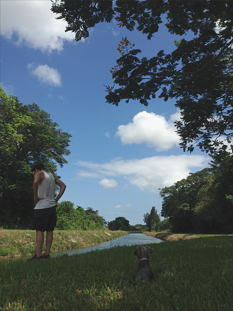
Cycling La Gloria Road to the summit of Gabilan Mountain Range (it’s highest peak is 3,455’/1,053 m), in San Benito County, is one of my favorite California adventures to date. On the way, we stopped at CalFire Bear Valley Station (famous for its helicopter), near the turn off to La Gloria Road, to ask for advice regarding where to park.

The friendly firefighters said we’re welcome to park at the fire station when they know they won’t need to leave the station, which requires them to lock the gate to the parking lot and helipad. But they did have to leave the station that day, and so recommended finding a place to park on the side of La Gloria Road. I was glad we did, because the initial ascent up La Gloria Road is pretty steep.

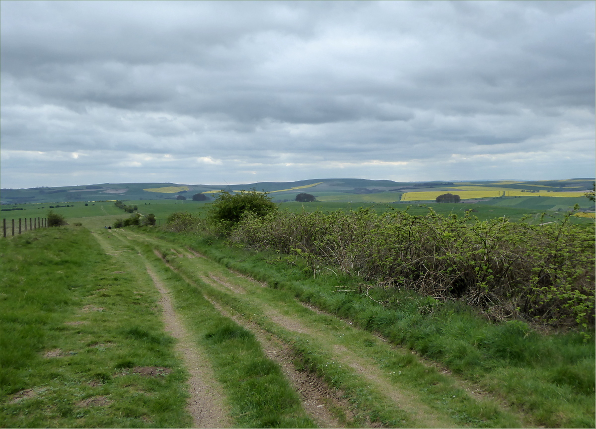
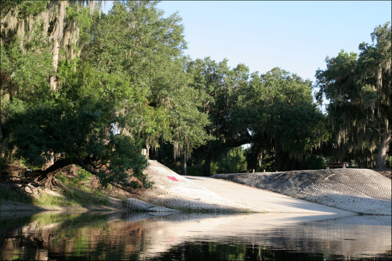
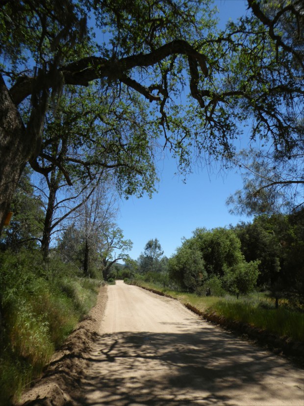
The 1 1/2 lane, graded dirt road has been in use for over a hundred years. It had recently been graded, but there was already some washboarding, as well as tree roots, rocks and snakes to avoid – all of which added some fun, technical challenges to the ride.

Gopher snake (Pituophis catenifer catenifer)? It was about 4′ (1.2 m) long.

The road was perfectly quiet. Over the course of five hours, we saw a handful of trucks – the inhabitants all smiled and waved, and gave us plenty of clearance – and an SUV with fishing rods poking out of the back.

Flame skimmer (Libellula saturata)?

The ride to the summit was easy and the ascent gradual, but the ride back required some skill. The biggest challenge was remaining in control on the bends, where it was easy to skid out of control in the loose dirt.

We had carefully selected a sunny, spring day for the ride. It was 20°C (70°F) with a gentle breeze, and as we approached the summit, the cooling effect of Monterey Bay added a freshness to the air that we could feel in our lungs.

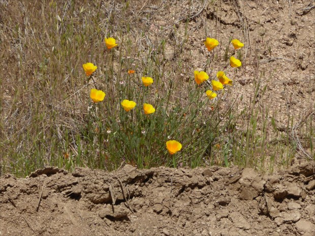
Golden poppy (Eschscholzia californica), California’s state flower.

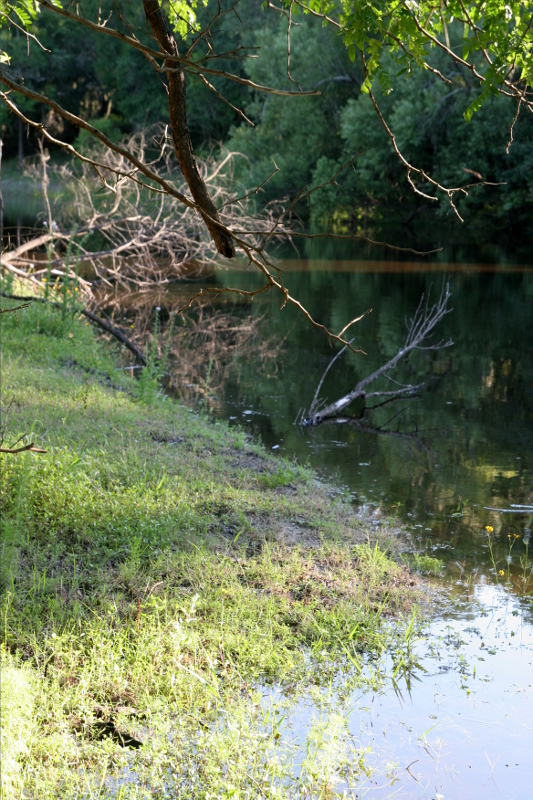
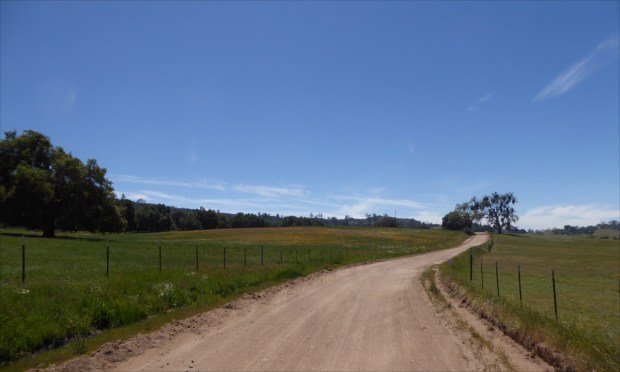
The landscape was breathtaking – pristine, unusual, diverse. At the summit, a meadow stretched across the horizon. And it. smelled. heavenly! Every so often a breeze would waft a fragrance resembling Old Spice cologne across our noses!

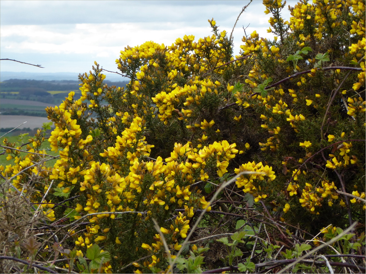
It was past peak wildflower season in California, and yet sections of this meadow were blanketed with flowers.

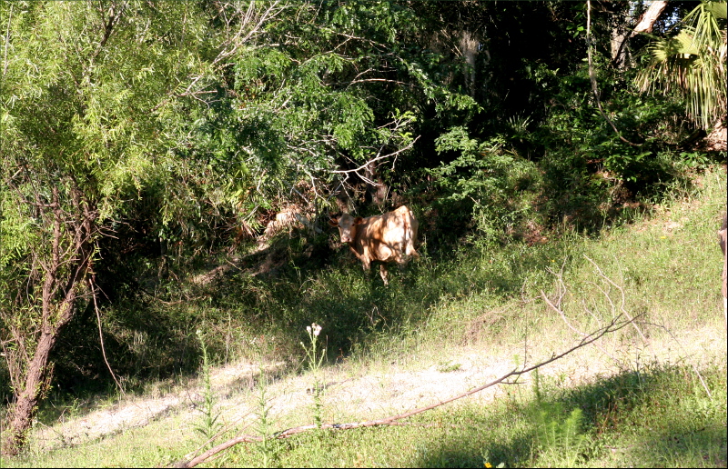
But perhaps the most memorable part of the ride was an encounter with a cow. As a kid, my brothers and I would fall over laughing at my dad’s animal noises. His cow-noise was the best. Far from sounding like the consonant+vowel phoneme pair kids growing up in Australia in the 1980s were introduced to in their first few days of school – i.e., “moo” – my dad’s cow vocalization tapped into a phoneme rarely used in the English language. His cow-noise is a very French-sounding “mœ.”

Gauthier had just left to scope out some more of the road, when a little, black cow head appeared above the grassy trench where we were picnicking. Naturally I greeted it with my most charming “mœ.” “Hello cute, cow fellow,” I hoped to communicate, “You have the most lovely pasture. I hope you don’t mind us sharing it with you.”

The cow came closer, and we talked some more. I should say, I talked some more; the cow was silent. I’m not usually so gregarious, but it made constant eye contact, which I took to be a sign of encouragement. Then all of a sudden hoof beats, like the sound of powerfully undulating helicopter blades, approached from the distance.

The herd slowed to an amble as they neared the fence separating Oliver (who was far more interested in where Gauthier had gone than the cows), and I, and our new cow friends from them. Their vocalizations possessed a tone of authority. “What’s going on here?” they seemed to demand. “Mœ,” I said to them – and barely attracted their attention. So I opened up my diaphragm and let out a long, deep “mœ.” To see their heads whip around in unison and stare, you’d think they’d never heard a human say “mœ” before. I let out a couple more assertive “mœs,” intended to communicate that “we are all friends here,” and the herd collectively decided to depart, and trotted away.

The wire fence offered new insight into the character of our new friend. “Now why was the herd on one side of the fence, and this cow and her companions on the other?” I wondered to myself. I looked around. The fence was definitely intended to restrict the cows’ movement to a fenced-off enclosure. “A bold and artful escapee and her nervous followers,” I reasoned.

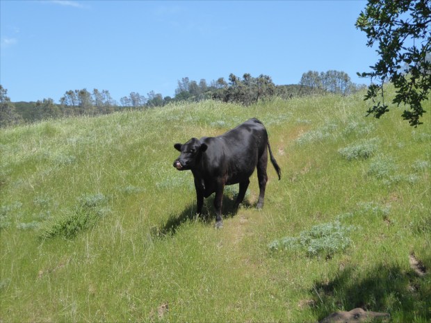
What the cow was musing – or mœsing – I cannot say, but apparently her thoughts led her to the conclusion that it would be safe to advance farther. As she rounded the top of the trench, her shiny black coat came into focus, as well as an alarming quantity of offal attached to her rear end, and a host of flies.

When we were finally face-to-face, she paused for a moment, then broke eye contact and looked over my shoulder towards the road. Then with a swish of her tail, as if to say, “See ya later,” she continued walking. After pausing again to give her companions – who had avoided me by taking a long, arced route across the trench – time to catch up, she turned left towards Soledad and sauntered down the road.

Resources Consulted:
AA Roads Forum, Topic: La Gloria Road
Commonly Encountered California Snakes, CaliforniaHerps.com
Flame Skimmer, International Union for Conservation of Nature’s Red List of Threatened Species
Gabilan Range, Revolvy
Santa Cruz County Amphibians and Reptile

A Mostly Flat Route in Nor Cal, May 2018

Start point: 36°40’21N 121°15’08W elev 257m
U-turn point: 36°31’04N 121°08’15W elev 415m
Total ascension (2 ways): 316m (1,037′)


Our bikes, which had taken us over the rounded hills of England’s South Downs, up and down the plateaus of Cornwall, and through French forests and Florida swamps, were not quite up to the task of taking us over the steep hills of California’s mountain ranges, where mountain biking was born. So we set to building new bikes. Until then, we sought out the flattest routes we could find.

On a sunny, still day in May, we took scenic Highway 25 in Paicines, near Hollister, San Benito County, all the way to the entrance of Pinnacles National Monument. It was a 15 mile (8 km) ride one way, and was mostly flat except for a single section that accounted for most of the ascent, which was a bit of a challenge on a three speed.

Highway 25 is also known as Airline Highway. Sections of the road are so flat and so straight that we wondered if the road had once served as a landing strip, but some cursory online research offered another explanation. Steve Johnson, of the Road Pickle blog, explained that “before the advent of radio communications, airplane pilots used the highway as a visual aid.”

The road follows the San Andreas fault. It was a very surreal experience to be straddling two tectonic plates.

The many folded hills looked like arms nestling grazing cattle.

The scenery is so beautiful that the road is eligible for State Scenic Highway designation.

If you go, you won’t regret stopping at Eva Mae’s Café . Although they don’t allow dogs inside the café, they insisted on bringing a table outside for us. The hospitality and the food were both excellent.

Resources Consulted:
“California Scenic Highway Mapping System,” Department of Transportation
“California State Route 25; the Airline Highway,” Sure, Why Not
“Earth Science: Chapter 7 – Faults, Earthquakes, and Landscapes,” Geology Cafe
“Eva Mae’s Café,” Facebook
“Fault line and fault zone illustrated for the San Andreas Fault in the Santa Cruz Mountains near San Jose, California,” Geology Cafe
“Immaculate Conception Church,” Mapquest
“Maps – Pinnacles National Park,” National Park Service
“Pinnacles National Park, California,” National Park Service
Road Pickle: The Adventures of Sash and Steve
“The San Andreas Fault,” Geology.com
State Route 25 (Wikipedia)
“Where’s the San Andreas Fault,” USGS website

From the Downs to the Sea – Day 2, Apr 2017

Emsworth to Portsmouth via Hayling Island offered a change of scenery. We swapped rolling, grassy hills and ancient ewe tree forests for port towns and low-tide trails. It was chilly, and rainy, and the wind was so strong at times that it almost blew us off our bikes, but there were plenty of pubs happy to serve dripping-wet customers a warm tea and a Young’s real ale.

Cycling The Ridgeway Trail – Day 3, Apr 2017

902 ft maximum height
National Trails The Ridgeway Trip Planner

The time between our brains receiving the message “Ache in bum region” to the time the message changed to “What heavenly surroundings,” was once again very rapid. The ascent up the side of the ridge was steep and wild and the trail rutted and crumbly. Gauthier carries Ollie in the basket except when riding up hills. Here’s how it works: I generally follow behind; when Gauthier stops at the base of hills to remove Ollie, he yells, “Go Emily, go!” at which cry I whiz past and Ollie tears after me.

racehorse gallop

A racehorse gallops!

The section of The Ridgeway between Wantage and Goring is a dream to ride. It has large stretches of grassy hard-pack, hardly any ruts, and few if any steep hills.

GWR tunnel
We stopped to have a snack atop a derelict GWR tunnel. “I remember riding this line with my dad before it was shut down in 1963,” a passing hiker told us.

leaving The Ridgeway
Before we knew it we were saying goodbye to The Ridgeway and turning our bikes towards Goring, a village of 3,200 inhabitants with a Norman church.

Goring village with view of church

Goring was recently in the press for being the home of and place where George Michael passed away. It’s also Wind in the Willows country.

Goring Lock

The homes are old, posh and lush. Goring Lock (above) is situated in Goring Gap.

mossy roof of Catherine Wheel
Catherine Wheel is Goring’s oldest inn, dating back to Elizabethan times. It serves traditional British food (i.e., a variety of roast dishes) and real ale, hosts live jazz, has a predilection for all things French…

French safari-inspired wallpaper at the Catherine Wheel

French safari-inspired wallpaper at the Catherine Wheel

and a sign at the bar informs guests that “Witches are welcome.”

Goring Gap with boats
Our final stop was Reading and to get there we took the Thames Path, which cuts through The Ridgeway just north-west of Reading at the Goring Gap.

Norman church

We followed a quiet, gently descending road, canopied by trees and intermittently littered with horse droppings. The soundscape was fantastic: birdsong, burbling brook and the distant clip clop of horses’ hooves. Hidden behind the dense foliage was a large estate with another lovely Norman church.

donkeys
Ollie loves donkeys. These friendly fellows ambled over to say hello. Ollie gave one of them a little lick on the nose.

Ollie gives the donkey a lick
After taking us through the countryside, the Thames Path took us up a pine-scented hill with a wonderful view of the river.

Thames Path with view of Thames
The trail was narrow.

narrow path

and hilly.

steep descent
Can you picture Mr. Toad careening down this hill in a motor car? “Oh, pooh! I’m not afraid of heights! Silly, boyish fear! Sheer waste of time! Toot, toot!!”

steep ascent
It took a bit out of us to carry our bikes up this slope. Parts of the Path front lavish homes.

grazing cattle

and other parts take you past farms.

Mapledurham
And a very short detour takes you to Mapledurham, a tiny village of 317 inhabitants named after a 12th century family estate with one of the largest Elizabethan houses in Oxfordshire.

water mill

Also on the estate is the only water mill on the Thames to be in commercial production; the same water mill that graces the cover of Black Sabbath’s first album.

Mapledurham
Among the films and television programs filmed here are The Eagle has Landed, Miss Marple and Midsomer Murders.

Thames Path in Reading
Thames Path brings you almost to the doorstep of the Reading train station. With only minutes to spare until the next train left for London, and loath to wait an hour for the next one, we raced through the large station with Ollie at our heals and reached the train just in time. As Gauthier swung his bike aboard, Ollie leaped on after it, hopped up onto an empty seat and curled into a little ball. He was not about to be left behind!

To read more about our experience cycling the Ridgeway Trial, see our posts for Day 1 and Day 2.

Resources Consulted

BBC News: Wind in the Willows used in Goring Weir court plea, 18 November 2016

Cycling The Ridgeway Trail – Day 1, Apr 2017

902 ft maximum height
National Trails The Ridgeway Trip Planner

We spent a lot of time at the public library when we first moved to the UK, and one day we checked out a travel guide about the ancient Ridgeway trail, Britain’s 5,000 year-old road. Captivated by visions of neolithic pilgrims, Roman soldiers, Viking and Saxon invaders, drovers and traders, we promised ourselves we would cycle it as soon as the weather warmed up.

Originally a complex of braided tracks along the 400-mile chalk crest of the North Wessex Downs and The Chilterns, some as much as a mile wide, with subsidiary ways diverging and coming together, today the exact course and width of the tracks is defined by earth banks, thorn hedges and barbed-wire fences. This change occurred over two-hundred years ago during the local Enclosure Acts of 1750, which saw common land transferred into private hands.

In 1972 the 87-mile central section was approved as The Ridgeway National Trail. Most of the remainder has been way-marked, however, and is shown on Ordinance Survey maps under different names. Some local landowners objected to the Trail, so in 1987 the Countryside Commission charged all local highway authorities with ensuring that every footpath be unblocked by the year 2000. Lawsuits were filed and today access to the Trail is unfettered.

Spectacular, bright-yellow fields of rapeseed were in bloom everywhere.

Spectacular, bright-yellow fields of rapeseed were in bloom everywhere.

The streets were eerily quiet on Good Friday morning when we cycled to Paddington Station via Hyde Park to catch the 0927 to Swindon. We were glad we’d made bike reservations as space for bikes is limited on GWR trains and some cyclists were turned away.

We had a thorough ride itinerary that considered routes, weather, accommodations and food for both ourselves and Ollie. Our route avoided car traffic as I can’t enjoy cycling with cars whizzing by. The plan: day one we would cycle Swindon to Avebury and back to Swindon (25 miles), day two we would cycle Swindon to Wantage (25 miles), and day three we would cycle Wantage to Reading (25 miles) where we would take the train back to London.

We used four mapping websites: 1) Sustrans provides a map of the National Cycle Network, or NCN, which is a series of safe, traffic-free paths and quiet on-road cycling and walking routes that connect to every major town and city in the United Kingdom; 2) CycleStreets caters to the needs of both confident and less confident cyclists and provides an exceptional map of bridleways and footpaths, some of which are all but hidden from the naked eye; 3) Walk4Life, originally government funded, provides trail characteristics, such as surface (flat, firm), barriers and hazards; and 4) GoogleEarth street-view helped us visualize the route.

Ollie patrols the perimeter at Three Trees farm shop.

Ollie patrols the perimeter at Three Trees farm shop.

We packed light. We carried 12kg, including Ollie and a thermos full of tea: Ollie – 5kg, Ollie’s bag – 800g, tea thermos and water – 2kg, change of clothes – 1.5kg, bike lock and tools – 1kg, food – 1.5kg. We used front racks rather than panniers as front racks distribute weight more evenly. Packing light was important because my bike has only three speeds.

The M40 pedestrian/cycle overpass.

The M4 pedestrian/cycle overpass.

NCN 45 connects to the Ridgeway and is well-marked and easy to find from Swindon Station. It’s a 30 to 40 minute cycle from the station to the trail. If you plan on taking this route, note that this section of NCN 45 follows both footpaths and minor roads, so pay attention to signposts.

We stopped at Three Trees farm shop, where we snacked on delicious scotch eggs and Belgian buns and picked up some Wiltshire blend tea. From Three Trees we took the NCN 45 northwest to some minor roads that took us through scenery out of a story book until we reached a track that led up the side of the down.

The track was paved for about three miles and then turned into a multiplicity of dirt-based surfaces for the duration of the ride to Avebury, which was to be our destination before heading back to Swindon for the night. We stopped several times to inflate or deflate our tires to adjust to trail conditions. There were few other cyclists, but many hikers. The trail is intersected by roads, so it is easy to ride or hike small sections.

Birdsong followed us throughout the trip as we passed through Marlborough Downs before reaching Avebury.

“In 2012 the Marlborough Downs farmers formed a unique partnership and began to work together to make space for nature on their farms. Originally government funded, the partnership involves over 30 farms covering 25,000 acres of Wiltshire countryside.”

“One of the most important geological sites in Britain. Natural events have created valleys with spectacular quantities of sarsen stones, which now support rare and unusual lichens. The remains of settlements, field systems, burial mounds, ancient tracks and the widespread working of sarsen stones show that people have worked and lived in this downland landscape for over 7,000 years. The reserve is part of the Avebury World Heritage Site.”


What we found most striking about the chalk grasslands of Fyfield Down were the giant, yellow-flowered broom bushes and the large, silicious sandstone boulders (i.e., sarsen stones) that were transported to the area through glacial action during the ice age.

Fairly significant sections of the trail are sadly deeply rutted by motor vehicle traffic, which is very detrimental to walkers and cyclists alike, as well as being ugly and unnatural-looking, although it does provide an outstanding opportunity to practice some technical riding. Riding the rutted parts in sustained rain, with puddles and mud, would be hellish, so it’s important to pay attention to the weather forecast.

It’s also uphill for a good third of the way. The combination of ruts, ascents and an 18 mph wind in our face made the ride challenging, but it was totally worth it.

Ridgeway trail terminates a few miles before Avebury in a gigantic mound complete with standing stones. The sarsen stones were dragged from the surrounding hills in the late Stone Age. We found it interesting that whereas henges with defensive purposes have ditches with external banks, Avebury Henge, like Stonehenge, has an inside ditch. We also found it interesting to note how well protected the Henge was from the wind, situated as it is in a valley.

Standing inside the bank, looking at the massive stones, contemplating the incredible amount of labor needed to create such a monument was awe-inspiring. English Heritage points out that henges such as Avebury’s “bear witness to the existence over many hundreds of years of a great civilisation in this part of Wessex. […] The sheer amount of labour required to excavate the huge ditches, to gather, transport and erect the massive stones, and to raise the strange mound of Silbury Hill, indicates the availability of a substantial population, and the quality of the work, particularly in the latter stages, shows their considerable skills.”

Apparently, by the 1930s many of the stones had fallen over and the site been disfigured by buildings. English Heritage explains that “the appearance of the site today owes much to Alexander Keiller, heir to a fortune made from the famous Keiller marmalade, who bought the site and cleared away buildings and re-erected many stones in the late 1930s.” I found out a little more about Alexander Keiller’s role from some documents stored at The National Archives.

In addition to exploring the Henge, we ate at the Red Lion where we were entertained with stories about thatch rooves and hidden rooms by a retired historic building conservation consultant, and admired St. James Church, the earliest parts of which date from 1,000 CE.

Lichen covered gravestones.

We did not have enough time to do Avebury justice. That would have taken at least four hours. Also, bringing a dog placed limits on what we could do. We would have liked to visit the 16th-century manor house (you can actually touch the furniture and lie on the beds!) and the Alexander Keiller Museum.

With the wind at our backs and a mostly downward journey, the trip back to Swindon was swift and fairly painless. It would be a lie to say we weren’t suffering a bit by the time we arrived at our hotel around 7pm. Among other aches and pains, I had somehow acquired a sunburn on my lips. We stayed at TravelLodge. It was clean, quiet, well-located, had a bar and 24 hour restaurant and, most importantly, accepted dogs and bikes.

Swindon is an interesting city rich in railway heritage. Swindon’s rail workers received health care that became a model for the NHS, and access to personal enrichment programs that included xylophone lessons. It also had the UK’s first lending library. Today it is home to Oxford University’s Bodleian Library book depository, which contains 153 miles of bookshelves. It also has the English Heritage National Monument Record Centre and the headquarters of the The National Trust. And apparently you can see iconic punk-rock bands, such as the U.K. Subs, play live at local dive-bars for £8 (if only we’d known this sooner)!

To read more about our experience cycling the Ridgeway Trial, see our posts for Day 2 and Day 3.

Resources Consulted
Atlas Obscura: Found A Hidden Stone Square Inside the World’s Largest Megalithic Stone Circles
Friends of the Ridgeway: The Ancient Ridgeway
Fylde Ramblers Walking Holidays: The Ridgeway, 4th April to 10th April 2013
History of Avebury Henge and Stone Circles
Introduction to Heritage Assets: Prehistoric Henges and Circles
Swindon (Wikipedia)
Walking World: Ridgeways

Spring and Fall in Southwest Miami-Dade County, 2015


Spring starting point:
Silver Palm, FL 33170
25°33’03.40″N 80°26’43.82″W elev 11 ft

Fall starting point:
SW 168 Street and SW 208 Avenue, Miami FL 33187
25°36’30.57″N 80°31’30.14″W elev 5 ft

Our bike riding adventures took us to southwest Miami Dade County twice this year. In May, they took us to the Redland historic agricultural area. Our path followed public roads barely recognizable as roads and canal C-102. We saw a variety of farms: avocado, palm tree, mango, dragon fruit, bromeliad and many others. We also saw donkeys and purple love grass.

In November, we ventured into the fringe of Miami Dade County just west of the C-357 seepage canal where “farmburbia” peters out and the Everglades National Park begins. Once again we followed the ruins of public roads. This time they were overgrown with grasses as thick as your thumb and so high they blocked out the sun. Once inside the perimeter of Everglades National Park, there were two roads to choose from. One was cut out of the native limestone floor. We took this road as far as we could before it became flooded, which wasn’t very far. The other was made of raised hard pack and offered a great view of the endless horizon of Shark River Slough. We saw mocking birds, blue jays, butterflies, goats, chickens, cows, horses, dogs and, unfortunately, discarded tires, soda pop cans, mini fridges and cell phone accessories circa 2005. We also stumbled upon Julio’s Apiary, a licensed bee farm.

redlands

1505-4

1505-9

1505-7

1505-5

1505-3

1505-12

1505-11

1505-6

1505-2

1505-10

1505-8

1505-1

7 miles on the Fringe

151101-1

151101-2

151101-3

151101-6

151101-5

151101-4

Resources
Select Florida Native Grasses for North Central Florida – Fact Sheet #67, by Gale Kempner, University of Florida IFAS Extension
Modified Water Deliveries to Everglades National Park, 8.5 Square Mile Area, by Michael J. Collis, US Army Corps of Engineers, Jacksonville District, May 23, 2012
Agrilicious: Julio’s Apiary & Avocado/Mango Grove

Three Days and 31 River Miles (50 km) on Peace River, Nov 2014

27°13’54.87″N 81°53’29.69″W elev 28 ft
Launch site: Zolfo Springs; Landing site: Canoe Outpost – Peace River, Inc., 2816 NW County Rd. 661, Arcadia, FL 34266, (800) 268-0083

Canoe Outpost maps and instructions

Gauthier and I chose to spend Thank-you Day floating down the quiet waters of Peace River this year, feasting our eyes rather than our stomachs.

IMG_2730_W1200

Our shuttle from Arcadia to Zolfo Springs.

IMG_2750_1200

Sloth cows, bison, llamas, mastodons, tapirs, megalodon sharks, mammoths, camels, dolphins, dugongs… What stories the river could tell!

IMG_2733_W1200

IMG_2763_W1200

Gardner Public Boat Ramp

IMG_2783_W1200

IMG_2818_W1200

IMG_2823_W1200

IMG_2898_W1200

He was seven feet long.

IMG_2906_W1200

IMG_2912_W1200

View from our camp site, night one. It got pretty chilly: 41 degrees Fahrenheit (6 degrees Celsius).

IMG_2917_H1200

IMG_2922_W1200

IMG_2987_W1200

IMG_3052_W1200

IMG_3103_W1200

IMG_3072_W1200

IMG_3156_W1200

Arcadia, Peace River and Highlands Hammock State Park, May 2014

27°17’59.64″N 81°50’29.66″W elev 27 ft
Brownville Park, 1885 NE Brownville St, Arcadia, Florida, 34266

ABH1_IMG_2425_edited_H800
May 4-5, Gauthier, Ollie and I took a trip into Florida’s heartland. We stopped briefly in Arcadia, the county seat of DeSoto County, which is one of six counties that compose the Florida Heartland. Arcadia’s historic downtown antique district is listed on the National Register of Historic Places. We checked out the Arcadia Opera House, built in 1906, now a museum and enormous antique shop complete with antique stage props. Then we ate at Wheeler’s Cafe, founded in 1926. The food was excellent and the wait staff were super friendly. I could easily spend days in Arcadia just window shopping.

ABH2_photo 1 (1)_edited_W800
Including our stop in Arcadia, it took us four and a half hours to get to Brownville Park from Miami. We took a scenic route that wound up and down hills and around orange groves and cattle ranches. The park, small and well maintained, is on the banks of the Peace River.

Peaceflrivermap_edited
This is a map of the Peace River watershed created by Karl Musser based on USGS data, http://en.wikipedia.org/wiki/File:Peaceflrivermap.png. According to Wikipedia, it was called Rio de la Paz (River of Peace) on 16th century Spanish charts. It appeared as Peas Creek or Pease Creek on later maps. The Creek (and later, Seminole) Indians call it Talakchopcohatchee, River of Long Peas.

ABH3_IMG_2546_edited_W800
Not all campsites had electricity, but all had water hookups, fire pits, and grills. Because there was only one other site being used, the park custodian allowed us to stay at a site with electricity for the price of a site without electricity, which was $16.50 per night. We chose the site because it had good amounts of shade and sunlight and access to an adorable, little labyrinth of trails. Miraculously, there were very few mosquitoes and no deer flies.

ABH9_IMG_2536_W800
Brownville Public Boat Ramp is located inside Brownville Park. Talk about a great kayak launch!

ABH4_IMG_2451_edited_H800
This is Peace River. Palmettos, cypress, water locust, sweet gum, cabbage palm and live oak are the predominant tree species along the river.

ABH5_IMG_2504_H800
When we checked the level of the river the day before we left, it was 16 inches below normal. We arrived shortly after a 48 hour rainstorm. The water had risen 34 inches, which put the kibosh on any plans we had to hunt for fossils. In this picture, you can see how swollen the river is; grass that was above the water line two days previously is inundated.

ABH6_photo 2 (1)_edited_W800
We saw six turtles, including a baby one. I edited this picture to make the turtle clearer; it’s a little fuzzy because it was taken on an iPhone instead of my Canon EOS 20D. We didn’t kayak very far because the fast moving current made paddling very difficult. The distance we padelled in an hour against the current took us about 15 minutes to paddle with the current!

ABH7_IMG_2530_edited_W800
These yellow, daisylike coreopsis are Florida’s state wildflower.

ABH8_IMG_2496_edited_W800
Barbed wire fences lined the mile of river we kayaked. This gal found a hole in the fence.

ABH10_photo 4_H800
We took a detour to Highlands Hammock State Park before returning home. We biked the park’s lovely 3 mile trail. The live oak were huge. Here, Gauthier and Ollie are standing against a live oak.

Resources
http://www.protectingourwater.org/watersheds/map/sarasota_bay_peace_myakka/peace/
http://www.myregion.org/clientuploads/pdfs/ncfl_lakewales.pdf
http://www.swfwmd.state.fl.us/education/interactive/peaceriver/
http://www.floridastateparks.org/HighlandsHammock/