The Incredible Estérel Coastal Path, Jan 2019

My sister-in-law’s family recently moved to Saint-Raphaël, which means that we now have an excellent excuse to visit this spectacular part of the world!

On our first visit, belle-soeur introduced us to dozens of interesting places, including one of the coolest trails I’ve ever been on, the Estérel coastal path.

She explained that the path was created as a result of French laws that view the coast as public property. The law has been hanging in the balance for the last thirty years as developers and environmental activists fight to change it.

And global warming is causing the coastline to move inward towards private property lines, which could also impact public access.

Given these threats to the path, we felt incredibly lucky to be able to hike it when we did.

Early one morning, we followed belle-soeur’s car to Agay where we parked our car, and then belle-soeur drove us back to the trail head in Port de Santa Lucia, in downtown Saint-Raphaël.

It took us about six hours to hike the 7 or so miles (11 or so km).

The terrain was unreal. The City of Saint-Raphaël’s website offers a really helpful, concise overview of its coastal geology, and is in general a great resource.

We scrambled over volcanic organ pipes,

solidified volcanic ashes dating from the Mesozoic period 65 million years ago,

and beaches of esterellite pebbles,

the hardest rock in France! In Roman times, esterellite was extracted from mining sites around St Raphael, and used to pave roads and monuments.

The going was tough, and Oliver had to be carried at times.

We were occasionally assisted by stairs cut out of rock and repaired with concrete.

There were few trail markers, but finding the path was part of the fun!

It was remarkable to think that we were sharing a view with the owners of the beautiful mansions that line the coast.

Our path came to an abrupt halt at a damaged levee possibly caused by construction on an adjacent luxury hotel.

Does the abandoned construction in the background hearken back to the days of stricter coastal property laws? And why was the construction in the foreground abandoned… bankruptcy?

It seemed like a sure sign of the times.

The water was so clear and calm, and the weather so sunny and warm that we were tempted to jump in and swim the four or five feet to the other side.

But I was worried about Ollie, who was very nervous, so we backtracked until we found a way back to the Route de la Corniche.

Our makeshift path back to the Route de la Corniche.

We walked along the shoulder of the road for about a mile before connecting to the sentier littoral du Cap Dramont,

which took us to Agay, where we sipped chocolat chaud as we watched the sun slip behind the horizon.

Can you see the sailboat?

Next time we intend to kayak the route.

Resources Consulted:
L’Estellerite, AzureAlive
Esterel Coastal Path, Saint-Raphaël Tourism
“Managing the Coast in France,” Littoraux et Changements Côtiers

Red Rocks Over the Côte d’Azur, Dec 2018

One of the many reasons I love going to France is because when we’re there my husband reminisces about his youth. On our last trip, he drove us from Saint-Raphaël to the Forêt Domaniale de l’Estérel by memory, his eyes lighting up and his speech accelerating every time we passed a familiar landmark.

The trees in the foreground are maritime pine.

Carefully avoiding cyclists, we took the aptly titled Route De La Corniche through the towns of Boulouris and Agay. “Very little has changed,” my husband said, and I pictured him and his buddy following the same route on scooters, making ribald jokes and challenging themselves to appear adult.

The 4.3 mile (7km) Cap Roux Loop begins at Sainte-Baume and takes about three hours to complete. Ollie and Belle-maman took the paved circuit at the base of the mountain, which is an ideal walk for those who want to enjoy the beautiful surroundings, but don’t want to do the loop.

As we began the climb, three things became immediately apparent: the trail is rocky, the rocks are red, and we were not alone.

Despite arriving early there were already many people on the trail. We were a varied assemblage. One woman appeared to perhaps have taken a wrong turn on her way to the shopping mall, dressed in brogues, tight jeans, a leather jacket and a cross-body shoulder purse with spaghetti strap. And several times we overtook a man dressed in head-to-toe spandex that brought into sharp relief his many rippling muscles, who stopped frequently to pose for photographs on top of large rocks.

The rocks were created by volcanism, which is the reason they’re red. They’re called “porphyry,” and silica crystals embedded in them twinkle when you hold them up to the light.

I couldn’t find many French websites about the trail, but those I did find noted the many short, gnarly, native cork oaks (chênes-lièges) that punctuate the landscape.

Not all parts of the trail were equally rocky, but it was necessary to always keep one eye on the ground underfoot to avoid stumbling, although the wee kiddies that whizzed past us had no such concern. I envied them their nimble, little feet and low center of gravity.

We had a picnic lunch of nectar of the gods, I kid you not. Memories of the mini-feuilletées at Boulangerie La Fournée in Saint-Raphaël are causing me to drool as I write this.

The site where we picnicked

The site where we picnicked.

At the pinnacle (2,014 feet/614 m), there is a magnificent view of Cannes with the French Alps in the background.

And a plaque with a large map (aka “viewpoint indicator”).

The trail ascends on the east and descends on the west. On our way down, the ribbon-like trails in the forested mountains across the way reminded us that the region had been managed by the Church up until the French Revolution.

It was fun to imagine what it must have been like to be a monk following one of those trails, perhaps collecting medicinal herbs along the way.

Shortly before the trail ends, hikers participate in a custom whereby they pick up a rock and throw it onto a giant mound of rocks created by all the hikers who came before.

At this point the other hikers headed for the parking lot, but we chose to climb another six stories to see the ruined chapel of La Sainte-Baume and the “Grotte Chapelle,” or “Cave Chapel.” I marveled at the ability of the keystones to maintain the arched structure of the doorways, and wondered what the monks looked for when they peered out of the embrasure-like windows.

Can you spot the ruined chapel?

Just outside the chapel was a mossy landing that was home to some fabulous ferns. The batteries on our camera had run out by this time, or we would have snapped some photos. Likewise, we would have liked to have snapped some photos of the adjoining cave chapel and the interesting assortment of religious tokens left behind by Christian hikers over the last sixty or seventy years.

The trail to the ruins was steep and narrow and required the use of a metal rope to haul yourself up near the top, but it was worth the effort!

Resources Consulted:
Boulangerie La Fournée
Cap Roux, Saint-Raphaël Tourisme
Cap Roux Loop, Saint-Raphaël Tourisme
Corniche, Wikipedia
Esterel, Wikipedia
Massif de l’Esterel, Trip Advisor
Randonnée : Les balcons du Cap Roux (Estérel)
Pic du Cap Roux, Michelin Travel
Une forêt… de l’Estérel, Office National des Forêts

Skyline Trail, Oct 2018

Skyline Trail, which is a part of the Bay Area Ridge Trail, was our introduction to Bay Area hiking. Here’s the trail map: Wunderlich to Huddart County Park via Skyline Trail. It was a quiet trail and an easy hike. Blogger, David Baselt, mentions in his gorgeous and incredibly informative website, Redwood Hikes, that the trail includes some little-known patches of old-growth redwoods, although unfortunately we didn’t find them. Baselt’s site also offers detailed, highly readable trail maps, and San Mateo County’s website offers a succinct description of the trail and it’s connectivity to surrounding trails.

Sun-rays slanted through tall pines, painting pine needles gold and creating panels of light that intersected the trail and were so thin that you could almost step through them.

I think the hollow in this sandstone is called a “tafoni.” There’s a great explanation of what tafone are in this article: https://baynature.org/article/the-rock-in-the-redwoods/.

Fallen conifers look so funny without their needles! Is this a spruce?

This was our first encounter with a Madrone tree (Arbutus menziesii). They reminded us of South Florida’s gumbo limbo trees, also known as tourist trees because they are red and peeling, like this guy.

Acorns of the Tanoak, which are in fact related genetically to both chestnuts and oaks. Tanoaks are native to the region and play a significant role in its history.

Resources consulted:
Bay Area Ridge Trail
“Geological Outings Around the Bay: Las Trampas Regional Wilderness,” by Andrew Alden in KQED Science (10 Jan 2013)
Lewis’s Five Firs, Discovering Lewis and Clark
“Madrone / Stunning evergreen tough to tame,” by Pete Veilleux in SFGate (28 Dec 2005)
“Mechanical Weathering Through Physical Processes,” by Andrew Alden in ThoughtCo (2 March 2019)
Skyline Trail, County of San Mateo Parks Department
Redwood Hikes Press Trail Maps
“The Rock in the Redwoods,” by Carolyn Strange in Bay Nature Magazine (1 Jan 2007)
Tanoak, Calscape (includes map of plant range)
The Skyline Trail: San Mateo County Parks, Redwood Hikes
“The Tanoak (Notholithocarpus densiflorus), A Significant Santa Cruz Native Plant,” by Melissa Ott in Sierra Club Santa Cruz Group (7 Dec 2014)
Wunderlich to Huddart County Park via Skyline Trail Trail Pap, Bay Area Ridge Trail.

Kayaking Baylands Preserve, Sept 2018

Baylands Nature Preserve is a little piece of the San Francisco Peninsula that was a yacht club, then a landfill, and is now a two-thousand acre tract of pickleweed marshland protected from development and owned by the City of Palo Alto, with fifteen miles of trails and a kayak launch.


It’s adjacent to San Francisquito Creek and the Palo Alto Flood Basin.


We kayaked there a couple weekends in September.


The water’s pretty shallow, and the winds, blowing northeast, were a chore. We talked to a wind surfer who said a 15 mph northeast wind is pretty typical there.


It was very scenic though.

We saw gulls,


great egret

some beady-eyed vultures

the cutest least sandpipers


and some metal birds (Palo Alto Airport is a stone’s throw away).

And on one occasion, we were serenaded by a talented saxophonist

as we packed up to go.

Resources Consulted:
How to Identify White Herons—Excerpt from “Better Birding” Book, The Cornell Lab or Ornithology
Least Sandpiper, Audubon Guide to North American Birds
Map of The Baylands, City of Palo Alto
Officials unveil first phase of San Francisquito Creek flood protection, Palo Alto Online
Palo Alto Baylands Nature Preserve (Wikipedia)
Palo Alto Baylands Preserve, San Francisco Bay Trail (lots of great information and photos in here)
San Francisquito Creek Baylands Map, Guide to San Francisco Bay Area Creeks
Shorebird Identification, Pacific Flyway Shorebird Survey

Sea Lions and Otters and Whales oh my! Jul-Aug 2018

Santa Cruz was one of the first places we explored upon settling down in San Mateo County. Why? Well, it’s surrounded by redwood forests, it has a magnificent wharf, it’s the birthplace of Santa Cruz Skateboards (the screaming hand logo is awesome), and it has an amazing outdoors scene.

Santa Cruz Harbor is on the Monteray Bay National Marine Sanctuary, which is part of the migratory route of many whale species, and the site of massive kelp forests that are home to sea otters, seals and sea lions. We went there to kayak almost every weekend in July and August.

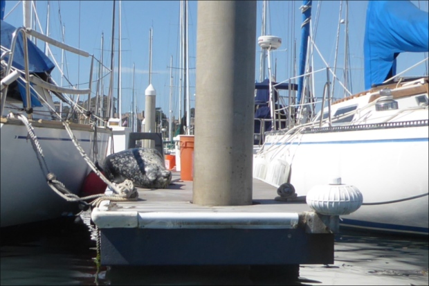
South Harbor Launch Ramp charged $8/day for parking in 2018 (according to their website, the fees change so regularly that it’s not worth listing them), but did not charge a launch fee for kayaks. Although the parking lot is large and we always managed to find a spot, it did get packed on days when the weather was perfect.

Harbor staff were very friendly and very helpful, which is amazing given the demands of their job: they’re under the hot sun, directing parking, and coordinating the movement of boats – big and small, commercial and personal, from water taxis to tugboats – and even liaising with ambulances.

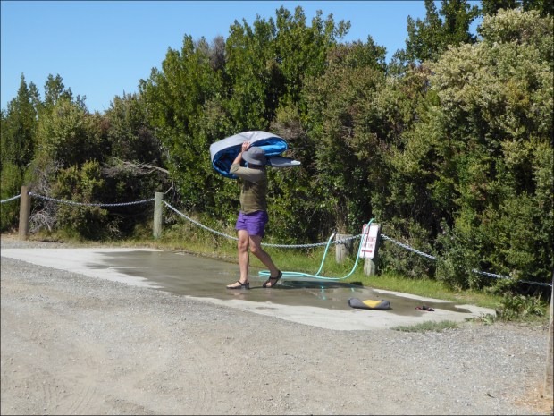
One day a murmur moved through the crowd of pedestrians threading their way along the South Harbor sidewalk to restaurants, bathrooms and the beach, that a boater had burned his hand at sea while maintaining his engine. As we inflated our kayak with a yellow hand pump, I heard snippets of conversation over harbor staff walkie-talkies that seemed to confirm the rumor. Sure enough, an ambulance pulled up and, just as we were about to launch, a tugboat pulled into view. As we pushed off of the pier and paddled away, harbor and ambulance staff, who had been saving their energy and keeping cool under whatever shade they could find, jumped into action.

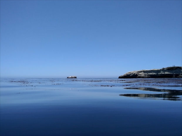
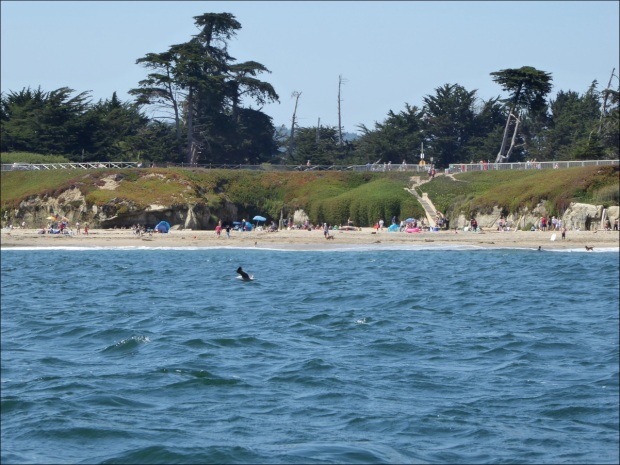
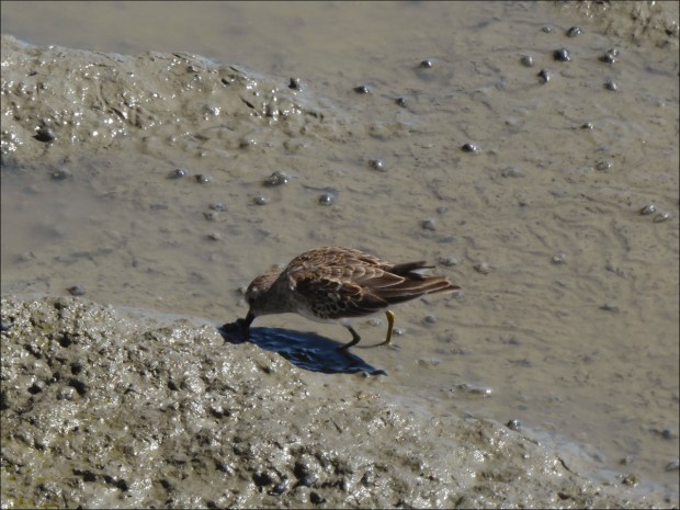
Our first paddle in Monteray Bay was absolutely amazing. The water was still as oil (“comme l’huile” they say in France), and there was so much to see: pelicans and cormorants diving into the water, people old and young fishing along the harbor walls leading to Walton Lighthouse,

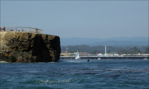
surfers queuing up and catching waves in Steamer Lane,

otters frolicking in the kelp forests,

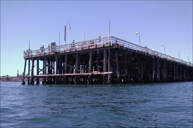
seals making a ruckus inside the labyrinth of beams that hold up Santa Cruz Wharf, onlookers on the Wharf craning their bodies over railings to see what the ruckus was all about,

dolphins playing the way only dolphins can (sorry, no photos), birds having a good gossip over their morning tea,

sleepy sea lions reclining on Seal Rock,

flocks of common murre floating peacefully, boaters sailing slowly out to sea, and here and there clusters of colorful rental kayaks that seemed to extend the colors of the canvas created by Santa Cruz Beach Boardwalk Amusement Park out onto the water.

One time we saw a blue whale. Heading out to the bay, I caught what sounded like the word “whale” over a megaphone as we moved over to let an O’Neill Charter Yacht pass us. Intrigued, we decided to paddle in the direction of the yacht. Only moments later, we saw a huge plume of water shoot out of the bay about 200 feet away, followed by the sudden appearance of a gigantic tail! The megaphone informed us that it was a blue whale. Every minute or so huge plumes shot out of the water as the giant, watery shadow of the whale moved northward.

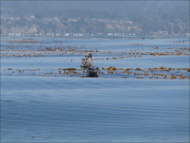
On another occasion, a gang of seals (or “sea dogs” as Ollie likes to call them; the expression on his face when they disappear under the water is priceless) surrounded us. We were paddling slowly over the kelp, puzzling over what type of bird it was that was making a sound like “adam,” when we saw a herd of seals ahead of us. We followed the National Marine Sanctuaries guidelines for ocean etiquette and began back paddling away from them, only to discover another herd behind us. So we stopped paddling and waited for them to pass. But instead of passing us, they began to pop their heads up out of the water, one after another, and look at us. It became a game to try to predict where the next head would pop up. We weren’t too worried about Ollie, safely ensconced in my spouse’s lap. But I was worried that they’d decide to take a closer examination of the kayak. Luckily only one seal was interested enough to make a close perusal, swimming slowly along the surface of the water, two feet away. Then suddenly the heads stopped popping up out of the water and they were gone.

Perhaps the experience that got our adrenaline up the highest was the time we paddled out to the Santa Cruz lighted whistle buoy (“Mile Buoy”), a mile out to sea. We’d been enjoying the thrill of the rise and fall of gentle ocean swells, when we heard the plaintive sound of Mile Buoy’s whistle. It seemed so close that we decided to paddle out to it. For thirty minutes the swells seemed to get longer and steeper. It was very quiet. We could no longer hear the pelicans, cormorants or gulls, and with no boats around, the only noise was the steady pulse of Mile Buoy and the sound of our paddles stroking the water. It was an eerie sensation, being out there all alone in a kayak with sixty feet of frigid ocean water beneath us, our vision focused on Mile Buoy, raised high and lowered down by the swells, like us, but out of sync, and the horizon hidden by fog. Finally, when we were close enough to Mile Buoy to see sea lions lounging on its base, we turned around and returned to the bustle and safety of shore.

There’s another thing to recommend Santa Cruz: it’s microbreweries. Few things in life are as exquisite as a day of paddling Santa Cruz Harbor followed by beers at Humble Sea Brewing Co. or Santa Cruz Mountain Brewing.

Resources consulted:
“30 Years of the ‘Screaming Hand’ — An Icon of Santa Cruz Skate Culture,” NBC Bay Area
gpsnauticalcharts.com online chart viewer
Humble Sea Brewing Company
“Kelp Forests,” SIMoN: Sanctuary Integrated Monitoring Network
“King of the Buoy – Sea Lion Fight in Santa Cruz” (YouTube)
“Lighted Whistle Buoy set to hold anchor,” by Yvonne Falk, Santa Cruz Waves
“Ocean Etiquette,” NOAA National Marine Sanctuaries
O’Neill Yacht Charters
Monteray Bay National Marine Sanctuary, NOAA
Monteray Bay Whale Watch, LLC
Santa Cruz Beach Boardwalk
“Santa Cruz Breakwater (Walton), CA,” lighthousefriends.com
“Santa Cruz Harbor (South Harbor Launch Ramp),” California State Parks Division of Boating and Waterways
Santa Cruz Harbor: Gateway to the Monteray Bay National Marine Sanctuary
Santa Cruz Mountain Brewing
Santa Cruz Skateboards
“Santa Cruz Surf Spots,” SantaCruz.com
“Santa Cruz Wharf,” City of Santa Cruz
“Swell (Ocean)” (Wikipedia)
“The Ultimate Nor Cal Brewery Map,” San Francisco Chronicle
“Whistling Buoy,” Dictionary.com

A Mostly Flat Route in Nor Cal, May 2018

Start point: 36°40’21N 121°15’08W elev 257m
U-turn point: 36°31’04N 121°08’15W elev 415m
Total ascension (2 ways): 316m (1,037′)


Our bikes, which had taken us over the rounded hills of England’s South Downs, up and down the plateaus of Cornwall, and through French forests and Florida swamps, were not quite up to the task of taking us over the steep hills of California’s mountain ranges, where mountain biking was born. So we set to building new bikes. Until then, we sought out the flattest routes we could find.

On a sunny, still day in May, we took scenic Highway 25 in Paicines, near Hollister, San Benito County, all the way to the entrance of Pinnacles National Monument. It was a 15 mile (8 km) ride one way, and was mostly flat except for a single section that accounted for most of the ascent, which was a bit of a challenge on a three speed.

Highway 25 is also known as Airline Highway. Sections of the road are so flat and so straight that we wondered if the road had once served as a landing strip, but some cursory online research offered another explanation. Steve Johnson, of the Road Pickle blog, explained that “before the advent of radio communications, airplane pilots used the highway as a visual aid.”

The road follows the San Andreas fault. It was a very surreal experience to be straddling two tectonic plates.

The many folded hills looked like arms nestling grazing cattle.

The scenery is so beautiful that the road is eligible for State Scenic Highway designation.

If you go, you won’t regret stopping at Eva Mae’s Café . Although they don’t allow dogs inside the café, they insisted on bringing a table outside for us. The hospitality and the food were both excellent.

Resources Consulted:
“California Scenic Highway Mapping System,” Department of Transportation
“California State Route 25; the Airline Highway,” Sure, Why Not
“Earth Science: Chapter 7 – Faults, Earthquakes, and Landscapes,” Geology Cafe
“Eva Mae’s Café,” Facebook
“Fault line and fault zone illustrated for the San Andreas Fault in the Santa Cruz Mountains near San Jose, California,” Geology Cafe
“Immaculate Conception Church,” Mapquest
“Maps – Pinnacles National Park,” National Park Service
“Pinnacles National Park, California,” National Park Service
Road Pickle: The Adventures of Sash and Steve
“The San Andreas Fault,” Geology.com
State Route 25 (Wikipedia)
“Where’s the San Andreas Fault,” USGS website

Landing in Concord, Aug 2017

In August of 2017, we relocated to the San Francisco Bay Area. Not yet certain of where we would be working, we took the most affordable Airbnb we could find, which happened to be in Concord, in the foothills of Mount Diablo, the tallest mountain peak in the Bay Area at 3,849 ft (1,173 m) with one of the largest viewsheds in the Western United States. Apart from it’s geographic significance, it has religious significance to many Native Americans, and early Christian settlers told of miracles happening there. Mount Diablo State Park labels offer a lot of information about the hill’s significance.

Mount Diablo is in the far background of this picture, taken in Concord Community Park, which has some of the boldest, cheekiest squirrels Ollie or I have ever seen.

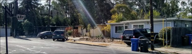
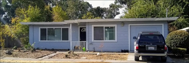
The huge size of the suburban roads and houses, and the brightness of the sun, which made the colors of the California landscape vivid, especially the reds and yellows of the parched hillsides, came as a shock after a year spent in the U.K.

This picture was taken in Concord Community Park, which is watered by a sprinkler system every night.

We were struck by the shape of these [valley oak? coastal live oak?] acorns. I’ve got one preserved at home, and it’s about 2 inches (5 cm) long.

No longer able to rely on public transportation, our bicycles became our main mode of transportation until we found a car. Riding on the street posed challenges as bike lanes don’t connect to one another and drivers in Concord don’t offer cyclists the courtesy that drivers in other regions of the Bay Area do. But Concord has something very special – the Contra Costa Canal Trail, which connects to the California State Riding and Hiking Trail.

Ollie is just discernable in the shadow.

Quoting from the East Bay Parks Regional District website: “The CA State Riding and Hiking Trail connects Martinez to Lime Ridge Open Space in Concord, beginning at the Carquinez Regional Shoreline. The trail passes over the Franklin Hills and connects with the John Muir Historical Site. It passes through the residential areas and parks of Martinez before entering Pleasant Hill where it shares a paved, multi-use trail with the Contra Costa Canal Trail. It follows the Canal Trail past Walnut Creek’s Larkey Park and Heather Farm Park then crosses Lime Ridge Open Space, residential areas and Newhall Community Park in Concord. The trail then continues southwest towards Lime Ridge and will eventually connect to Mt. Diablo State Park.”

This is the section of the Contra Costa Canal Trail that took us from our Airbnb, near Concord Community Park, to Rivendell Bicycle Works.

One of the many great things about the Contra Costa Trail is that it nearly intersects with BART stations in Concord and Walnut Creek. One of the first things we did upon arriving in Concord was to take the Trail to Rivendell Bicycle Works in Walnut Creek, home to one of our heroes, Grant Peterson. We were mildly star-struck when he adjusted my brakes on the spot. Not only does Rivendell design, manufacture and sell really cool lugged steel frame construction bikes, but it also sells tons of hard-to-find bike parts and accessories. We stocked up on “unracer” patches and other goodies.

Another fun trip to take is the Contra Costa Trail from Concord to the Walnut Creek BART Station, then the BART from Walnut Creek Station to Civic Center/UN Plaza Station, and then ride from the Civic Center/UN Plaza Station to Golden Gate Park. BART staff are super friendly and more than happy to help. But if you’ve never been to San Francisco before, take heed that the Civic Center/UN Plaza Station is an epicenter of San Francisco’s homelessness problem.

One day when we were cycling around Concord, we were surprised to stumble upon an Eichler neighborhood.

Joe Eichler was a post-WWII building developer who valued “correct” architectural aesthetic over making a large profit. He is one of the America’s most famous building developers. Most people assume he designed the Eichler homes (myself amongst them), but they were in fact originally designed by Anshen & Allen.

Eichler homes were affordably-priced, mass-produced, modern works of art consisting of 3 bedrooms/2 baths, blank front facades, flat or peaked rooves, rear and side walls of floor-to-ceiling glass, kitchens open to the family room, wood siding and post-and-beam ceilings, radiant-heat concrete floors, and atriums, spanning 650 to 1,500 square feet with enclosed backyards.

“The use of Anshen & Allens’ ‘concentric circle’ or ‘bull’s-eye’ site plan, which featured cul-de-sac streets that reduced vehicular traffic, created varied views of the houses and more privacy” (“Design for Living: Eichler Homes,” by Jerry Ditto, Lanning Stern, 1995).

Eichler homes sell for a pretty penny today, but originally targeted middle class families.

Significantly, Joe Eichler, a product of the frontier ideology of individualism and equality associated with California, sold to non-whites, facing down complaints from white home-owners.

Nearby there was an example of a far more modest Post-WWII, flat-roofed development.

We loved our stay in Concord. If you’re looking for a place to stay in the Bay Area, and don’t need to be close to San Francisco, consider Concord. It was a fantastic introduction to the California countryside, and only a 60 minute BART ride away from San Francisco. By the way, Mike Gianni’s Airbnb is amazing (look for my review posted in October 2017).

Resources Consulted:
Airbnb, Luxury 37′ Triple Slide Motorhome in Concord
Anshen & Allen (Wikipedia)
Bay Area Rapid Transit (BART), About
California Department of Parks and Recreation, Mount Diablo State Park
California State Riding and Hiking Trail (list of trails)
City of Concord California, Parks
Ditto, Jerry, Lanning Stern, Marvin Wax, Joseph L. Eichler, Joseph L. Eichler, and Joseph L. Eichler. 1995. Eichler homes: design for living. San Francisco: Chronicle Books.
East Bay Regional Park District, California Riding and Hiking Trial
Grant Peterson (Wikipedia)
List of summits of the San Francisco Bay Area (Wikipedia)
Lugged steel frame construction (Wikipedia)
Mount Diablo (Wikipedia)
Review of “Just Ride” by Grant Peterson in the New York Times, 27 July 2012
Rivendell Bicycle Works
UC Berkeley Environmental Deisgn Archives, Oakland & Imada
University of California Oak Woodland Management, California’s Oak Woodland Species

Bonjour Morvan, Aug 2017

While in Burgundy, we also stopped at the Parc naturel regional du Morvan. Quoting from Wikipedia: “parcs natural regional (regional natural parks or PNRs) are public establishments in France between local authorities and the French national government covering an inhabited rural area of outstanding beauty, in order to protect the scenery and heritage as well as setting up sustainable economic development in the area.”

The Parc du Morvan is the site of Mont Beuvray, where the fortified city of Bibracte once stood, and where the Roman armies of Julius Caesar defeated the Gauls at the Battle of Bibracte in 58 BCE.

Do the monoliths used to erect this bridge date back to Bribracte? We’d like to think so.

A northerly extension of the Massif Central, it’s trees are frequently cut, so the forest is always young and the trees relatively small compared to other forests, such as the Fontainebleau.

The Parc du Morvan is also the site of the largest mountain biking venue of the French Cycling Federation (FFC), La Grande Traversee du Morvan. We saw only one other cyclist. He had a paper map attached to his handlebars, which I thought was pretty clever as the many intersecting trails, paths and roadways that zigzag the park can be difficult to navigate. We found this map to be useful (scroll down the page to find it) because it lets you select trails based on difficulty.

This is a marker for a hiking trail. Cycling trail markers have an illustration of a bicycle that consists of a circle next to an inverted triangle next to another circle.

The ride took us over gentle slopes…

and a variety of paved and unpaved terrains.

Resources Consulted
Map of the Grande Traversee du Morvan (scroll down the page to find the map)
Bibracte (Wikipedia)
Comite Regional du Tourisme de Bourgogne-France-Comte, The Great Morvan Crossing on a Mountain Bike
Comite Regional du Tourisme de Bourgogne-France-Comte, The Morvan Lakes
Le Morvan par Bernard LeComte
Michelin Voyages, Parc Naturel Regional du Morvan
Regional Nature Parks of France (Wikipedia)

Bonjour Canal de Bourgogne, Aug 2017

The Canal de Bourgogne is a hop, skip and a jump away from the small, agricultural town of Soussey-sur-Brionne, where my spouse has family. The Canal was originally conceived of in 1605, but construction didn’t began until 1775, and was completed in 1832. It spans 150 miles (242 km) and connects the Atlantic Ocean to the Mediterranean Sea.

Lock near Pouilly en Auxois.

We traveled a very small section of the Canal, limiting our journeys to day-trips around Pouilly-en-Auxois. However, we saw quite a few cyclists, generally in couples, loaded down with enough gear to last several days.

I found the lock-houses (“maisons d’ecluse” in French) fascinating. Although they’re no longer inhabited by lock-keepers (“gardiens d’ecluse”), their location, abutting the trail wherever there is a lock, were vivid reminders of the days when movement through the Canal was hand- and horse-powered. The structure of each lock-house was consistent, but each bore the stamp of their owner in their color schemes and embellishments. All were beautifully maintained.

Lockhouse near Vandenesse.

Some antique agricultural equipment on display outside the Vandenesse lock-house. I used to work at Vizcaya Museum and Gardens, former residence of James Deering (1859–1925), heir to Deering Harvester Company (which became International Harvester Company), so seeing this old Deering equipment was quite a thrill. James Deering had a close relationship with the French, and was even awarded the French Legion of Honor.

Motorized vehicles are prohibited on the trail, but that doesn’t stop locals, young and old alike, from using it to zip from one village to the next on motorized scooters.

Chateauneuf-en-Auxois in the background, with the canal and canal boats in the foreground, make this an unmistakably French scene.

An old and weathered Cardinal butterfly (Argynnis Pandora) enjoying his last days.

Oliver says the grass along the Canal de Bourgogne is some of the best in the world!

Resources Consulted:
Bourgogne-Franche-Compte Tourisme: Chateauneuf-en-Auxois
Canal de Bourgogne (Wikipedia)
I Love Walking in France: Walking the Burgundy Canal
Travelling the Canals and Rivers of Europe: Pouilly en Auxois to Pouillenay
Trip Suggest: Discover Creancey in France!

Bonjour Villentrois, Aug 2017

For many generations, my spouse’s family has had a home in Villentrois (population 645) near Valençay, at the northern tip of the Indre departement. In the past, the town was famous for its mushrooms, which blanket the landscape in November. Mushrooms are also grown in deep caves cut out of the Tuffeau limestone hills. My spouse’s family home has such a cave. They keep you lovely and cool in the summer. Tuffeau limestone is also used to patch neighboring Loire Valley castles, the most famous of which is probably Chambord.

We cycled trails, wrought by tractors, that skirted the boundaries of farms and intersected major roadways, and dirt roads cut by lumber companies, patched with ceramic shards, that disappeared in the shadow of Forêt de Brouard. We avoided major roadways as the roads are small and drivers speed and are unused to cyclists. Small restaurants – none more authentic in France – quenched our hunger. Only one word of caution: check the weather forecast before you leave, as there aren’t very many places to take shelter during rainstorms.

Veuil has a cluster of restaurants that are worth risking a drenching for. We arrived late to Le P’Tit Veuil with a ferocious storm close on our heals, but they did not hesitate to welcome us in, and fed us with such alacrity that I have had to reconsider my definition of hospitality!

The dark area is the Forêt de Brouard. We got caught in a rainstorm while in the forest. The best shelter we could find was a young tree that slowed the passage of the rain, but in no way prevented it from reaching us. The storm lasted about thirty minutes! It was a fantastic ride, though.

Sunflowers, or “tournesols” in French.

A house built with blocks of Tuffeau limestone.

This trail in the Forêt de Brouard was on the delimitation between two departments. The concept of “departement” is similar to “county” in English, but the jurisdiction of departements is wider than that of counties (“comte” in French), which are usually part of departements.

The entrance to a nest of European hornets. Wikipedia says they’re docile unless engaged in contest with another wasp, or defending their nest. They were unbothered by us.

Classic Valencay cheese, made with goats’ milk, little flattened pyramids of heaven.

Route Departemental (D33), road from Lucay-le-Male to Villentrois. The glass insulators on the power lines were old in the 1960s. When my spouse was a child, these funny, old insulators imprinted themselves in his memory so that they will forever be associated with Villentrois.

Resources Consulted:
A Gardener in France: Troglodyte flower show in central France
European Hornet (Wikipedia)
Cheese.com, Valencay