Oliver

A Wintry Ride on Old Haul Road, Jan 2019

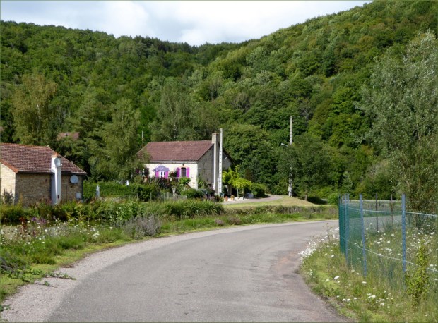
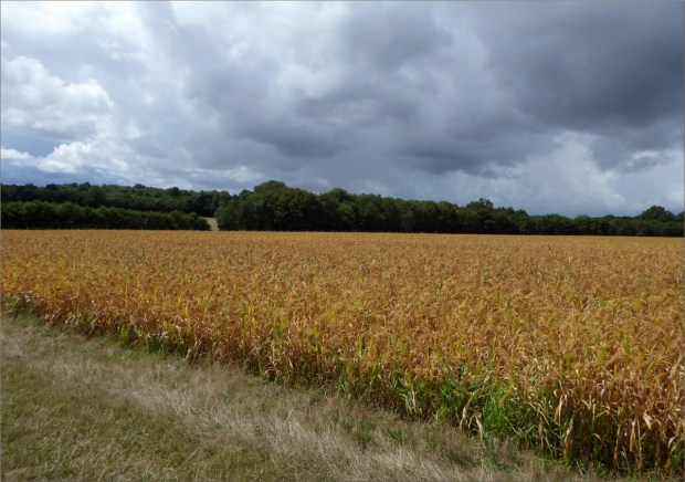
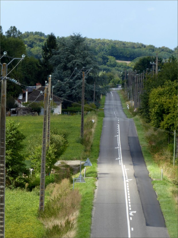
It was a quiet ride along Pescadero Road (a minor road that follows the serpentine path of Pescadero Creek) to Old Haul Road. We passed working farms, cow pastures and cottages. As we passed the last farm before entering the thick, shady redwood forest surrounding Loma Mar (population 113), the temperature dropped abruptly, an interesting characteristic of this region, which is made up of hundreds of micro-climates.

After a while, we turned off Pescadero Creek Road onto Wurr Road…

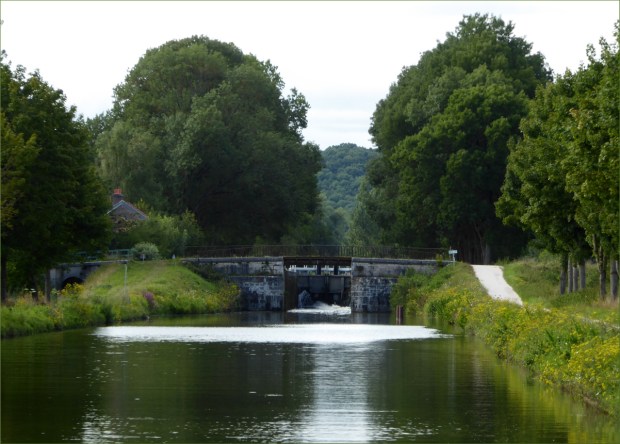
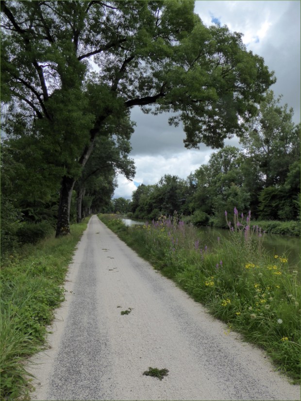
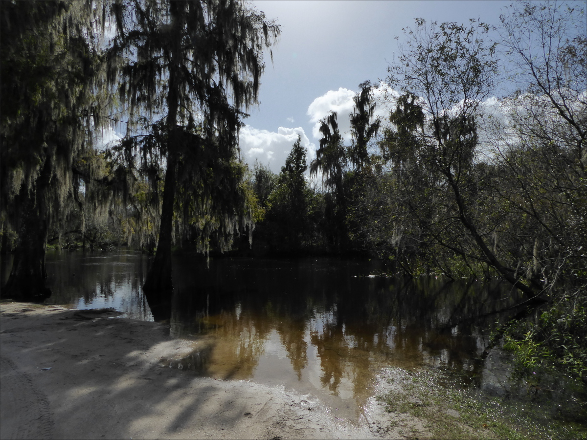
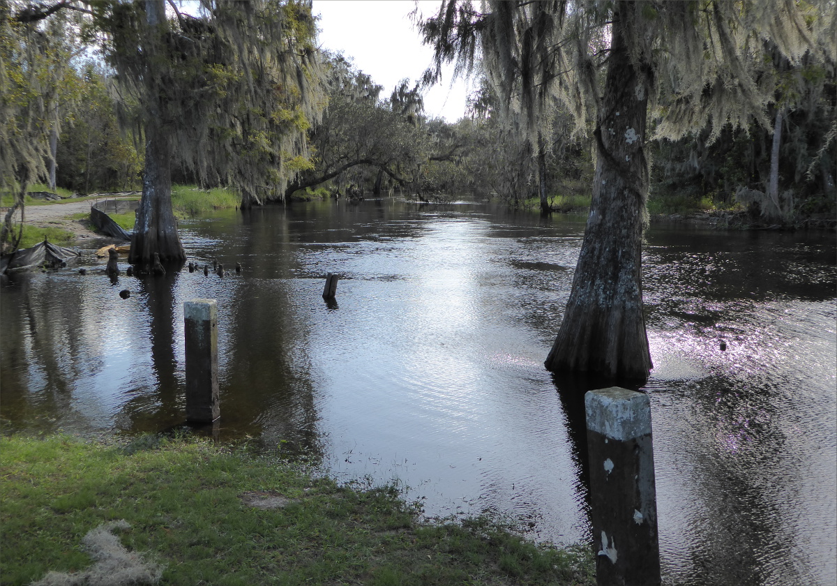
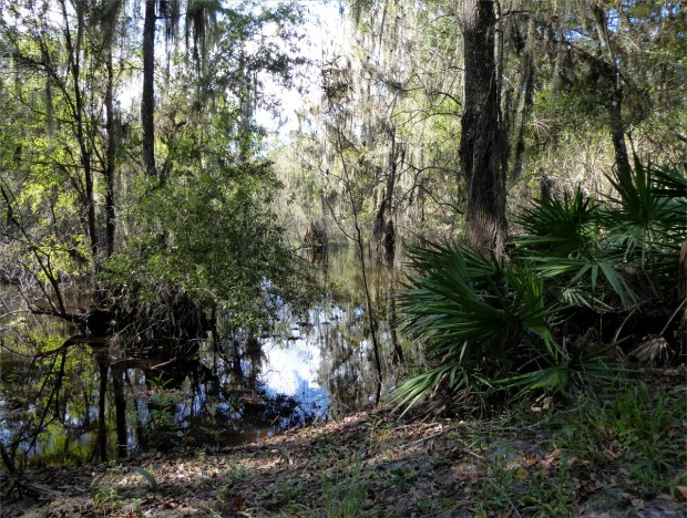
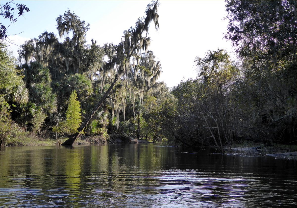
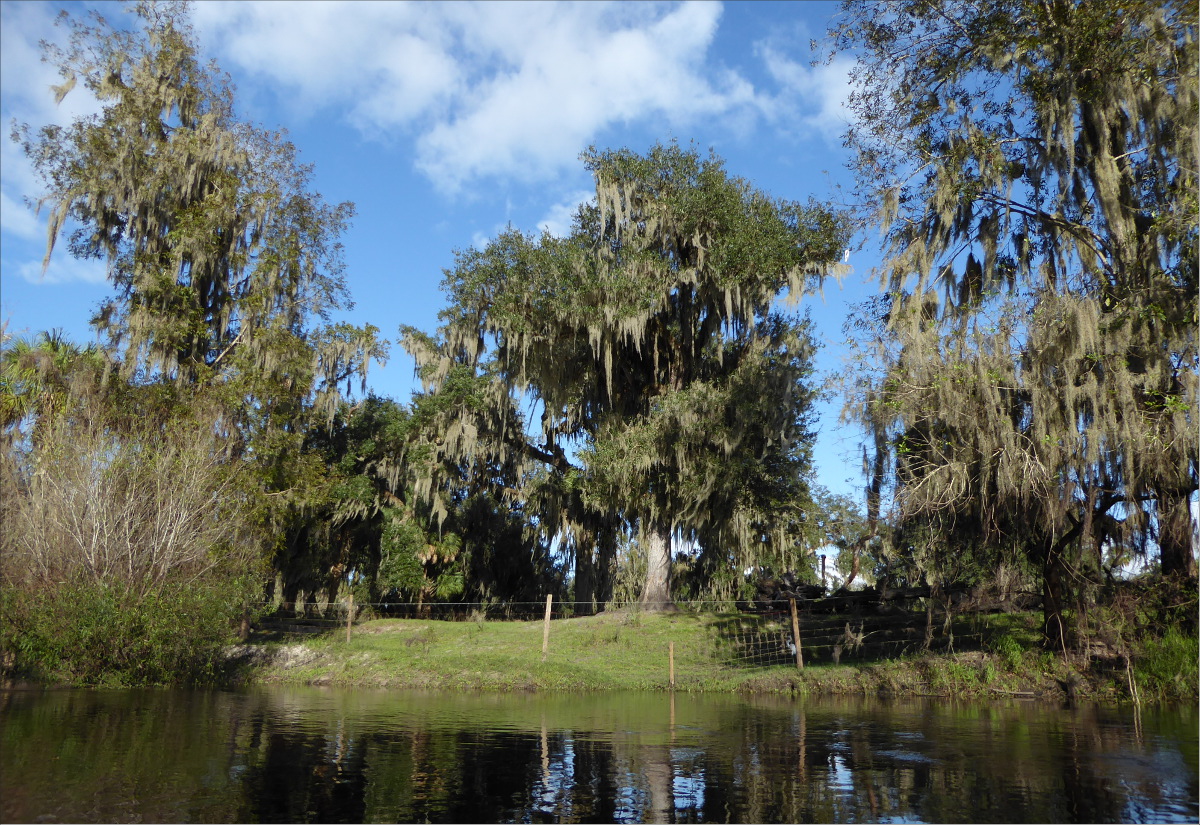
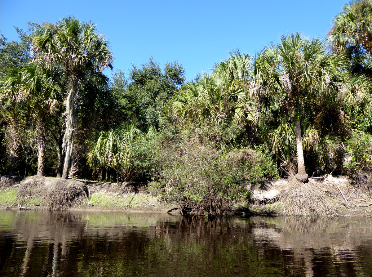
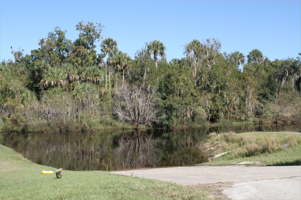
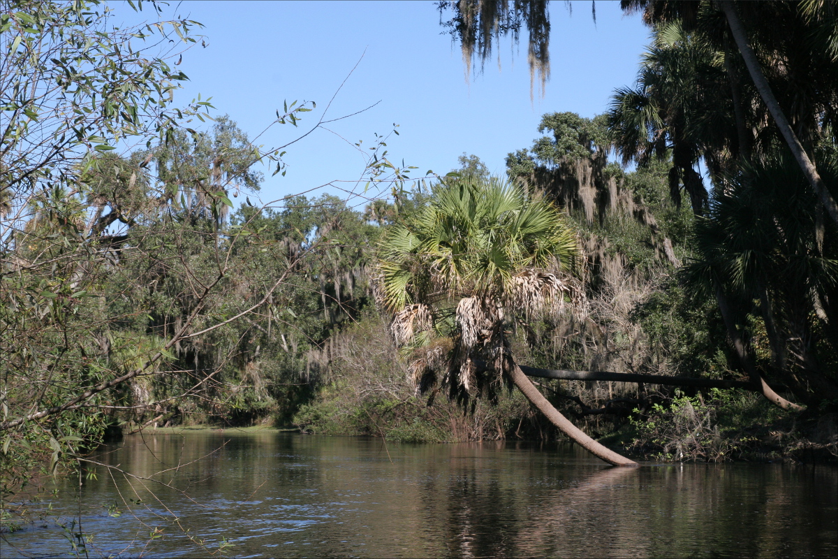
and crossed Pescadero Creek.

Pescadero Creek

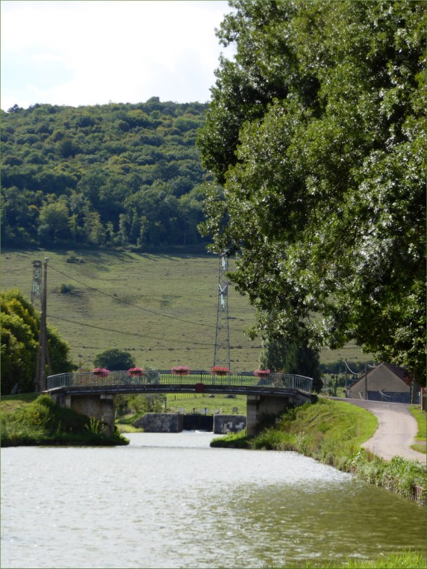
Wurr Road has a steel stringer bridge with a timber deck, built in 1962, around the time the State started buying back land from farmers and lumber companies.

Wurr Road Bridge

We stopped on the bridge for a little while and took in our surroundings. A cloud of smoke escaped from the chimney pipe of a nearby timber frame cabin and blew towards the coast, a fisher held his rod over the creek in search of trout and salmon as fishers must have done for centuries (pescadero means “fishing place”), and Pescadero Creek moved slowly over prehistoric river rocks, fallen trees, fish and fishermen’s feet on its journey back to the ocean.

Pescadero Creek County Park is San Mateo County’s largest park at 5,700 acres. It is one of three parks in the Pescadero Creek Park Complex, which also includes Sam McDonald County Park and Memorial County Park. Click here to be directed to a Parks Department brochure and map.

Wurr Road

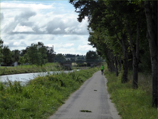
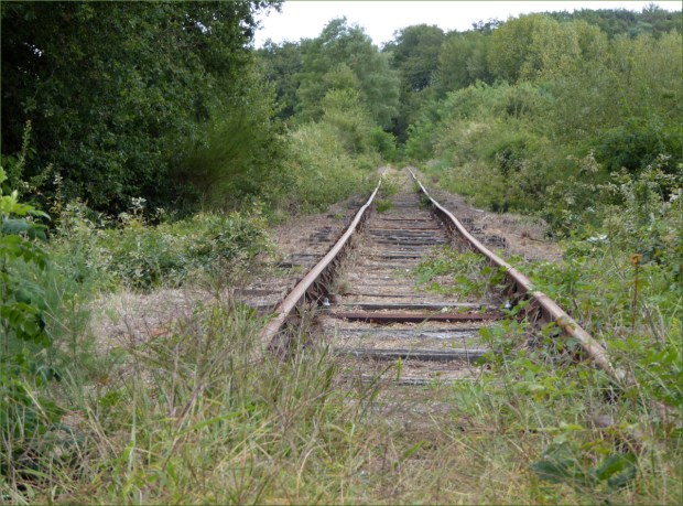
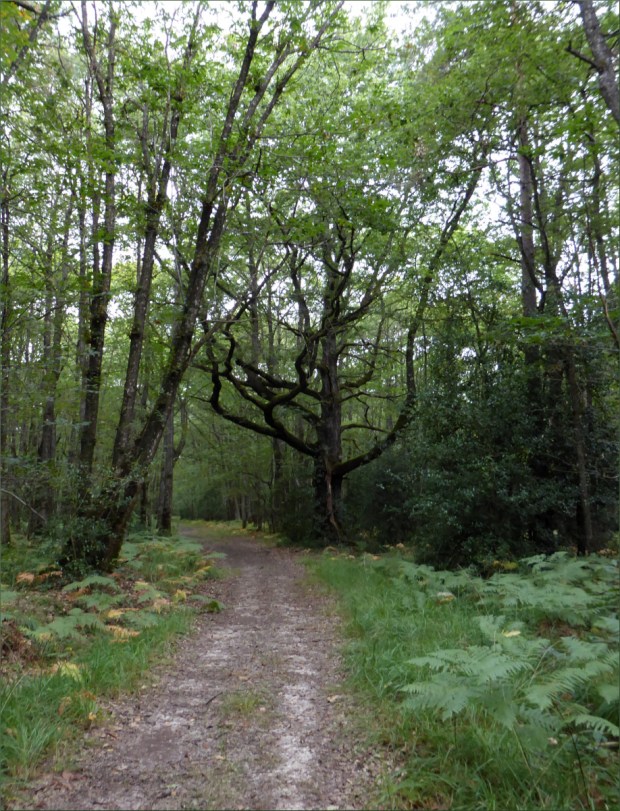
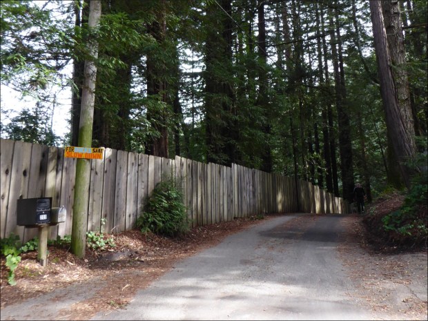
Pescadero Creek County Park has miles of trails. Old Haul Road is one of them. The County website describes it as a multi-use route for hikers, bicyclists and equestrians that intersects with many of the other trails within the park.

Wurr Road

The website advises that visitors should be aware that Old Haul Road is the main access road for maintenance crews, and should expect to meet the occasional heavy truck and tractors along the way.

The website also explains that much of the road follows the route of a narrow gauge railroad line that hauled logs to the various mills that once flourished in the Santa Cruz Mountains. “Even today you can find rusty choker cables used to skid and lift logs on to flatcars,” it says.

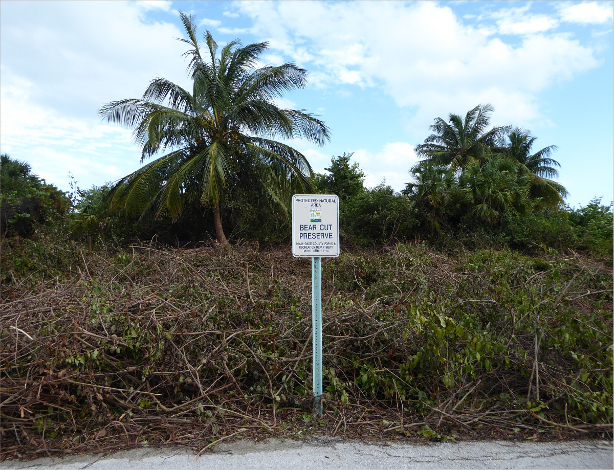
An information board at the trail head (just past a small parking lot) offers the following information: “Pescadero Creek County Park shares its eastern border with Portola Redwoods State Park; trails also connect to Big Basin Redwoods State park. The ranger station in Memorial County Park serves as headquarters for all three parks. The park sits atop a deposit of natural gas and crude oil, which pools in Tarwater Creek and seeps into Jones Gulch Creek. Trees in the park include coast redwood, Santa Cruz cypress, tanoak, and knobcone pine. Visitors may see black-tailed deer and occasional coyote and mountain lions.”

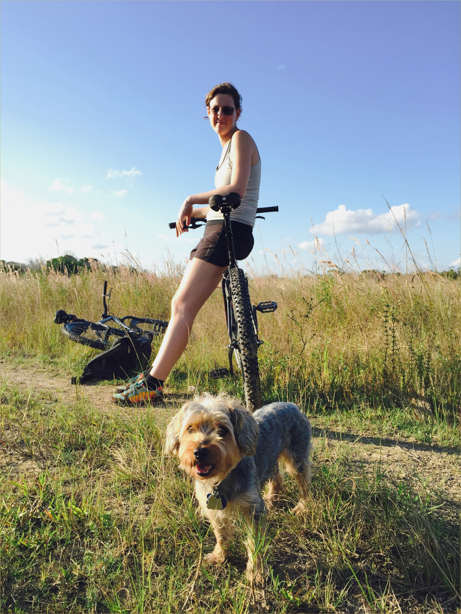
As a beginner mountain biker, the 5.7 mile (9.2 km) trail was an absolute blast to ride. Having finally figured out how to use my gears effectively, the intermittent humps, none higher than 369 feet (112 m) and cumulatively totaling about 1350 feet (411 m), were a thrill to ride over.

The only other people we saw were a group of boys accompanied by an adult, all on mountain bikes, and a ranger in a pickup truck. One of the young mountain bikers made me laugh when he yelled at the top of his lungs, “I-can’t-ride-any-more!” I thought to myself, “If his little lungs can create sounds that are capable of reaching that decibel, he’ll be alright.”

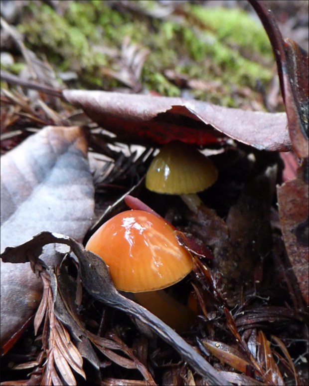
Gliophorus psittacinus (parrot mushroom)?

Galerina Marginata (Autumn Galerina)?

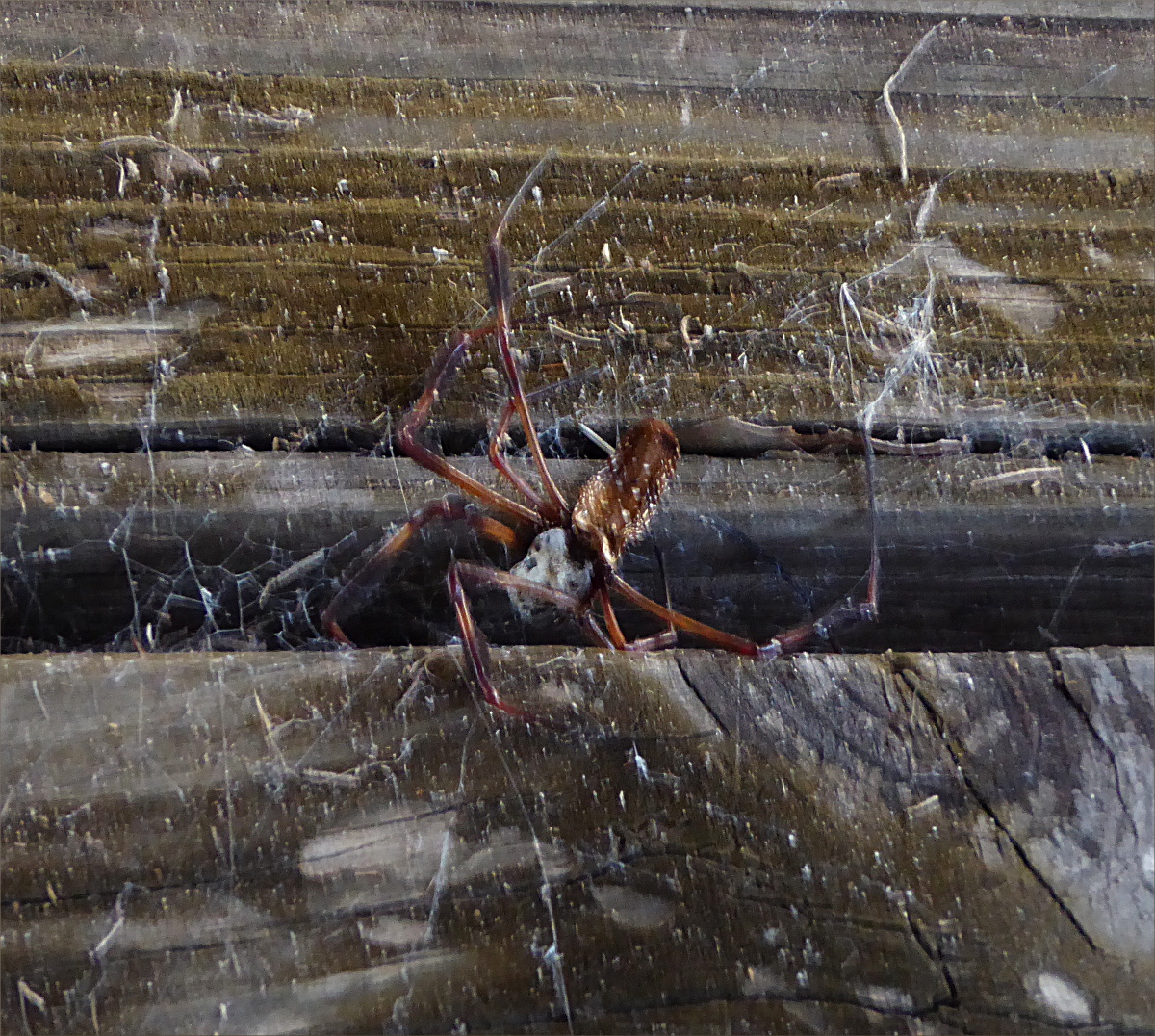
A terrible photo, but an exciting find: a turret spider’s burrow! We find them easily now. When spiderlings leave their mother’s burrow, they don’t venture far (because they’re small and dehydrate easily), so it’s common to find a large turret surrounded by several smaller ones. We’ve seen up to a dozen!

The banana slug… not a relative of the banana spider. They grow up to 10 inches (25 cm) long! The hole in the side of its body (they’re hermaphrodites) is called a Pneumostome. Also called a breathing pore, it allows air to enter the animal’s single lung,
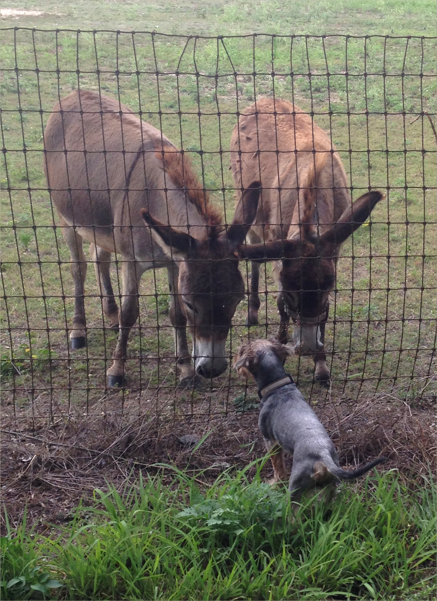
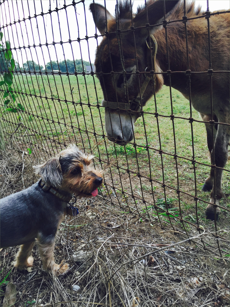
Donkeys!

Resources Consulted:
California banana slugs: Fun Facts About Our Vibrant, Terrestrial Molluscs, Golden Gates Natural Parks Conservancy
California Fungi—Gliophorus psittacinus, MykoWeb
“Five Common Mushrooms that can Poison Your Pet,” by By Dr. Tina Wismer for VetStreet
Old Haul Road, Bay Area Mountain Bike Rides
Old Haul Road, County of San Mateo Parks Department
Pescadero Creek (Wikipedia)
Turret Spider, Friends of Edgewood
“Turret Spiders Launch Surprise Attacks From Tiny Towers,” by Josh Cassidy for KQED Science
Wurr Road Bridge, Bridgehunter.com Historic and Notable Bridges of the U.S.

Bonjour Canal de Bourgogne, Aug 2017

The Canal de Bourgogne is a hop, skip and a jump away from the small, agricultural town of Soussey-sur-Brionne, where my spouse has family. The Canal was originally conceived of in 1605, but construction didn’t began until 1775, and was completed in 1832. It spans 150 miles (242 km) and connects the Atlantic Ocean to the Mediterranean Sea.

Lock near Pouilly en Auxois.

We traveled a very small section of the Canal, limiting our journeys to day-trips around Pouilly-en-Auxois. However, we saw quite a few cyclists, generally in couples, loaded down with enough gear to last several days.

I found the lock-houses (“maisons d’ecluse” in French) fascinating. Although they’re no longer inhabited by lock-keepers (“gardiens d’ecluse”), their location, abutting the trail wherever there is a lock, were vivid reminders of the days when movement through the Canal was hand- and horse-powered. The structure of each lock-house was consistent, but each bore the stamp of their owner in their color schemes and embellishments. All were beautifully maintained.

Lockhouse near Vandenesse.

Some antique agricultural equipment on display outside the Vandenesse lock-house. I used to work at Vizcaya Museum and Gardens, former residence of James Deering (1859–1925), heir to Deering Harvester Company (which became International Harvester Company), so seeing this old Deering equipment was quite a thrill. James Deering had a close relationship with the French, and was even awarded the French Legion of Honor.

Motorized vehicles are prohibited on the trail, but that doesn’t stop locals, young and old alike, from using it to zip from one village to the next on motorized scooters.

Chateauneuf-en-Auxois in the background, with the canal and canal boats in the foreground, make this an unmistakably French scene.

An old and weathered Cardinal butterfly (Argynnis Pandora) enjoying his last days.

Oliver says the grass along the Canal de Bourgogne is some of the best in the world!

Resources Consulted:
Bourgogne-Franche-Compte Tourisme: Chateauneuf-en-Auxois
Canal de Bourgogne (Wikipedia)
I Love Walking in France: Walking the Burgundy Canal
Travelling the Canals and Rivers of Europe: Pouilly en Auxois to Pouillenay
Trip Suggest: Discover Creancey in France!

Bonjour Villentrois, Aug 2017

For many generations, my spouse’s family has had a home in Villentrois (population 645) near Valençay, at the northern tip of the Indre departement. In the past, the town was famous for its mushrooms, which blanket the landscape in November. Mushrooms are also grown in deep caves cut out of the Tuffeau limestone hills. My spouse’s family home has such a cave. They keep you lovely and cool in the summer. Tuffeau limestone is also used to patch neighboring Loire Valley castles, the most famous of which is probably Chambord.

We cycled trails, wrought by tractors, that skirted the boundaries of farms and intersected major roadways, and dirt roads cut by lumber companies, patched with ceramic shards, that disappeared in the shadow of Forêt de Brouard. We avoided major roadways as the roads are small and drivers speed and are unused to cyclists. Small restaurants – none more authentic in France – quenched our hunger. Only one word of caution: check the weather forecast before you leave, as there aren’t very many places to take shelter during rainstorms.

Veuil has a cluster of restaurants that are worth risking a drenching for. We arrived late to Le P’Tit Veuil with a ferocious storm close on our heals, but they did not hesitate to welcome us in, and fed us with such alacrity that I have had to reconsider my definition of hospitality!

The dark area is the Forêt de Brouard. We got caught in a rainstorm while in the forest. The best shelter we could find was a young tree that slowed the passage of the rain, but in no way prevented it from reaching us. The storm lasted about thirty minutes! It was a fantastic ride, though.

Sunflowers, or “tournesols” in French.

A house built with blocks of Tuffeau limestone.

This trail in the Forêt de Brouard was on the delimitation between two departments. The concept of “departement” is similar to “county” in English, but the jurisdiction of departements is wider than that of counties (“comte” in French), which are usually part of departements.

The entrance to a nest of European hornets. Wikipedia says they’re docile unless engaged in contest with another wasp, or defending their nest. They were unbothered by us.

Classic Valencay cheese, made with goats’ milk, little flattened pyramids of heaven.

Route Departemental (D33), road from Lucay-le-Male to Villentrois. The glass insulators on the power lines were old in the 1960s. When my spouse was a child, these funny, old insulators imprinted themselves in his memory so that they will forever be associated with Villentrois.

Resources Consulted:
A Gardener in France: Troglodyte flower show in central France
European Hornet (Wikipedia)
Cheese.com, Valencay

Bear Cut Preserve

25°43’34.35″N 80°09’13.38″W elev 8 ft
Bear Cut Preserve, Crandon Park
Key Biscayne

We hike, jog and bike this short 3.5 mile (5.5 km) trail regularly. I’ve provided the latitude and longitude of the entrance we always use. Parking is free across the street in the Crandon Park Marina. Fifteen years ago, there was ne’er a person to be seen on the trail and the gay community found privacy on the beach. Recently the trail has become popular with bicyclists. The southern end of the beach is popular with kite boarders.

Nov 2012

Nov 2012

At the northern end of the beach is a very cool fossil reef. Before they banned swimming in this section of the beach, we snorkeled there and once as I was parting the sea grass, one single blade failed to move, and when I looked more closely at it, I discovered that it wasn’t a blade of grass at all, but a seahorse! It stayed still only long enough for my eyes to focus on it and then it disappeared. We’ve also seen sting rays and jelly fish.

Apr 2013

Sting ray, Apr 2013

Restricted section of beach where fossil reef is, Jan 2016

Restricted section of beach where fossil reef is; notice the beach erosion; Jan 2016

Although it’s suffered from invasive nickernuts, kudsu and, more recently, beach erosion, it’s still a beautiful trail. All kinds of birds hunt along the coastline and on the many sand bars: plovers and sanderlings, terns, herons, pelicans, cormorants. We’ve even seen yellow warblers in the trees along the trail.

Nicker nut control, Jan 2016

Nickernut control, Jan 2016

Apr 2013

Brown pelicans, Apr 2013

Sometimes you’ll see a metal variety of bird flying high overhead: commercial jets, sea planes, and once we saw a fighter jet darting back and forth across the sky. Cruise ships departing from the Port of Miami are also a frequent sighting.

Apr 2013

Apr 2013

Papaya trees, sea grapes, sable palmettos, coconut palms, mangroves, wild coffee bushes (psychotria nervosa, perhaps the most appropriate Latin name ever given to a plant), American beauty berry, black eyed susans, morning glories, and even a couple edible plants, like sea purslane and prickly pear grow along the trail.

Sea purslane, Apr 2013

Sea purslane, Apr 2013

Prickly pear, Apr 2013

Prickly pear flower, Apr 2013

Prickly pear, Jan 2016

Prickly pear, Jan 2016

Psychotria nervosa under the protective arm of a sea grape, Jan 2016

Psychotria nervosa nestled under the protective arm of a sea grape, Jan 2016

Sea grapes, Jan 2016

Jan 2016

Sable palmettos, Jan 2016

Jan 2016

Path leading to beach from Osprey trail, Jan 2016

Jan 2016

Apr 2013

Dogs are not permitted on the beach, but until recently it wasn’t patrolled, Apr 2013

Bird Highway, Nov 2015

27°44’49.91″N 81°46’47.98″W elev 74 ft
Launch site: Fort Meade
Landing site: Pioneer Park, Pioneer Blvd, Zolfo Springs, FL 33890, (863) 735-0330

We returned to Peace River for Thanksgiving. This year we kayaked upper Peace River, from Fort Meade to Zolfo Springs. We left the car at Pioneer Park, where you can park overnight for free, and took a cab to Fort Meade for $40 including tip. Our cab driver, Mario, said it would be ok to give out his phone number: (863) 245-1527.

PeaceRiverNov2015001

PeaceRiverNov2015005

At fort Meade the river is narrow and intimate. It had overflowed from several days of rain, which sometimes made it difficult to tell which way the river bent. The current was fast and there were many downed trees, making paddling a little more rigorous than the year before.The thorny water locust trees that lined the banks were a concern in our inflatable kayak.

PeaceRiverNov2015002

PeaceRiverNov2015004

We heard lots of alligators; we saw few because they tended to jump in the water with a loud splash before we could get close enough to see them.

PeaceRiverNov2015024

PeaceRiverNov2015031

It was like a bird highway. Great blue herons coasted down the river 20 feet above the water, following its bends like a race car driver follows the bends of a race track. Brown and white ibises poked about for crayfish in pairs, little blue herons, their beaks a striking midnight blue in the sunlight, hunted frogs, egrets waded up to their bums in search of fish, white herons scanned the surface of the river for insects from atop fallen trees, and black headed vultures hung out in flocks high above the water hoping to spot a cow or armadillo carcass.

PeaceRiverNov2015008

PeaceRiverNov2015003

PeaceRiverNov2015029

PeaceRiverNov2015022

River cooters are shy like alligators and jump, sometimes from impressive heights, into the water when they hear us coming. Their compact little bodies make melodic plopping sounds when they hit the water.

PeaceRiverNov2015010

PeaceRiverNov2015011

We arrived late the first day, leaving us only three hours of paddling before it was time to set up camp. A campground provided a convenient place to spend the night. Rustic, it had no water or electricity, although there was a pavilion, bonfire pit, porta-johns, an elaborate, four-grill barbecue and a dumpster. The porta-john was green with lichen and neither Gauthier nor I dared to go in it. I was afraid of what it might smell like, but Gauthier was afraid of what we might find in it.

PeaceRiverNov2015018

PeaceRiverNov2015017

The ceiling of the pavilion was covered in spider webs and mud dauber nests. Spider carcasses made it look like a macabre scene from a movie. I was terrified and transfixed. Gauthier wanted to set our tent up under the pavilion, but didn’t argue when I suggested that we set it up under the stars instead.

PeaceRiverNov2015015

PeaceRiverNov2015014

Gauthier made moong dal and couscous with harissa for dinner, and southern hospitality supplied us with sweet potato pudding. Shortly after we arrived, a truck pulling a trailer drove up and a man in his 50s stepped out. Walking over to us, he introduced himself as Martin and asked us how we were doing. He was talkative and told us the park was built and maintained by the company he worked for, Mosaic. I told him I recognized the name because a sign in the entrance to the park said that the park was dedicated to all the people from Mosaic who had donated their time and labor to the construction and upkeep of the park. That made him smile. He said the park was built 40 years ago and had suffered greatly during the 2005 hurricane, but that everyone had chipped in to restore it.

PeaceRiverNov2015012

PeaceRiverNov2015027

I asked him about the spiders and he said they were harmless, that they called them “house spiders” (I later learned that they are called neoscona domiciliorum or spotted orb weaver). He said the mud daubers wouldn’t hurt you unless you crushed one, which was unlikely to happen unintentionally.

PeaceRiverNov2015013

Before he left, he said he and his two children would be camping on the other side of the campground and that we wouldn’t hear from them again, and insisted that we have some of his home made sweet potato pudding, still warm. It’s easy to regard the Mosaic phosphate mining company as the enemy – breaking EPA laws and decimating the landscape – but it was hard not to like Martin.

PeaceRiverNov2015016

Mosquitoes made it necessary to stay inside the tent, but there was a full moon and a clear sky and it was warm, but not humid, and we left the rainfly off the tent so that it was flooded with moonlight. I woke up several times throughout the night; every time I woke up the moon had traveled a little further across the sky, reminding me that we are all just floating in space.

PeaceRiverNov2015020

PeaceRiverNov2015019

Breakfast was scrambled eggs with fresh green onion, followed by pita bread filled with Nutella, peanut butter and honey. After sticking my foot in a fire ant’s nest, we returned to the river around 9:30 AM.

PeaceRiverNov2015021

The river widened near Wauchula. As we approached the city we expected to see other kayakers, and were very surprised when we didn’t. The only other boat we saw was a fishing boat with a trawler. There was one man inside the boat and another chest deep in the water outside the boat. The man in the boat yelled to us in a delightful, southern accent, “Did you see that alligator over there?! It’s 12 feet long!”  The man in the water smiled and nodded his head and pointed in the direction of the alligator. And there you have it. If a local fisher is not afraid to be up to his chest in the water with a 12 foot alligator nearby, I am not afraid of alligators either. Well, not very afraid.

PeaceRiverNov2015007

PeaceRiverNov2015009

It was the most peaceful paddling imaginable; effortless in a gently moving current that guided us around bends and islands. We took tiny sips of aromatic heirloom whiskey by Widow Jane.

PeaceRiverNov2015025

We stopped for lunch at Paynes Creek Historic State Park where we were welcomed by a “No Camping” sign. I wondered why they needed swinging trash cans. Did they prevent raccoons from making a mess?

PeaceRiverNov2015026

PeaceRiverNov2015023

Come 4:00 it was time to start looking for another place to camp. A lovely field on a high bank seemed safe from unsuspecting alligators. We had mashed potatoes and pouched tuna followed by split pea soup for dinner.

PeaceRiverNov2015030

That night, something large and solid rustled in the bushes nearby. An auroch, Gauthier said it was. But Ollie and I weren’t fooled. We knew it was an armadillo.

PeaceRiverNov2015035

In the morning, dew-drenched grass sparkled in the sunlight and revealed many tiny spider webs – orb and three dimensional – suspended from blades of grass. Ollie and I explored the webs for a while until we discovered a tick. Thankfully it was the only tick we saw. It was an all-black specimen, not like the red dog ticks we have around Miami.

PeaceRiverNov2015028

Between Wauchula and Zolfo Springs we passed many ranches and private homes. We saw confederate flags, enormous live oaks, and sable palmettos clinging to the river bank with roots that looked like hair. Once, we heard the sound of human voices interspersed with gun fire a little too close for comfort.

PeaceRiverNov2015032

Just before Zolfo Springs boat launch at Pioneer Park, you learn why it’s called Zolfo Springs. Gurgling up into the river, springs cause the tiniest bit of white water. I was very sorry to reach Pioneer Park, although the prospect of a shower tempered my disappointment.

PeaceRiverNov2015033

On the way home we stopped for lunch at Wheeler’s in Arcadia and browsed the antiques on sale in the stands that line the street every Saturday. An amazing traveling companion, Gauthier drove us through some very unique landscapes on the way home. Although we couldn’t go in the Archbold Biological Station to explore the unique Florida scrub because we had Ollie with us, we drove through it on Old State Route 8.

PeaceRiverNov2015034

We also drove by a pine tree plantation. On one side of the road was a vast forest of pines trees growing in eerie rows, and on the other side was the muddy and desolate remains of a harvested forest.

We traveled through Florida flatlands that reminded Gauthier of the south of France, and alongside massive orange groves, and around gigantic ranches with “Beef, it’s what’s for dinner!” signs hung outside. The Brahman cattle with their humped backs were a sight to see.

Closer to home, near Lake Okeechobee, they were harvesting sugar cane in the cane plantations. Bright lights lit up the fields like fire flies.

Spring and Fall in Southwest Miami-Dade County, 2015


Spring starting point:
Silver Palm, FL 33170
25°33’03.40″N 80°26’43.82″W elev 11 ft

Fall starting point:
SW 168 Street and SW 208 Avenue, Miami FL 33187
25°36’30.57″N 80°31’30.14″W elev 5 ft

Our bike riding adventures took us to southwest Miami Dade County twice this year. In May, they took us to the Redland historic agricultural area. Our path followed public roads barely recognizable as roads and canal C-102. We saw a variety of farms: avocado, palm tree, mango, dragon fruit, bromeliad and many others. We also saw donkeys and purple love grass.

In November, we ventured into the fringe of Miami Dade County just west of the C-357 seepage canal where “farmburbia” peters out and the Everglades National Park begins. Once again we followed the ruins of public roads. This time they were overgrown with grasses as thick as your thumb and so high they blocked out the sun. Once inside the perimeter of Everglades National Park, there were two roads to choose from. One was cut out of the native limestone floor. We took this road as far as we could before it became flooded, which wasn’t very far. The other was made of raised hard pack and offered a great view of the endless horizon of Shark River Slough. We saw mocking birds, blue jays, butterflies, goats, chickens, cows, horses, dogs and, unfortunately, discarded tires, soda pop cans, mini fridges and cell phone accessories circa 2005. We also stumbled upon Julio’s Apiary, a licensed bee farm.

redlands

1505-4

1505-9

1505-7

1505-5

1505-3

1505-12

1505-11

1505-6

1505-2

1505-10

1505-8

1505-1

7 miles on the Fringe

151101-1

151101-2

151101-3

151101-6

151101-5

151101-4

Resources
Select Florida Native Grasses for North Central Florida – Fact Sheet #67, by Gale Kempner, University of Florida IFAS Extension
Modified Water Deliveries to Everglades National Park, 8.5 Square Mile Area, by Michael J. Collis, US Army Corps of Engineers, Jacksonville District, May 23, 2012
Agrilicious: Julio’s Apiary & Avocado/Mango Grove

Just Down the Street, Mar 2015


Chapman Field Recreation Center
13601 Deering Bay Dr, Coral Gables, FL 33158
(305) 665-3837
25°38’42.13″N 80°17’25.47″W elev 16 ft

Chapman Field Recreation Center, or Chapman Field Park as it’s better known, is a ten minute drive down the lushly canopied Main Highway from where Gauthier and I live in Coconut Grove. We launched from Chapman Field for the second time two Sundays ago. I love this spot. It was quite busy on both occasions. On our first visit, we ran into a kayaker training to become a kayak tour guide in Alaska. On our second visit, we met a man who had just completed a 25 mile paddle on a Hobie. There were also several groups of kayakers.

Blog_MG_3487

The individual in the photo of the launch dock was part of a group of three who loaded their kayaks with beer, fishing gear and a boom box. We ran into them on our return trip. They were hanging out where Biscayne Bay meets the labyrinth of canals that takes you back to the launch. One of them was swimming and, as we approached, his buddy yelled “Alligator!” That brought him upright in a rush!

Blog_MG_3490

The history of Chapman Field is rather complicated, but fascinating. I found a very well written and detailed account of it here: Chapman Field – The Evolution of a South Dade Army Airdrome, written by Raymond G McGuire formerly of U.S. Department of Agriculture, last updated 2005.

Blog_MG_3491

What follows is a summary of that document:
The U.S. military created Chapman Airfield in 1918 to assist with the war effort. The site consisted of a marl landing field, a lagoon for water landings, channels into Biscayne Bay, and a town with electricity, waterworks, a sewage system and a hospital. It was named after the first American pilot casualty of the war. Abandoned after the war, the land was used by the United States Department of Agriculture.

Blog_MG_3496

Under the leadership of Dr. David Fairchild, a plant explorer in charge of the Bureau’s Office of Foreign Seed and Plant Introduction, and creator of Miami’s famous Fairchild Tropical Botanic Garden, the site was used as “an ‘Ellis Island for plants’ – a place where sensitive plants could be propagated and bred for resistance to colder temperatures prior to their introduction to areas of the U.S. farther north.” By 1938, they had brought over 9000 new plant specimens to the site. In 1935, the site was expanded to include space for conducting rubber research.

Blog_MG_3505

Portions of Chapman Field were subsequently used by Embry-Riddle flight school, the University of Miami, and passed through the hands of a private developer or two. As of 2001, according to the author, neighbors and environmental concerns had “stalled large-scale development sufficiently long that community interest has turned toward preservation of Chapman Field Park as a natural area.” The USDA has continuously occupied a section of the property since 1923, and continues to conduct plant science research there.

Blog_MG_3508

If you’ve ever wondered what an overgrown baseball field looks like, Chapman Field Park will provide you with the answer. The first thing you see when you enter the park is a small, elevated, outdoor recycling center, followed by a series of three overgrown baseball fields. The park also includes a hiking/bike trail. But of course, my favorite part is the kayak launch.

Blog_MG_3530

Blog_MG_3486
(In case you were wondering where Ollie was!)

Three Days and 31 River Miles (50 km) on Peace River, Nov 2014

27°13’54.87″N 81°53’29.69″W elev 28 ft
Launch site: Zolfo Springs; Landing site: Canoe Outpost – Peace River, Inc., 2816 NW County Rd. 661, Arcadia, FL 34266, (800) 268-0083

Canoe Outpost maps and instructions

Gauthier and I chose to spend Thank-you Day floating down the quiet waters of Peace River this year, feasting our eyes rather than our stomachs.

IMG_2730_W1200

Our shuttle from Arcadia to Zolfo Springs.

IMG_2750_1200

Sloth cows, bison, llamas, mastodons, tapirs, megalodon sharks, mammoths, camels, dolphins, dugongs… What stories the river could tell!

IMG_2733_W1200

IMG_2763_W1200

Gardner Public Boat Ramp

IMG_2783_W1200

IMG_2818_W1200

IMG_2823_W1200

IMG_2898_W1200

He was seven feet long.

IMG_2906_W1200

IMG_2912_W1200

View from our camp site, night one. It got pretty chilly: 41 degrees Fahrenheit (6 degrees Celsius).

IMG_2917_H1200

IMG_2922_W1200

IMG_2987_W1200

IMG_3052_W1200

IMG_3103_W1200

IMG_3072_W1200

IMG_3156_W1200

Off the Beaten Path, Dec 2012

Bill Baggs Cape Florida State Park, 1200 Crandon Boulevard, Key Biscayne, FL 33149
25°40’27.02″N 80°09’29.55″W elev 1 ft

Among the long overgrown campsites where only forgotten trail seekers dare to go…

IMG_1126 (H1200)
Giant Zebra Long Wings are everywhere.

IMG_1127 (W1200)

IMG_1153 (W1200)
And so are Golden-Silk spiders, also known as banana spiders. This one was about 4 inches long. Their bite is less painful than a bee’s, and apparently, “In the South Pacific, females are induced to build webs on bamboo frames, which are then used as fish nets. The natives also relish the gravid females as a protein supplement, eating them either raw or roasted. Different reports say that the flavor is somewhat like mixed raw potato and lettuce mixed, or nutty flavored like peanut butter with a sticky consistency (http://entnemdept.ufl.edu/creatures/misc/golden_silk_spider.htm)”.

IMG_1159 (W1200)
Ficus roots give Ollie a height advantage.

IMG_1139 (H1200)
The sable palmetto is not just a tree, it’s a habitat.

IMG_1169 (W1200)
One of South Florida’s many thorny vines…

IMG_1189 (H1200)
Is no match for Gauthier as he takes a photo of a dragonfly with his Lytro.

IMG_1193 (W1200)
A lizard (Eastern Fence?) with a skull pattern on its head reminds vagrant hikers of the dangers of hiking off the beaten path.