Start 25°32’13.67″ N 80°20’37.03″ W elev 5 ft
End 25°25’12.08″ N 80°21’27.76″ W elev 6 ft


Start 25°32’13.67″ N 80°20’37.03″ W elev 5 ft
End 25°25’12.08″ N 80°21’27.76″ W elev 6 ft
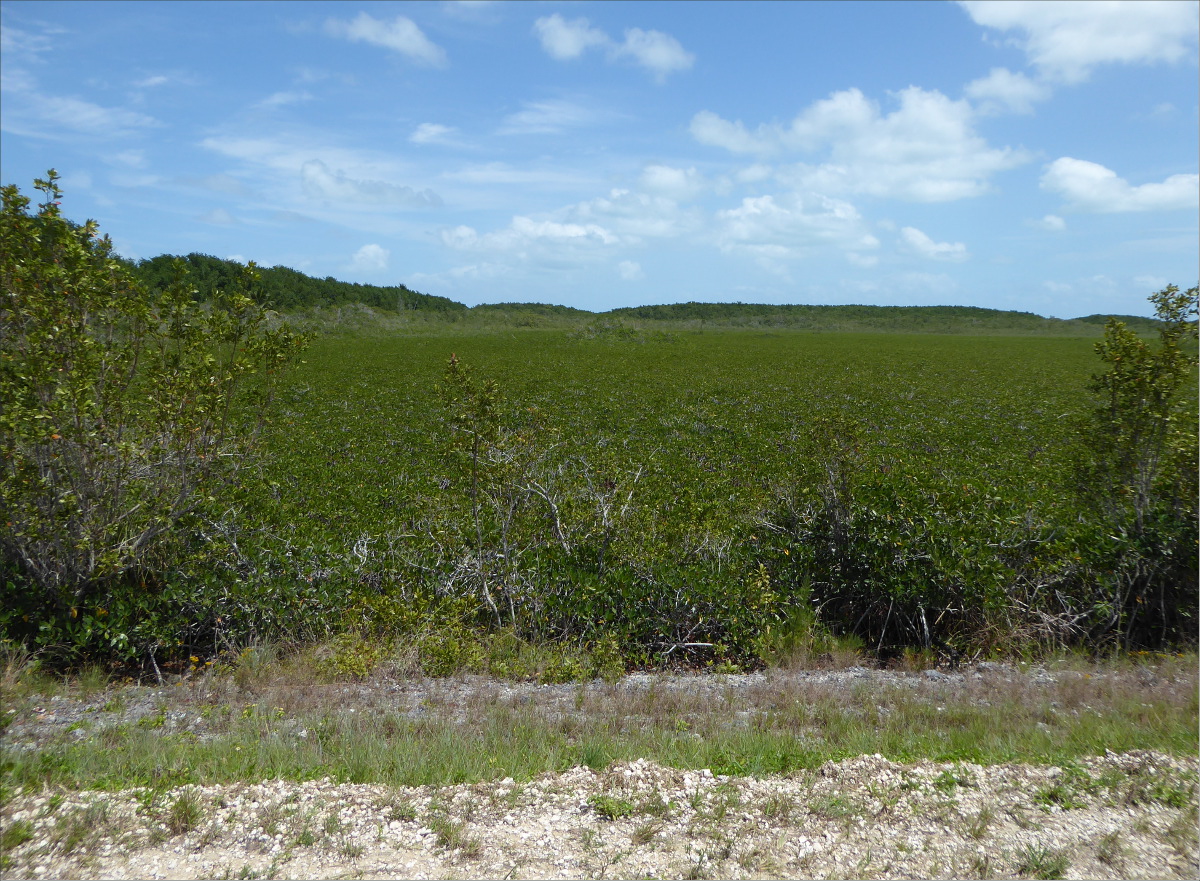
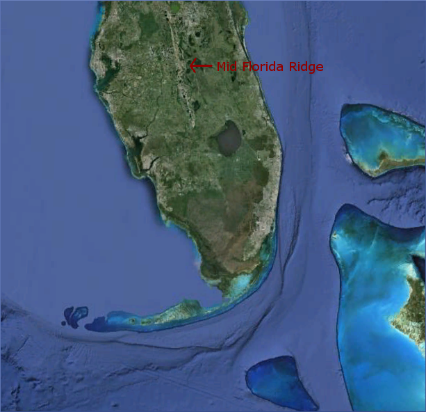
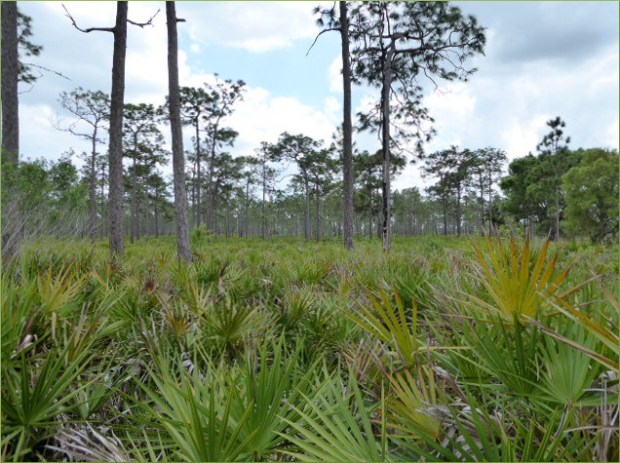
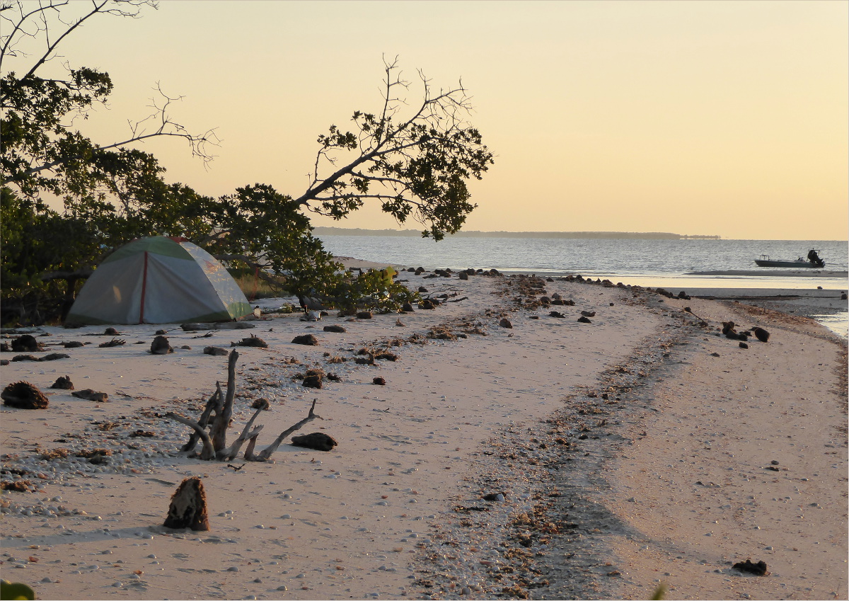
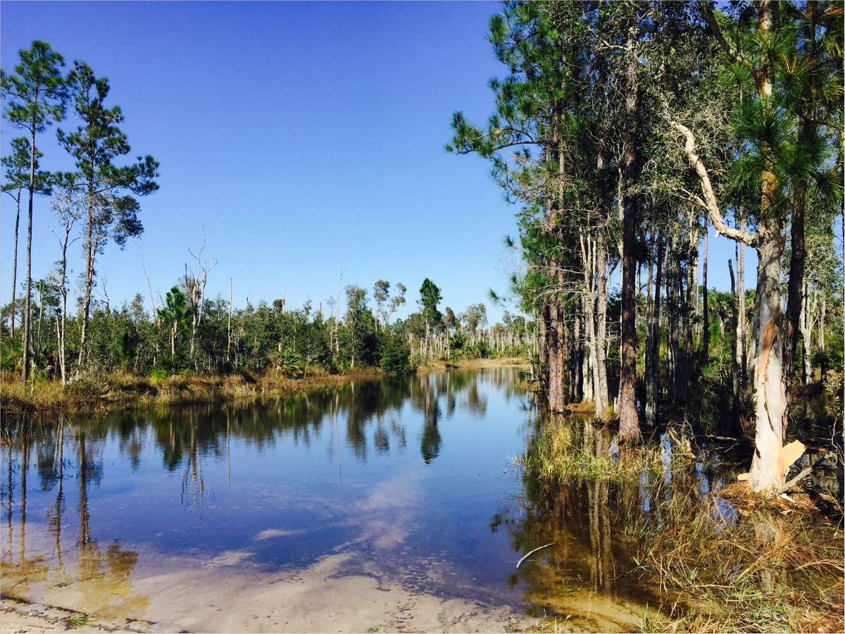
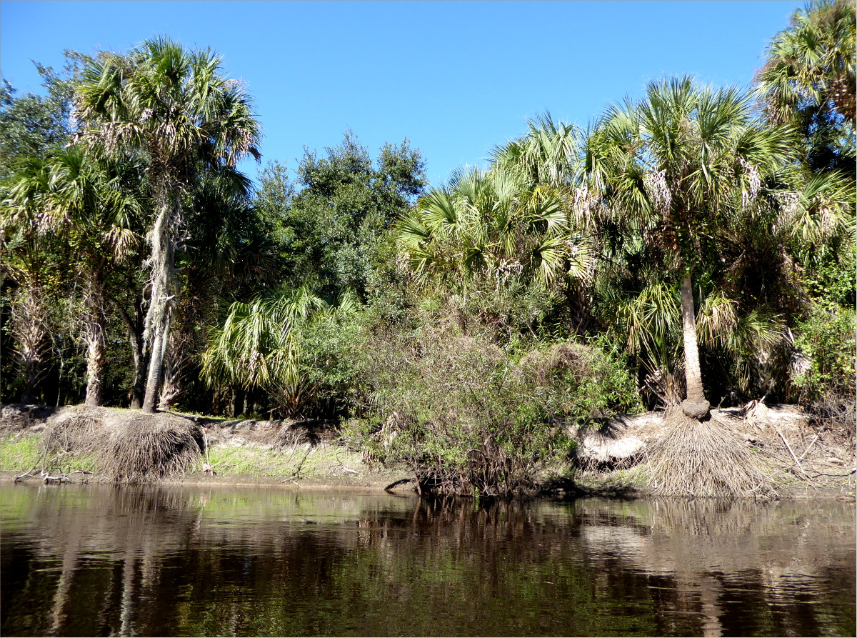
In March, we spent the Easter long-weekend here. This is Lake Wales Ridge, also called the Mid-Florida Ridge. The long, narrow dune extends 115 miles in length and four to 10 miles in width; the sands were deposited 650,000 years ago.

Doesn’t the outline of the southern end of the Ridge bear a striking resemblance to Florida’s southern coastline?
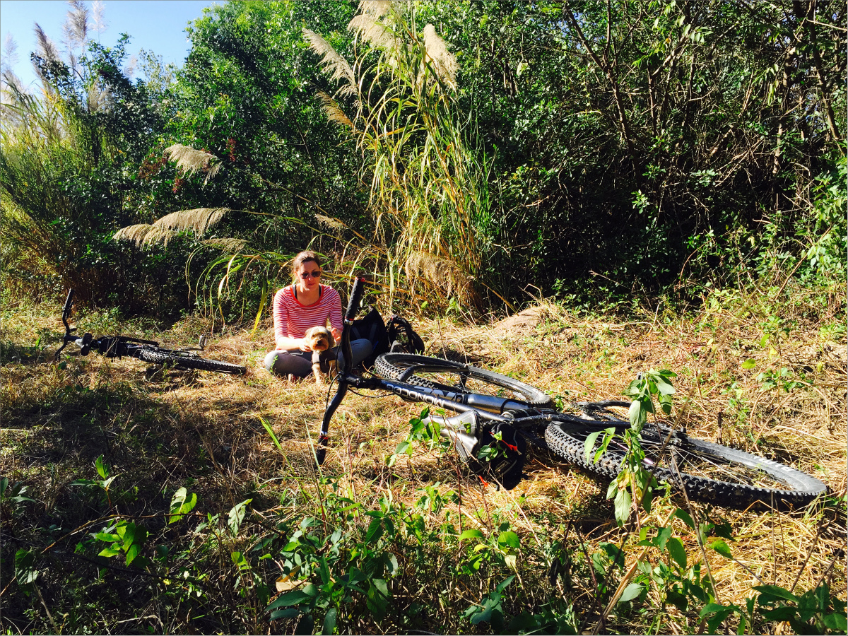
I like to imagine that we traveled not to Highlands or Polk County, but back in time to prehistoric Florida, when the Ridge was a series of land islands connected to the southwestern United States by the now-sunken Florida Shelf. While our primary goal was to visit Archbold Biological Station, we took detours to Platt Branch Wildlife and Environmental Area, New Boot Heal Road, and a once-public road on a now-private ranch. We stayed overnight at Fisheating Creek Outpost .
Platt Branch Wildlife and Environmental Area
Managed by the Florida Fish and Wildlife Conservation Commission
27°03’00.5″ N 81°21’54.0″ W elev 100 ft
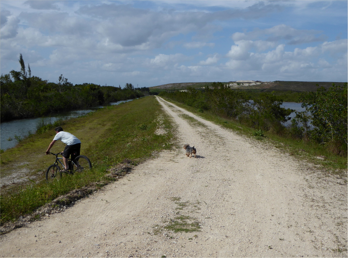
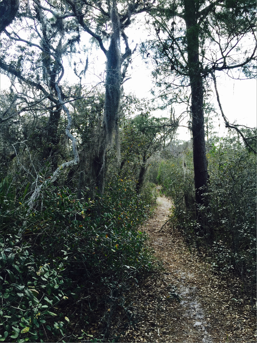
Bikes are prohibited on this other-worldly, sandy trail.


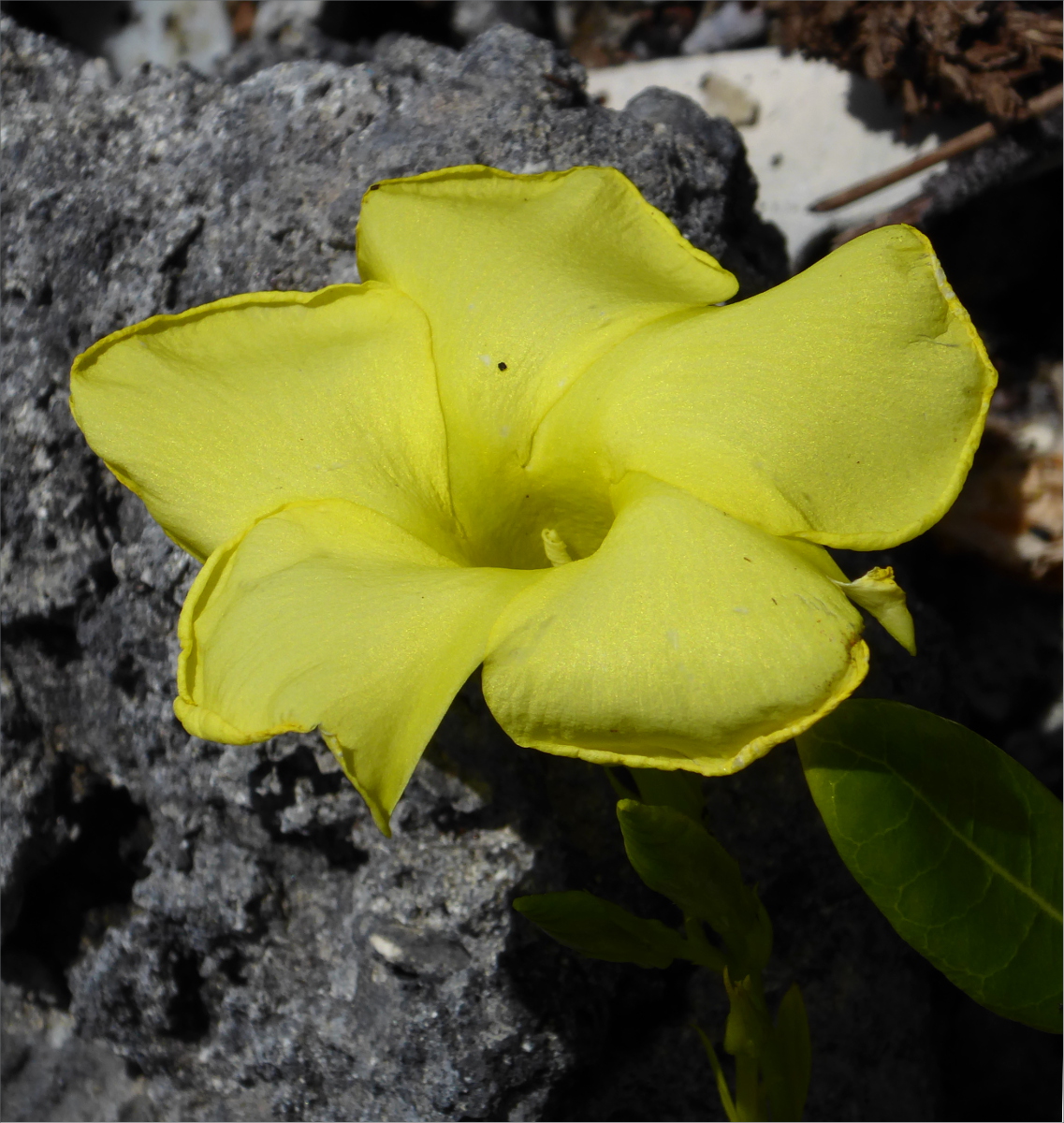
We’re not sure, but it’s possible that we saw a Florida black bear here. Although it was too far away to tell, it was the right size and color. We also saw deer, scrub jays, sandhill cranes, and mockingbirds, as well as the below Polygana nana (Candyroot).

Polygala nana (candyroot)
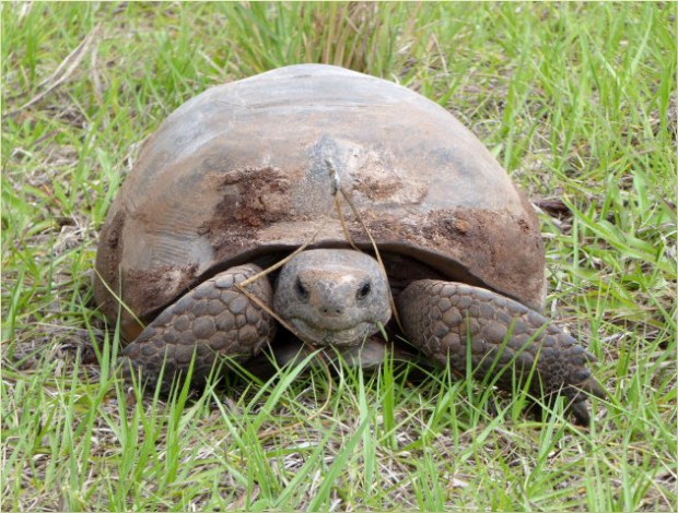
Just down the road from Platt Branch, we saw this gopher tortoise. We stopped in the middle of the road to photograph it. While we were stopped, a ranger pulled up beside us. “It’s incredible!” Gauthier exclaimed. The ranger smiled and replied, “This is their home.” Burrows dug by gopher tortoises provide refuge to many other animals during woodland fires and high summer temperatures.
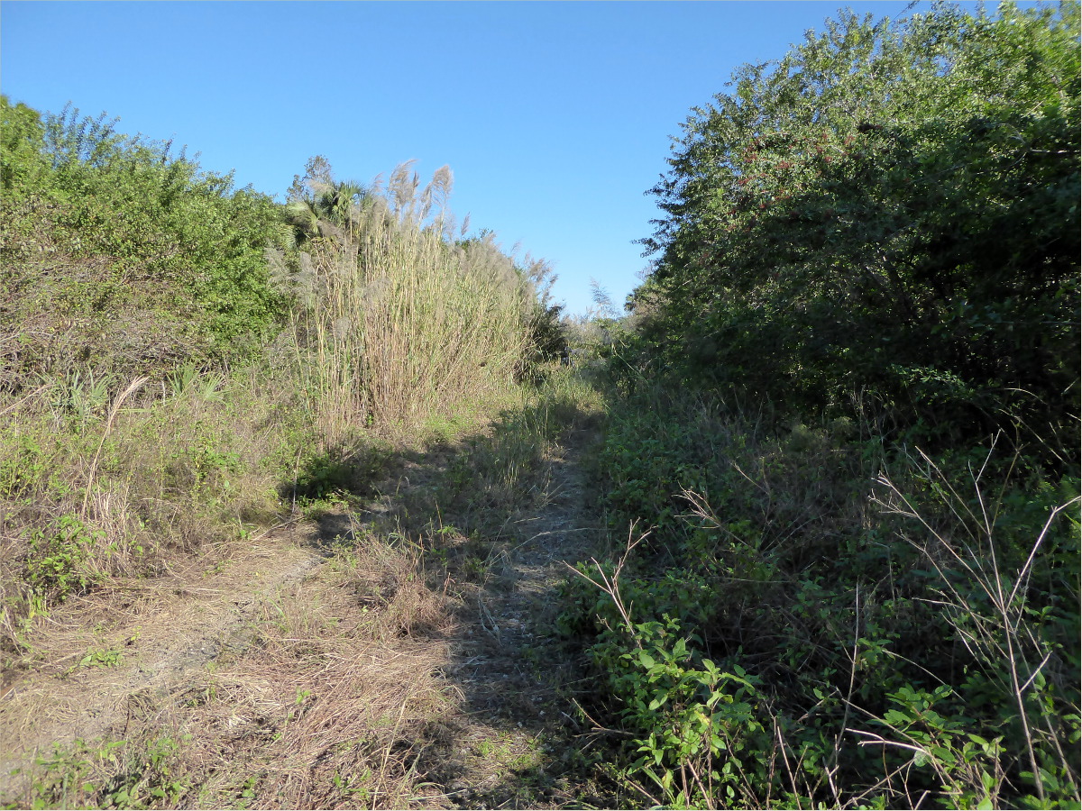
New Boot Heal Road
Start 27°05’15.47″ N 81°24’20.96″ W elev 85 ft
End 27°07’15.12″ N 81°26’51.61″ W elev 74 ft
This 10-mile ride took us along a mostly hard-pack road that zigs and zags in the pattern of… yes, a new boot heal. We passed by homes with large, beautifully maintained yards, ranches with hundreds of cows that stopped to watch us as we rode by, and a logged tree farm with the logs left stacked fifteen feet high in the middle of the road. The road ended at a dead end where a very lovely, yellow bird, perched upon a power line, sang us a song.


Fisheating Creek Outpost
26°56’21.73″ N 81°19’06.17″ W elev 39 ft
Fisheating Creek Outpost, 7555 U.S. 27, Palmdale, Florida, 33944
Campsite map and rules
We’d stayed here before, but not on a holiday weekend… or during a big, televised soccer match. Oh boy did our fellow campers enjoy that match. It was not a tranquil stay, but the cook got to try out his newly designed, ultra light-weight camp stove and all the kids running about reminded me of the camping adventures of my youth: the feel of gumboot-clad shins wading in the cool water of yabbie-filled creeks, scaling dried-up waterfalls, and riding my bike ten miles into town to buy my first bikini.

“I can’t take it?” I overheard one kiddo ask his dad. “No,” was the unequivocal answer. “I can’t take it?” he asked again… and again. Finally, exasperated, the dad explained to the equally exasperated child, “You can’t carry a 200 pound alligator.”
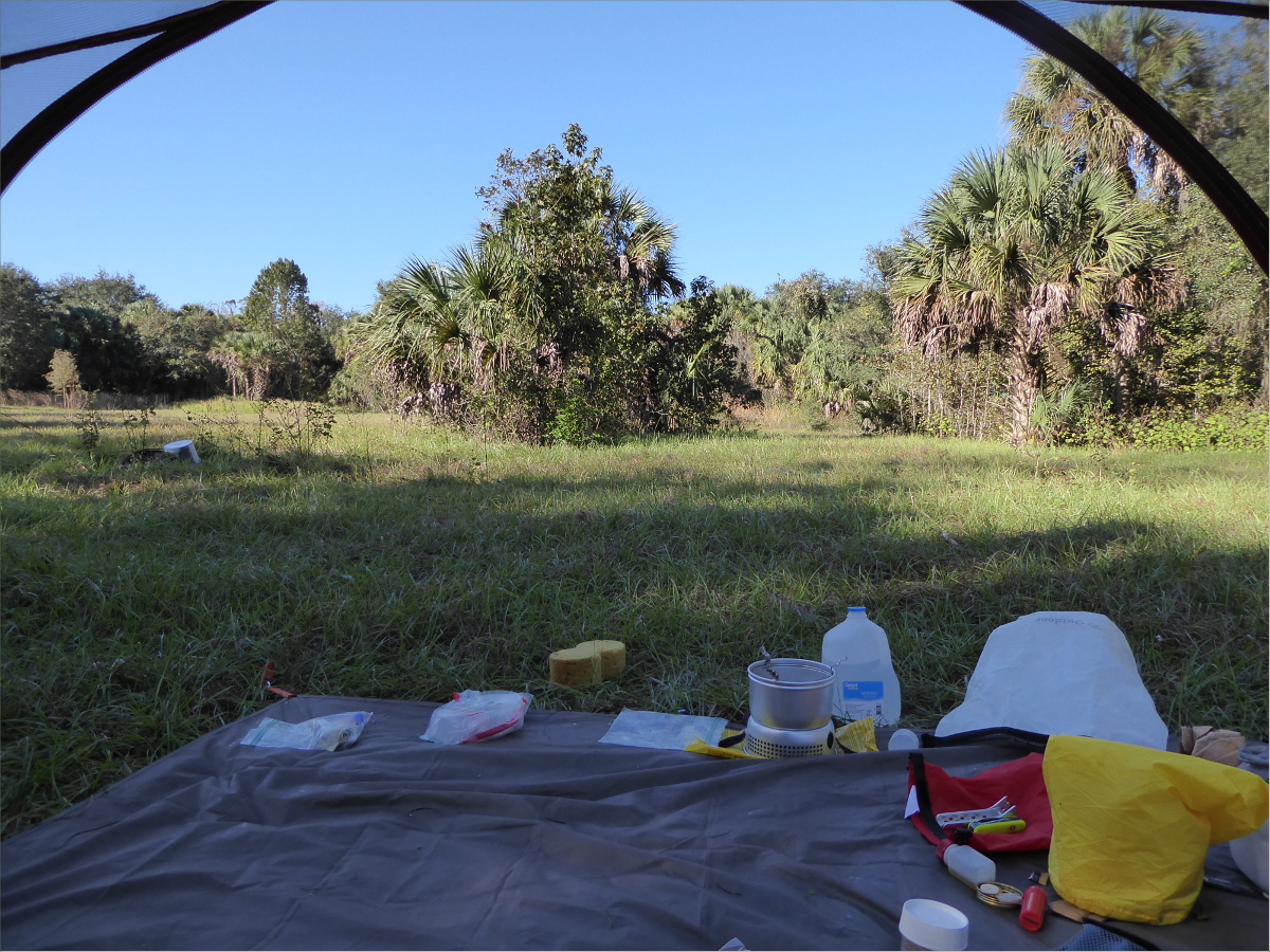
The view from our tent

A Once-Public Road
Start 27°05’29.90″ N 81°28’54.33″ W elev 72 ft
End 27°06’15.92″ N 81°29’04.10″ W elev 69 ft
I am a stickler for rules, so I reluctantly ignored the large sign indicating that the property we were about to enter was private. “On the map it looks like a public road” Gauthier patiently explained.
It wasn’t fifteen minutes before we were escorted out by a very polite woman, vaguely resembling my sister-in-law, with an SUV full of lil ‘uns. “It was a public road a long time ago,” she corrected us with apologetic eyes, but a firmly set jaw. In Europe, it’s not uncommon for private property to be intersected by public roads.


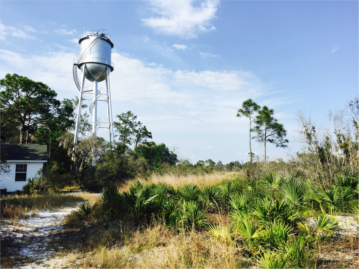
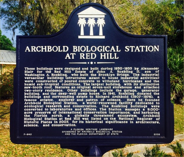
Archbold Biological Station
123 Main Dr, Venus, FL 33960
(863) 465-2571
27°10’58.19″ N 81°21’07.50″ W elev 137 ft
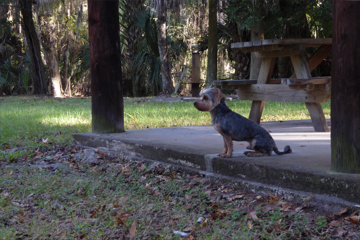
Archbold Biological Station has fantastic labels. The trails are labelled, the buildings are labelled, the donation box is labelled, the reused-concrete bridge is labelled. I love labels and I love Archbold Biological Station, even though they don’t allow dogs (hence no Ollie pictures in this post).


The labels encouraged me to touch the curled-up, waxy scrub oak leaves so that I’ll never forget them, and observe the different plant species on either side of a trail with two different elevations – one side was sandy and the other side had a layer of clay. I also learned how to tell scrub palmettos apart from saw palmettos. I love that scrub jays line their nests with the fibers that grow along the edge of scrub palmetto leaves.
Shrub-like scrub oak (Quercus inopina), sand live oak (Q. geminata), Chapman oak (Q. chapmanii) and myrtle oak (Q. myrtifolia) lined the trail.
It’s hard to tell saw palmettos and scrub palmettos apart, as you can see in this photo.

We didn’t know it at the time, but this captivating species of lichen, Cladonia perforata (Florida perforate reindeer lichen), is endangered.
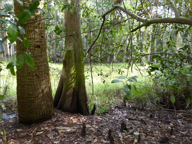
It’s wonderful that the Roebling and Archbold families recognized early on how special the Ridge ecosystem is and preserved it, and it’s doubly wonderful that it is accessible to the lay public as well as scientists. The architecture is also very cool.

Resources Consulted
Lake Wales Ridge, Lanscope America
History of Archbold Biological Station
25°07’06.31″N 81°04’48.28″W elev 1 ft
East Cape, Everglades National Park
Launch site: Flamingo Visitor Center,
40001 State Hwy 9336, Homestead, FL 33034
(239) 695-2945
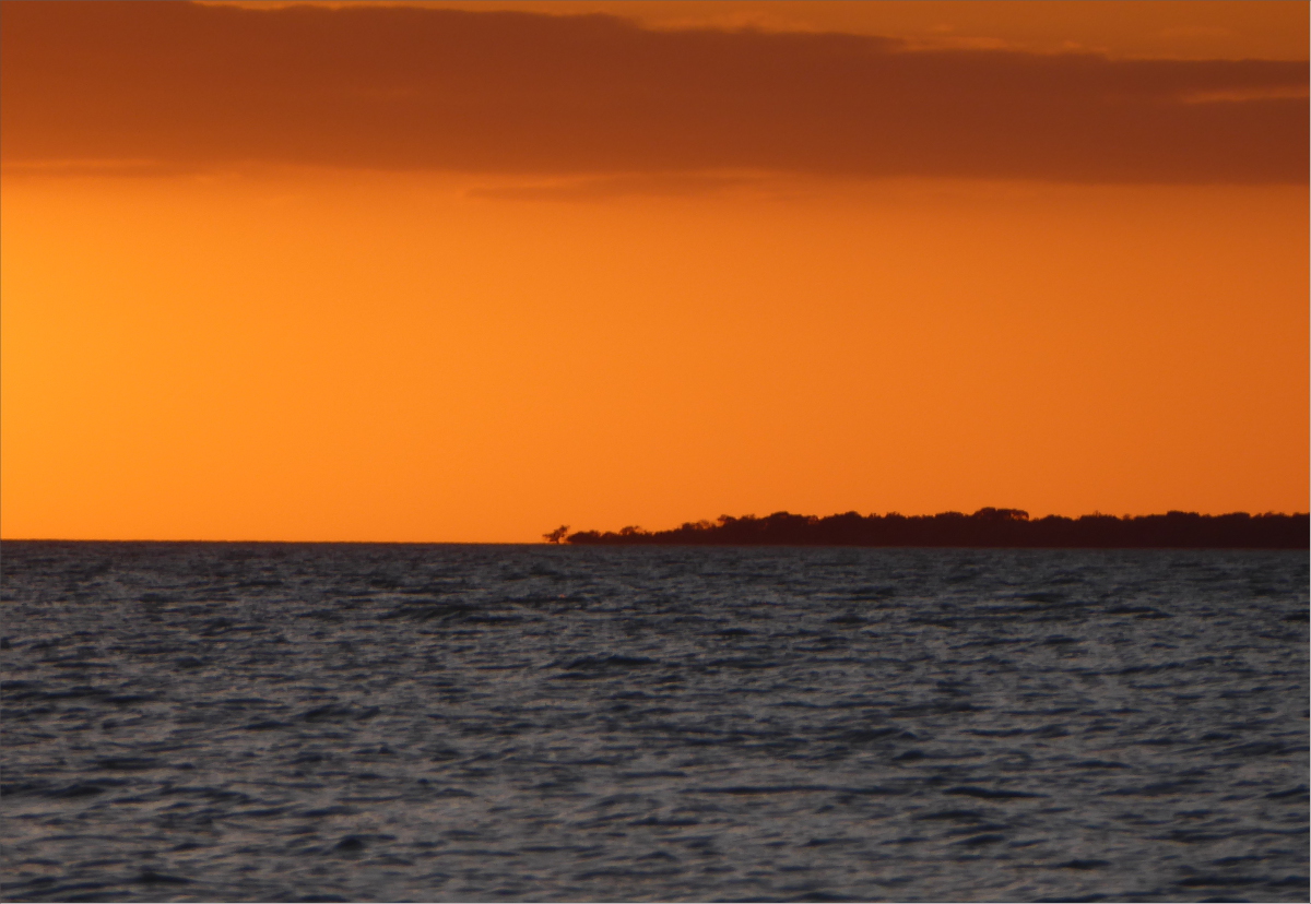
We didn’t quite make it to East Clubhouse Beach. Come 4:30 pm we were pretty tired, so we stopped about a mile shy of East Clubhouse Beach at Clubhouse Beach. Although we were paddling with the tide, the gusts were killing me. I was happy to claim this secluded little stretch of beach as our own for the night.
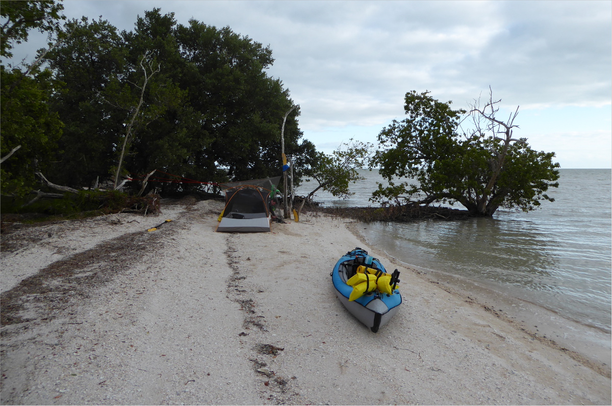
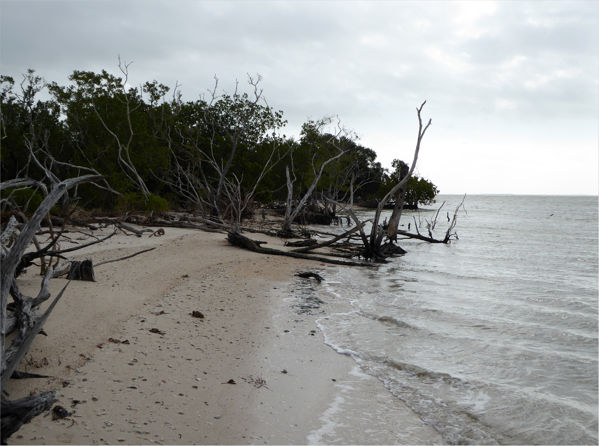
As Gauthier made dinner, I watched the tide come in… with some trepidation. “I wonder if we should move our tent a little higher up the beach”; the thought kept running through my mind.
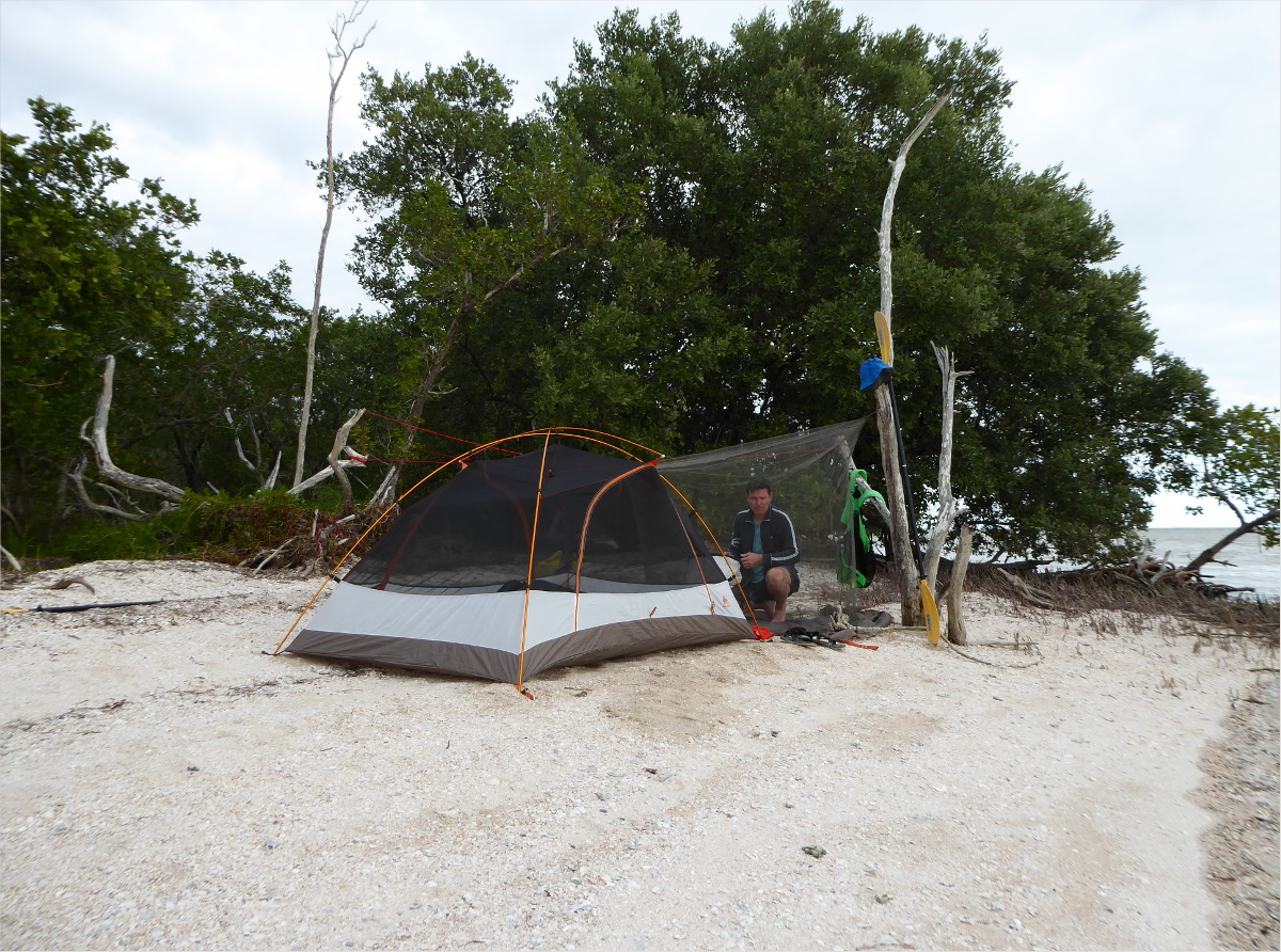
So we moved it.

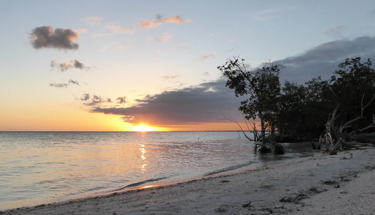
And I relaxed as the sun relaxed its grip on the day.
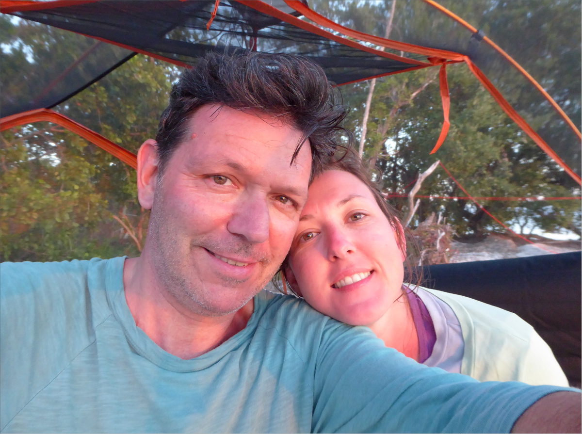
Two happy campers.
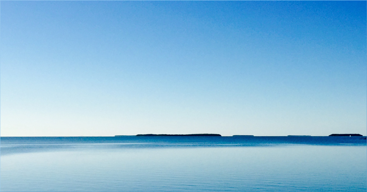
That tiny silhouette of a tree in the middle of the below photo, that’s the tree on the tip of Cape Sable that we used to gauge how far we’d traveled. Four hours and some sore shoulders is about how far away it is in this picture.
Unfortunately, we didn’t capture any photos of the final leg of the journey. We didn’t calculate the tide well, so we ended up fighting it as well as 25 mph winds on the way back. Kayaking along the coast of Florida Bay at low tide is stressful not only because the current is against you, but also because the shallowness of the bay makes it necessary to paddle far away from the coast and keep a wide berth of islands in order to avoid getting banked, and this can add miles to your journey.
I really regret not taking one photo in particular. A perfect, single layer of altocumulus clouds filled the sky for almost the entire journey home. It was spectacular. Almost as spectacular as Gauthier’s strength, patience and compassion when my arms gave out about a mile from our destination. With soothing words and a powerful stroke, he weathered a temper tantrum fed by fatigue and frustration and delivered us safe and sound to the Flamingo Visitor Center marina… about a mile east of where we had launched. Dang that low tide.
25°07’06.31″N 81°04’48.28″W elev 1 ft
East Cape, Everglades National Park
Launch site: Flamingo Visitor Center,
40001 State Hwy 9336, Homestead, FL 33034
(239) 695-2945
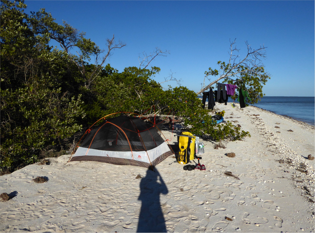
And on the 900th stroke, we arrived at East Cape. We were greeted by a family of campers in a motor boat that gave us first pick of a camp site out of deference to our muscle-powered wake, and a flock of Sanderlings.


By 4:45, we had set up our tent. As the day faded into night, we passed the time cooking, arranging seashells in the sand, chatting, sipping bourbon, and star-gazing. As the night wore on, the stars grew brighter and brighter, the rising and receding tide lapped against the shore twenty feet away, and giant wading birds stopped to sample insects outside our tent.
Gauthier woke up early to watch the sun rise.

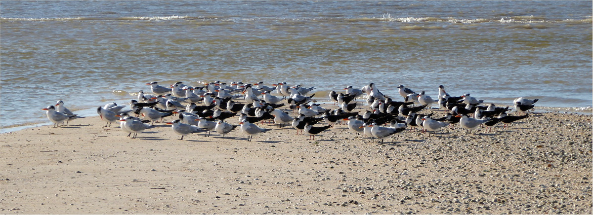
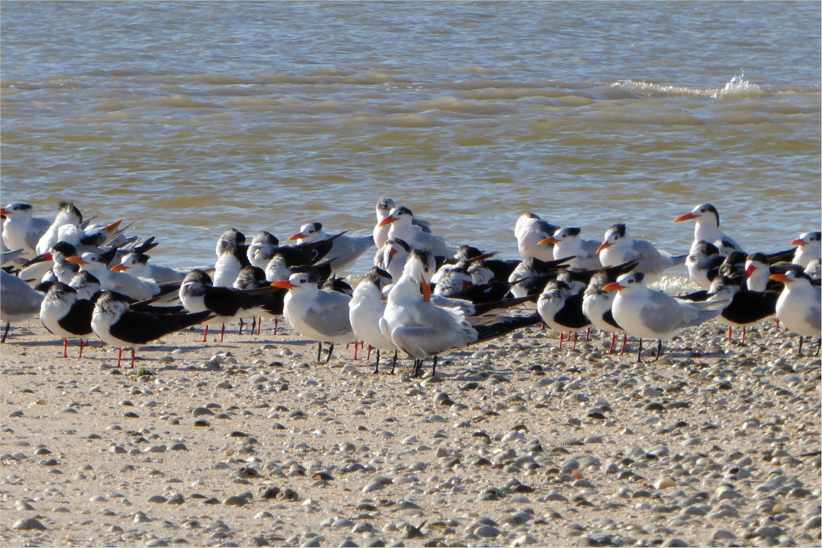
Our friends the Sanderlings were up early as well, as were a flock of Terns. During low tide, the shallow bay reveals muddy tongues protruding from the shoreline that are completely hidden during high tide, like the one these Terns are on.
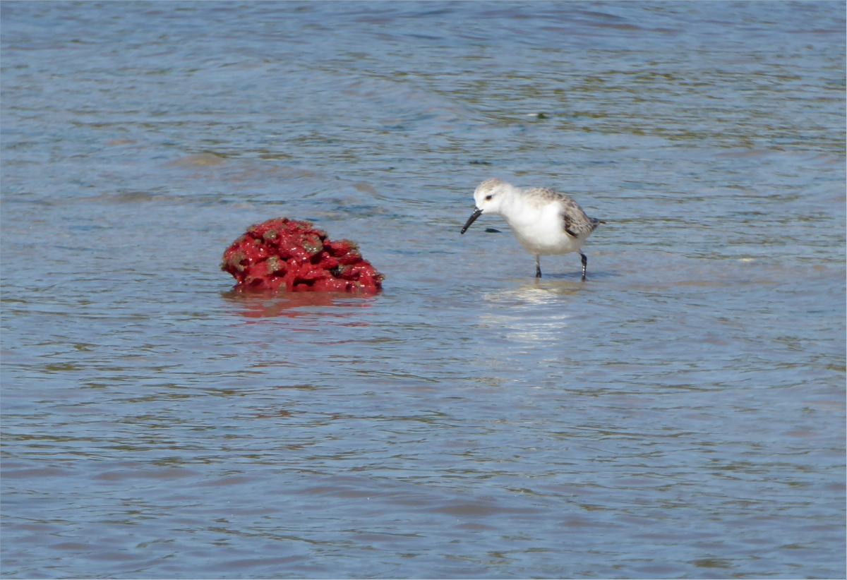
One characteristic that all of the beaches we stopped at had was washed up sea sponges. There are over two hundred sponge species in South Florida. The sponges in the photo below are vase sponges.
Sea sponges are a foundation species and a sign of a healthy ecosystem. In the photo below, a Sanderling inspects a Haliclona rubens.
Marjory Stoneman Douglas had a hard time making a case for the designation of the Everglades as a National Park. Folk saw holes in trees like the one below, assumed they were created by insects with really big teeth, and wanted nothing to do with it. Honestly, we wondered whether that hole, with its serrated edges, wasn’t created by giant, razor-sharp mandibles.

Holes in shells like those in the shells in the photo below provide clues as to how the shells died. Those tiny perforations were caused by sponges called Boring sponges. Boring sponges attach to shells for shelter, often smothering the host. The little holes are caused by the chemicals they use to attach themselves. Polychaete worms are the villains that cut grooves in oyster shells. And the little holes that are useful for turning shells into necklaces, those are caused by predatory sea snails and slugs.

Gauthier paddled to the southernmost beach on East Cape. The wind had picked up and was blowing from the east at a worrisome clip, so I chose not to accompany him and preserve my energy.
There he saw Gumbo limbos…

this sprawling Prickly pear cactus…

and this giant Horseshoe crab. This lovely lady was around two feet long from head to tail! She should scare me because horseshoe crabs are more closely related to spiders than they are to crabs, but seen from above she’s not very scary-looking. You have to respect a species that’s been around for more than 300 million years!

As we headed eastward towards East Clubhouse Beach where we were to spend night two, we paddled against the tide and a wind of around 18-20 mph (8-10 m/s). We used the tree below, which marks the southernmost tip of Florida, to gauge how far we’d traveled. It grew smaller very slowly.
Resources Consulted
Horseshoe Crab History
Marjory Stoneman Douglas: Writer & Conservationist
Restoring Florida Bay: Sponges the foundation for thriving ecosystem
Shell Wars (Shell Bioerosion)
South Florida Sponges: A Guide to Identification
25°07’06.31″N 81°04’48.28″W elev 1 ft
East Cape, Everglades National Park
Launch site: Flamingo Visitor Center,
40001 State Hwy 9336, Homestead, FL 33034
(239) 695-2945
Cape Sable, the southernmost point of Florida, had been on our “To Kayak” list for about three years. The promise of Roseate spoonbills, American crocodiles, Florida gopher tortoise and Smalltooth sawfish, combined with the challenge of a 23 mile round trip ocean paddle, and the lure of secluded shell beaches made this an adventure worth working towards. This year we were ready.
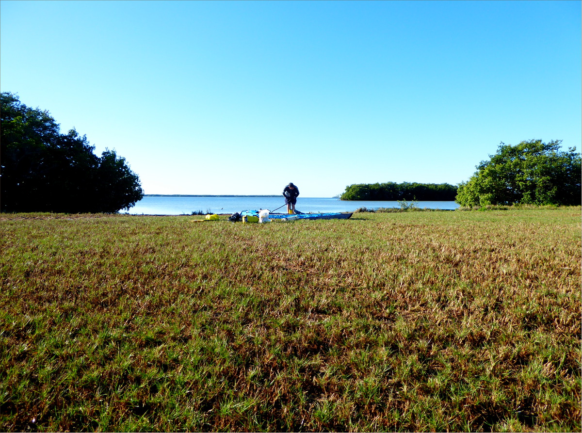
Gauthier had assembled a not unpraiseworthy collection of lightweight camping gear and we had improved our paddling skills and built up enough muscle and endurance to meet Florida Bay’s challenges. Currents, tides, winds, sun, and mosquitoes, we were prepared for them all. Ollie, unfortunately, had demonstrated that ocean kayaking was not his thing, so he stayed behind with his duncles and daunties (dogspeak for doggie uncles and aunties).

Our plan: Saturday, February 13, we would paddle 11 miles from Flamingo Visitor Center to Cape Sable. Sunday, we would paddle about half way back to East Clubhouse Beach. And Monday we would paddle the remaining five or six miles back to Flamingo Visitor Center.
We arrived at Flamingo Visitor Center just as it opened at 8 AM to pick up our back country pass. During the ranger’s protocols speech, we were surprised to learn that we would face gusts of up to 25 mph on our return trip, something the forecasts of the previous day, which specified maximum gusts of up to 15 mph, had not mentioned. Somewhere in the back of my mind a voice said, “Should we postpone?” but my unhesitating response to the ranger was “I guess I’ll be getting more excercise than I bargained for!”

The mosquito condition was described as “moderate,” which is not bad by Florida standards so long as you use repellent (and not the Whole Foods brands, the real stuff) and have your tent set up before dusk, which is when they come out in force. We planned our paddle out to coincide with high tide. As the Bay drained, it carried us out towards the Gulf. We paddled against a north wind of around 10 mph, but it was easy going overall.

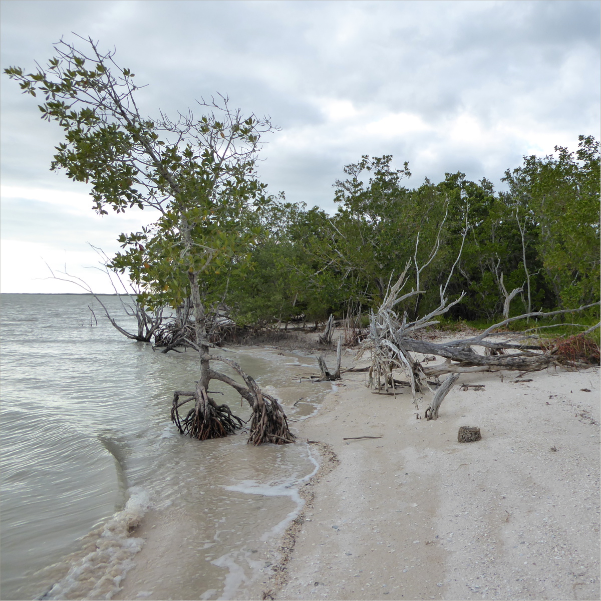
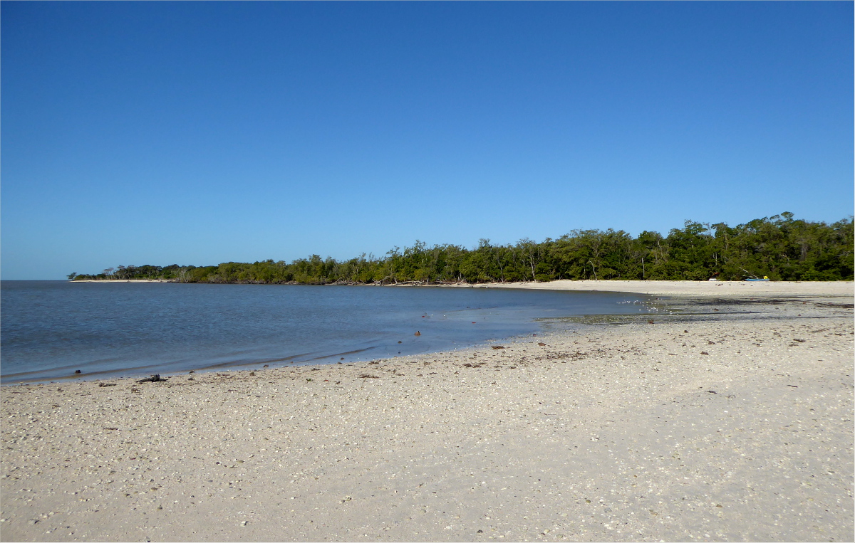
We had lunch at Clubhouse Beach, named for a clubhouse Flagler or another developer had wanted to build there many years ago, despite the freshwater marshes, marl prairie, saltwater lagoons and mangrove swamps.
If you liked making mud pies or walking barefoot in the rain as a little girl or boy, you may appreciate Florida Bay mud. The sensation of Florida Bay mud squishing between my toes is something I am unlikely to forget. The shallow Bay and receding tide meant anchoring our kayak in the mud and walking to shore.

Dimples in the mud near the shore were filled with shells. Angel Wings, Angulate Wentletraps, Antillean Nerites, Atlantic Distorsios, Atlantic Slipper Shells, Calico Scallops, Cancellate Cantharus, Common Bubbles, Common Nutmegs, False Drills, Fan Scallops, Flame Augers, Florida Cones, Florida Fighting Conch, Florida Rock Shells, Fly-specked Ceriths, Golden Banded Cones, Lion’s Paws, Muddy Ceriths, Periwinckles, Rose Petal Tellins, Sanibel Drills, Top Shells, Turkey Wings, we saw them all! After three or four hour’s paddling, there’s nothing more relaxing than arranging shells in the sand.
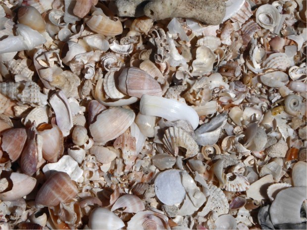

Shells of the Florida Gulf Coast illustrations by Jackie Leatherbury Douglass, copyright 2004 Steven Lewers & Associates

Sea pork: there is such a thing and if you venture out to Clubhouse Beach you just might see it. Sea pork is a small glob of cellulose that once housed zooids. Zooids are “a colonial animal that can survive only when connected with other zooids. Each has its individual personality, but collectively they exist as a single being with a shared goal of survival” according to an article in The Guardian (http://www.theguardian.com/environment/gallery/2013/oct/12/portuguese-man-owar-photography).

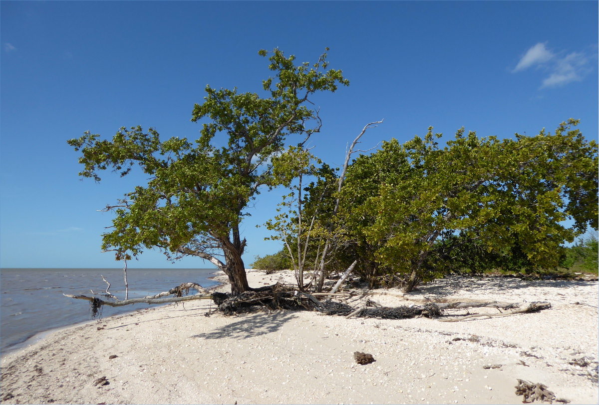
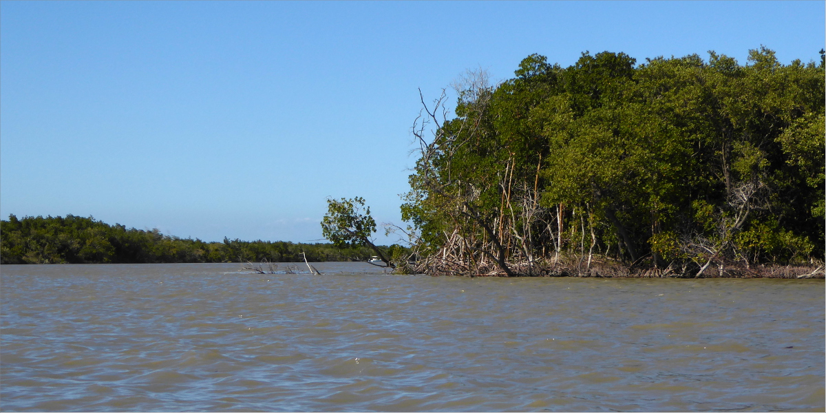
The Red mangrove below lent us its shade. I can never get my mangrove types straight, but here is a slice of mangrove wisdom from Florida International University: “Mangroves must survive the stresses of flooding and salt in the estuary. Red mangroves have prop roots that increase oxygen uptake and line the banks of keys and rivers in the Everglades. Black mangroves exude salt from their leaves and both red and black mangroves are well adapted to salinity changes” (http://fcelter.fiu.edu/education_outreach/Virtual_hydroscape/mangroves/?selected=fringe_mangroves).


Florida Tree Snails

Florida Tree Snail
After an expertly crafted meal (Gauthier does love camp cooking), we paddled onwards to East Cape, the easternmost and closest of Cape Sable’s beaches. At MicMac Canal (below) we counted 900 strokes to East Cape.
MicMac Canal

East Cape within view
The endless blue sky and mangrove coastline allowed undulating thoughts of work and family to creep into my consciousness. Mangroves transformed into excel spreadsheets, the blue sky transformed into birthday cards, and the sunlight sparkling on the water transported me to a Brownie Guides meeting, Adelaide, Australia, circa 1990… Five girls in brown uniforms seated cross-legged on the floor around a container of silver glitter and a bottle of glue… The container of glitter falls over and ten hands quickly sweep it up before their leader, Lutana of the Moora Mooras, can find out… Five exuberant girls stand in a ray of sunlight, watching their arms and legs sparkle.

Resources Consulted
Saltwater Intrusion Threatens South Florida Parks
The Ecology of Florida Bay
Sea Pork
26°05’43.35″N 81°37’06.97″W elev 9 ft
Picayune Strand State Forest,
Naples, Florida 34117
(239) 348-7557
We had been driving west along Tamiami Trail for a while. I occupied the passenger seat and felt a little guilty about it because it meant that I could sight see and Gauthier, in the driver seat, couldn’t. “Holy moly, are there ever a lot of alligators!?” I would exclaim, or “Did you see that Sandhill crane?! I’ve never seen one this far South!” but by the time Gauthier had looked over his shoulder, we had driven past it every time.
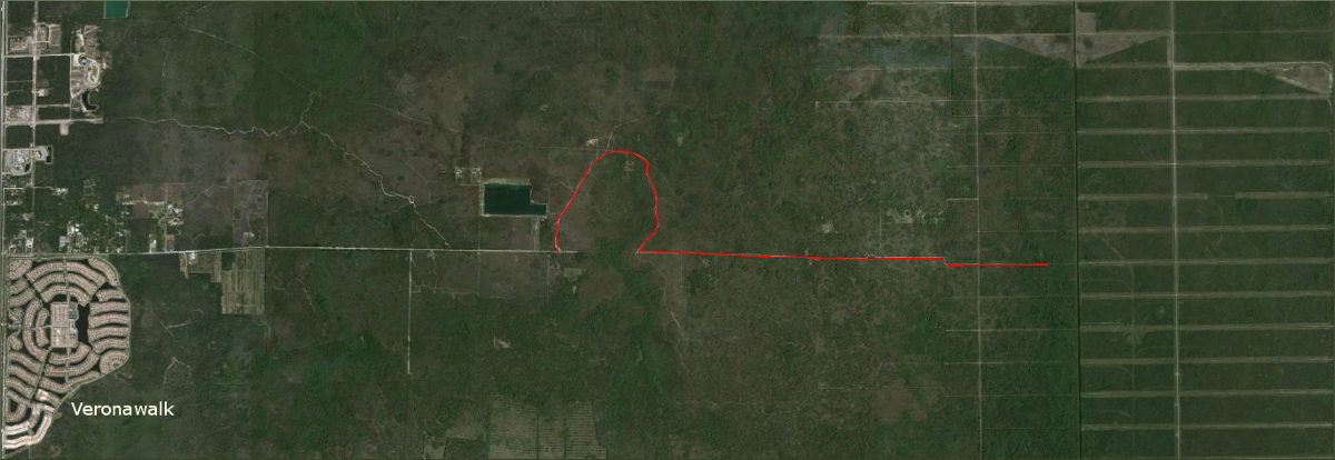
By the time we reached Collier Blvd, my exclamations had become less frequent and their tone had changed. “Veronawalk?” I asked skeptically as we drove past a cement bridge painted a muted red with gleaming white pilasters that led into a gated community. Emerging from a newly tarred four-lane roadway and as-yet vacant strip malls, Veronawalk looked like it could have been snapped together from an “Italian Revival” modeling kit. “Are we going in the right direction?” I asked.
Turning off of Collier Blvd onto Sabal Palm Road, I received my answer.

Driving along the narrow dirt road, a filament bounded on either side by a wild array of sable palmettos, saw palmettos and long leaf pines and the occasional elevated house and fern colony, Veronawalk seemed outrageously alien and sterile, the realization of a dream sold to 17,000 unsuspecting victims in one of the first swampland real estate schemes.


Platted, dredged and drained, Picayune Strand State Forest lacks the diversity of its neighbors, Fakahatchee Strand State Preserve, Florida Panther National Wildlife Refuge, and Collier Seminole State Park.

The trunks of erect but dead Australian pines add a vertical dimension to the grid of canals and roads that was “Golden Gates Estate.” Perched atop this trunk was a gorgeous Red-shouldered hawk (Buteo lineatus).


We parked at the edge of the swamp, where the road forks. Two-feet-deep puddles, murky but fresh from the constant sheetflow of the Everglades, had formed in the ruts of tire tracks and spread out across the road in both directions.

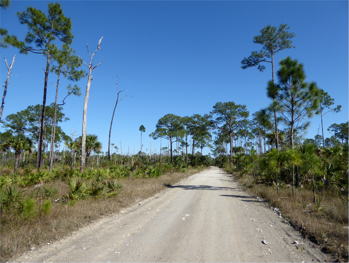
We hopped on our bikes and headed north, skirting the edges of the puddles and trying not to get wet with little success.
We passed a surprising number of jacked-up trucks, SUVs and Jeeps. Hunting is permitted and apparently popular in Picayune. The trail we had planned to take was completely flooded.
One truck stopped to ask us if the road we were on led back to a main road. “Are there any gates?” he asked. At over 76,000 acres, it’s scary to think of how easily you could get lost in Picayune.


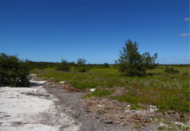
Where the road crumbled and disappeared is where it was wildest.
And a good place for a picnic.
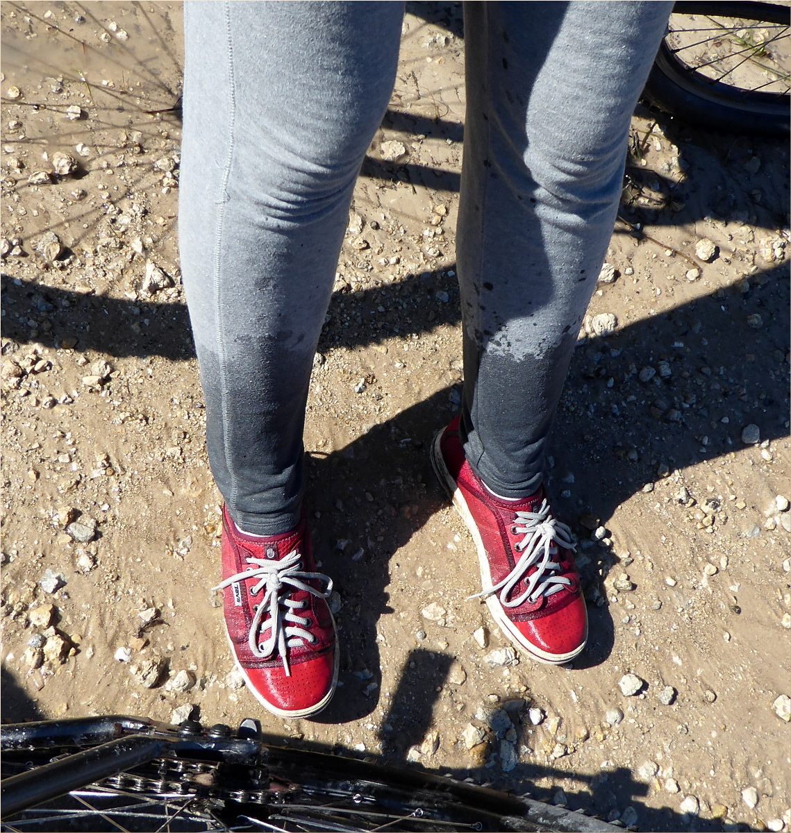
On the return ride, we abandoned the idea of staying dry and rode our bikes straight through the middle of those giant puddles. Fat tires inflated to just the right pressure, seat post shocks and padded underwear eliminated any discomfort we might have felt from the rocky and uneven surface and allowed us to pick up enough speed to keep our balance as our tires sunk into wet gravel and we projected ourselves through the water. It was exhilarating. I almost made it back without falling. Within view of the car, I fell, drenching my pants, but I still felt like a winner.

Resources consulted:
Everglades Foundation
Florida Natural Areas Inventory
Florida Fish and Wildlife Conservation Commission
Naples Daily News
Comprehensive Everglades Restoration Plan
Tidewater Florida
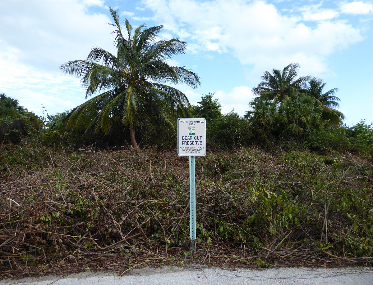
25°43’34.35″N 80°09’13.38″W elev 8 ft
Bear Cut Preserve, Crandon Park
Key Biscayne
We hike, jog and bike this short 3.5 mile (5.5 km) trail regularly. I’ve provided the latitude and longitude of the entrance we always use. Parking is free across the street in the Crandon Park Marina. Fifteen years ago, there was ne’er a person to be seen on the trail and the gay community found privacy on the beach. Recently the trail has become popular with bicyclists. The southern end of the beach is popular with kite boarders.

Nov 2012
At the northern end of the beach is a very cool fossil reef. Before they banned swimming in this section of the beach, we snorkeled there and once as I was parting the sea grass, one single blade failed to move, and when I looked more closely at it, I discovered that it wasn’t a blade of grass at all, but a seahorse! It stayed still only long enough for my eyes to focus on it and then it disappeared. We’ve also seen sting rays and jelly fish.

Sting ray, Apr 2013

Restricted section of beach where fossil reef is; notice the beach erosion; Jan 2016
Although it’s suffered from invasive nickernuts, kudsu and, more recently, beach erosion, it’s still a beautiful trail. All kinds of birds hunt along the coastline and on the many sand bars: plovers and sanderlings, terns, herons, pelicans, cormorants. We’ve even seen yellow warblers in the trees along the trail.
Nickernut control, Jan 2016
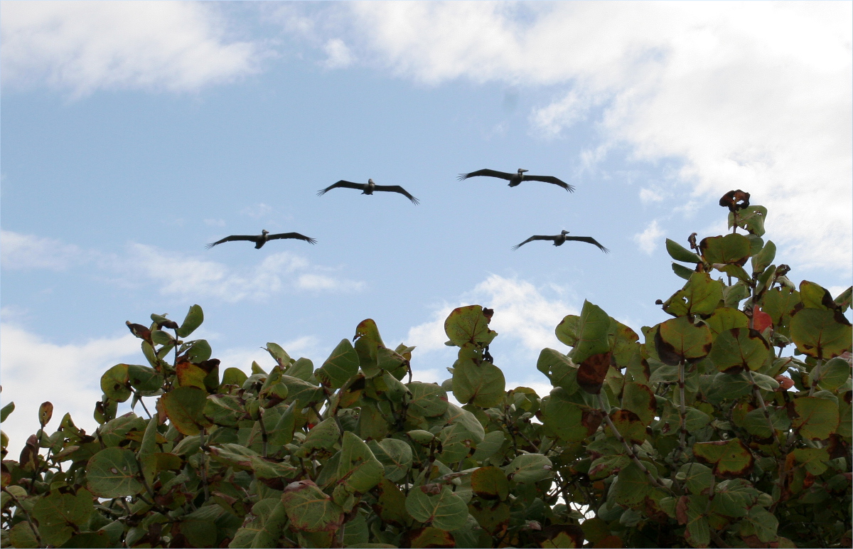
Brown pelicans, Apr 2013
Sometimes you’ll see a metal variety of bird flying high overhead: commercial jets, sea planes, and once we saw a fighter jet darting back and forth across the sky. Cruise ships departing from the Port of Miami are also a frequent sighting.

Apr 2013
Papaya trees, sea grapes, sable palmettos, coconut palms, mangroves, wild coffee bushes (psychotria nervosa, perhaps the most appropriate Latin name ever given to a plant), American beauty berry, black eyed susans, morning glories, and even a couple edible plants, like sea purslane and prickly pear grow along the trail.

Sea purslane, Apr 2013

Prickly pear flower, Apr 2013
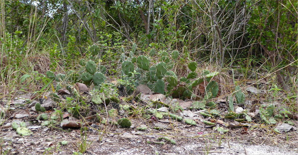
Prickly pear, Jan 2016
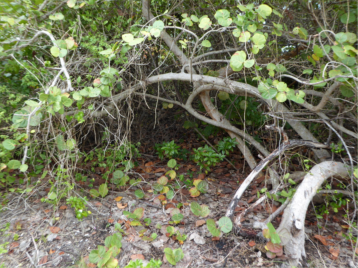
Psychotria nervosa nestled under the protective arm of a sea grape, Jan 2016

Jan 2016
Jan 2016

Jan 2016

Dogs are not permitted on the beach, but until recently it wasn’t patrolled, Apr 2013
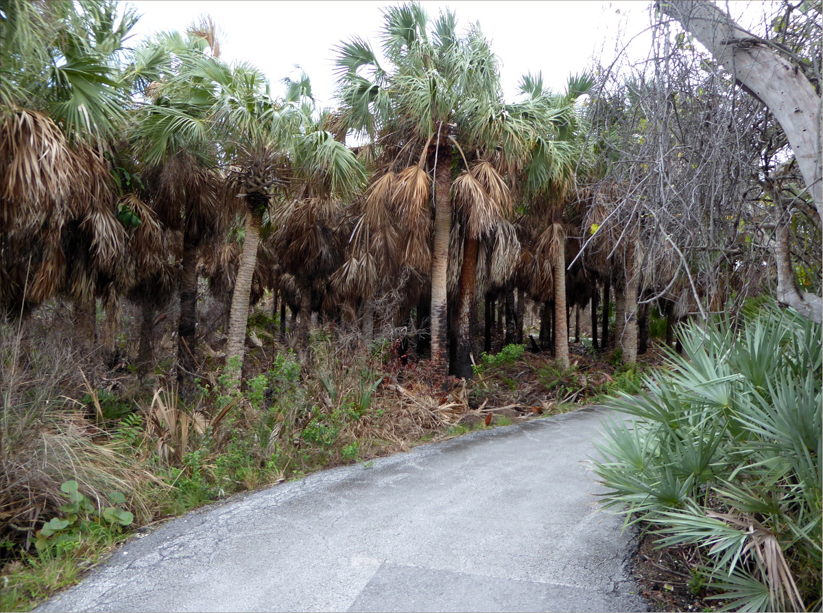
25°38’56.13″N 80°30’55.71″W elev 5 ft
Edge of Everglades Trail
Everglades National Park
Red line represents 8.7 miles (14 km)
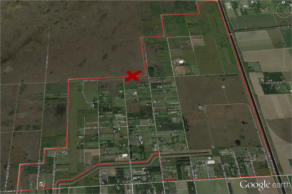
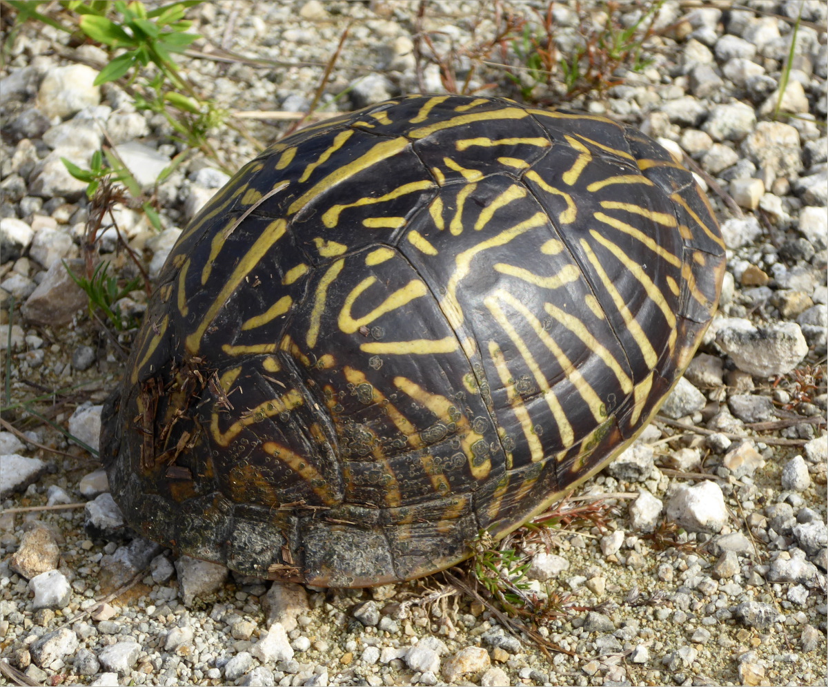
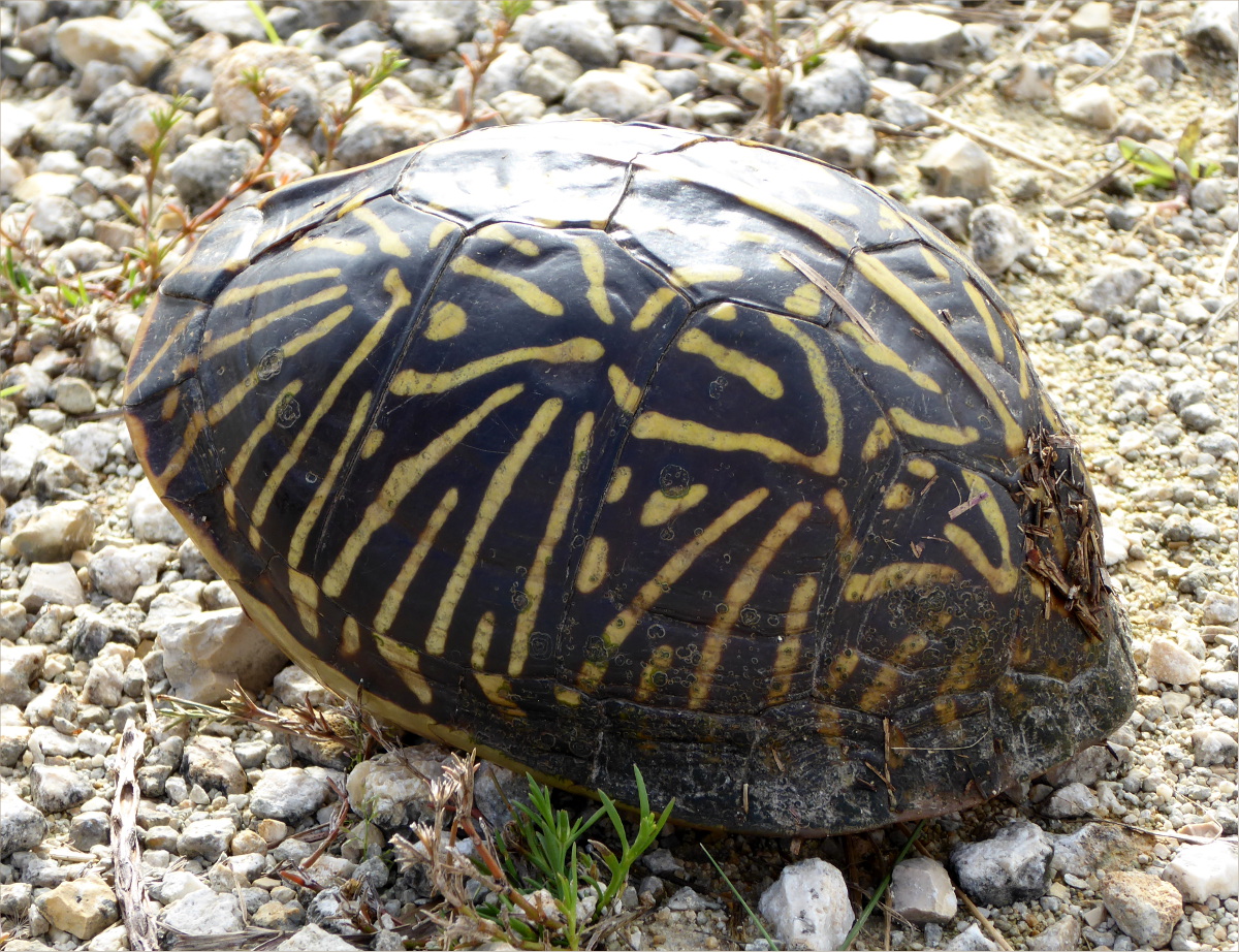
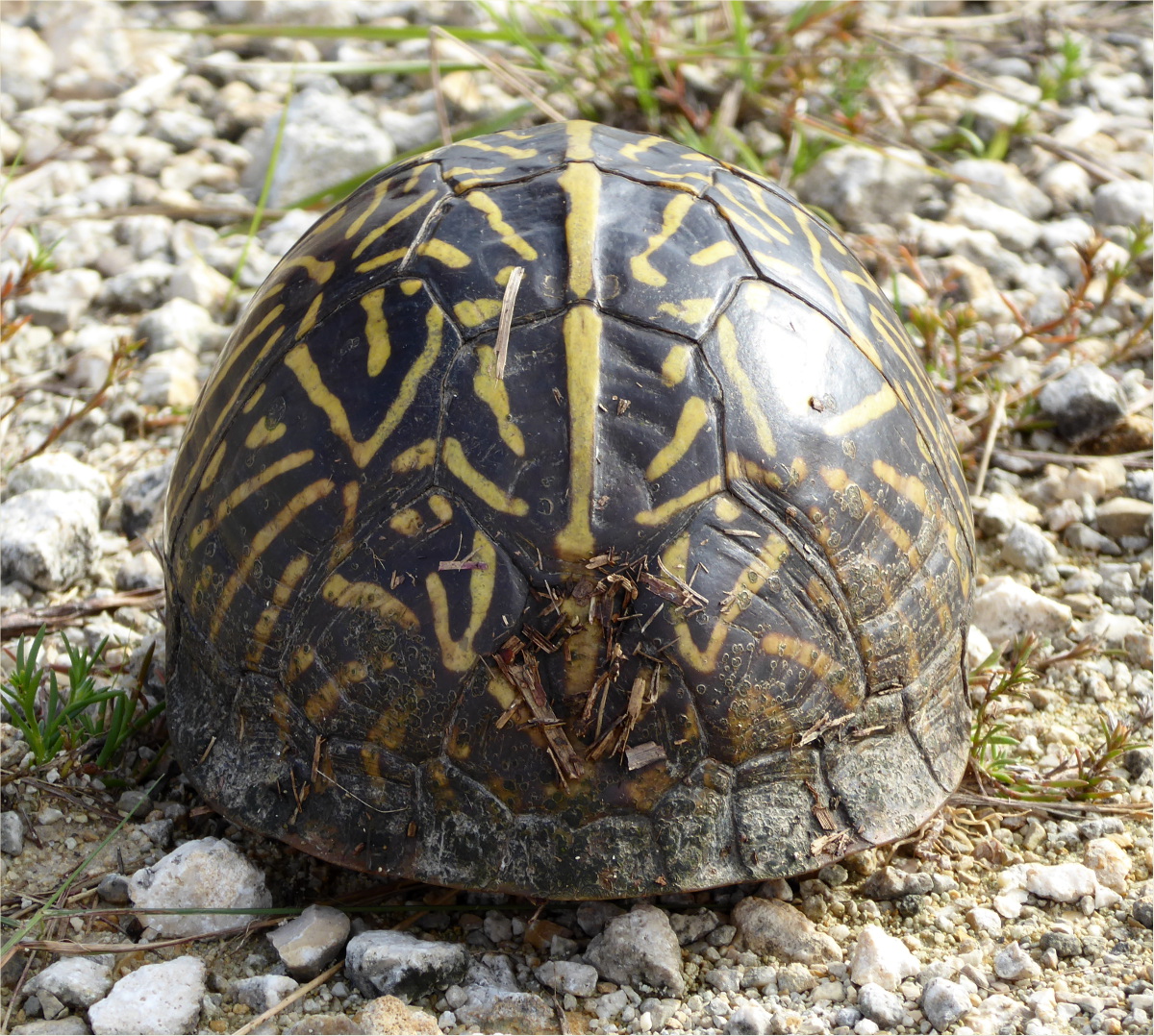
“X” marks the spot where we saw it. [Nous avons vu une Terrapene carolina bauri! “X” marque l’endtoit ou nous l’avons vu.]

A hinged plastron enables it to close its shell tightly. [Un plastron a charnieres le permet de bien fermer la carapace.]

We also saw Gulf fritillary (Agraulis vanillae) butterflies. [Nous avons vu des Agraulis vanillae egalement.]

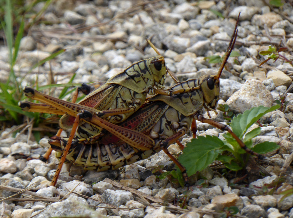
And some horny Southeastern lubber grasshoppers (Romalea microptera). [Et des Romalea microptera tres excites.]
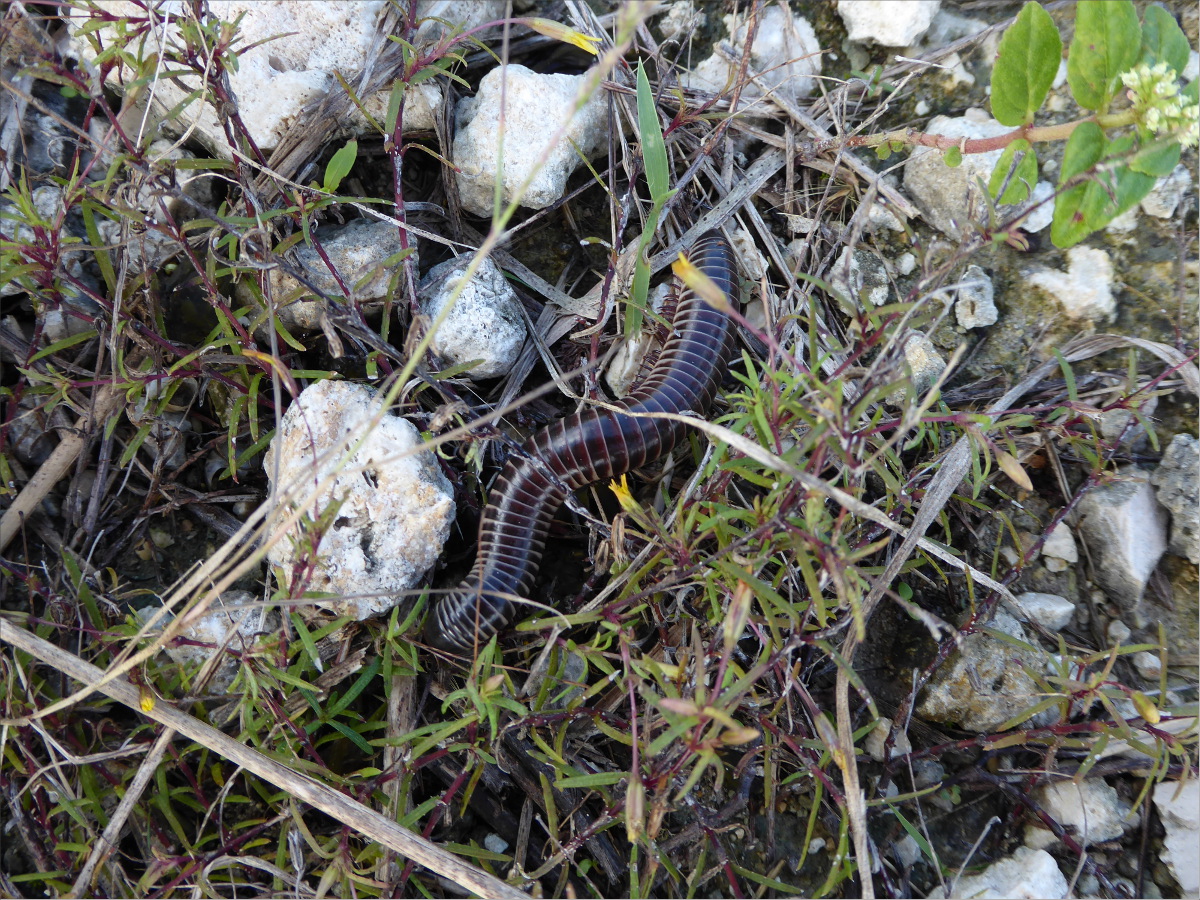
And four-inch long Florida ivory millipedes. I love their colorings. Their stomachs are white! [Et des Florida ivory millipedes qui etaient dix centemetres de long. J’aime leur couleurs. Leur ventres sont blancs!]
Florida is a strange place. Its relationship with nature has a fraught history. [Florida est un pays etrange. La relation avec le millieu naturel a une histoire tendue.]
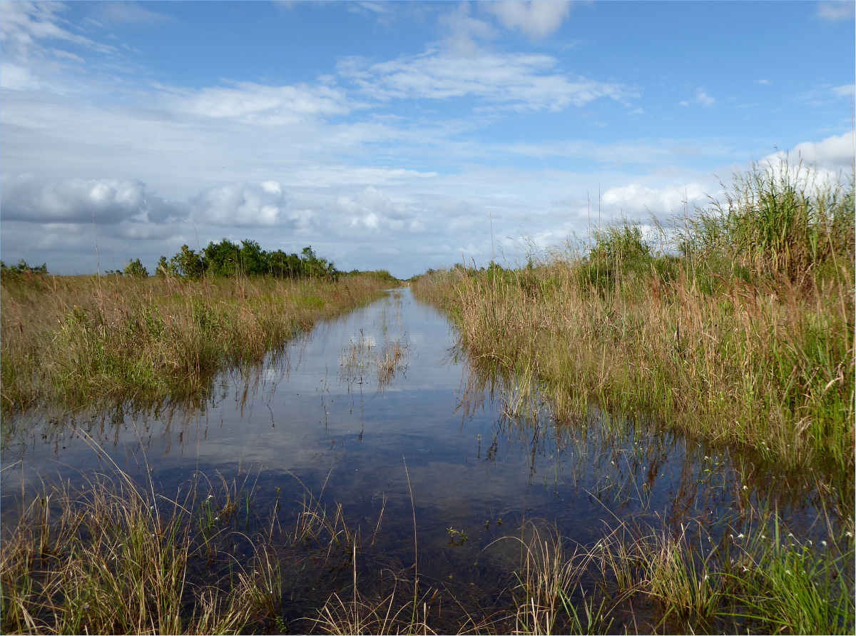
Can you believe that this was once a street? [Pouvez vous imaginer que il’y avais une route ici?]
[Je m’excuse pour n’utiliser pas des accents. C’est difficile les utiliser avec WordPress.com.]
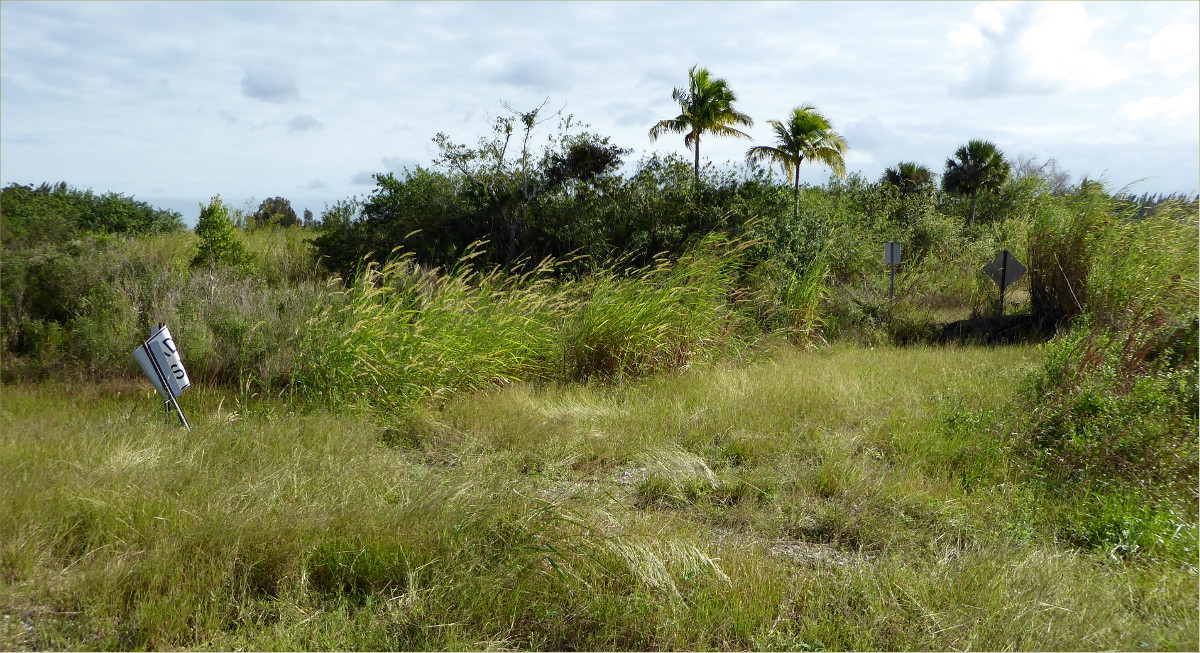
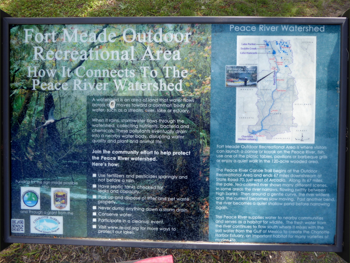
27°44’49.91″N 81°46’47.98″W elev 74 ft
Launch site: Fort Meade
Landing site: Pioneer Park, Pioneer Blvd, Zolfo Springs, FL 33890, (863) 735-0330
We returned to Peace River for Thanksgiving. This year we kayaked upper Peace River, from Fort Meade to Zolfo Springs. We left the car at Pioneer Park, where you can park overnight for free, and took a cab to Fort Meade for $40 including tip. Our cab driver, Mario, said it would be ok to give out his phone number: (863) 245-1527.
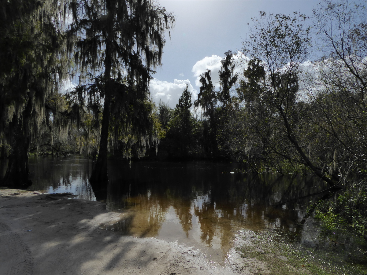
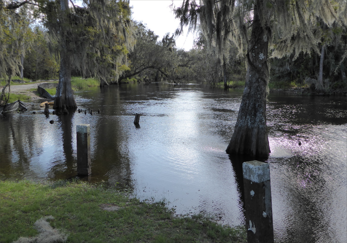
At fort Meade the river is narrow and intimate. It had overflowed from several days of rain, which sometimes made it difficult to tell which way the river bent. The current was fast and there were many downed trees, making paddling a little more rigorous than the year before.The thorny water locust trees that lined the banks were a concern in our inflatable kayak.
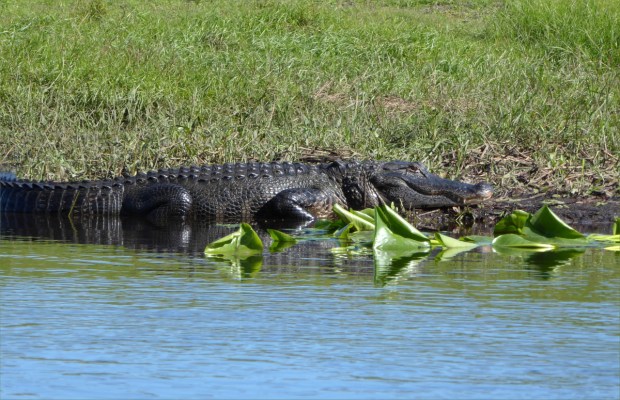
We heard lots of alligators; we saw few because they tended to jump in the water with a loud splash before we could get close enough to see them.

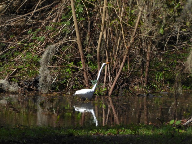
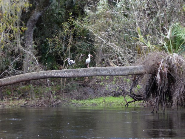
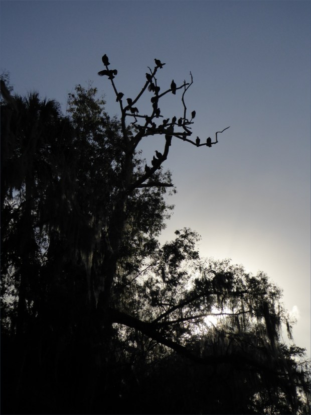
It was like a bird highway. Great blue herons coasted down the river 20 feet above the water, following its bends like a race car driver follows the bends of a race track. Brown and white ibises poked about for crayfish in pairs, little blue herons, their beaks a striking midnight blue in the sunlight, hunted frogs, egrets waded up to their bums in search of fish, white herons scanned the surface of the river for insects from atop fallen trees, and black headed vultures hung out in flocks high above the water hoping to spot a cow or armadillo carcass.


River cooters are shy like alligators and jump, sometimes from impressive heights, into the water when they hear us coming. Their compact little bodies make melodic plopping sounds when they hit the water.

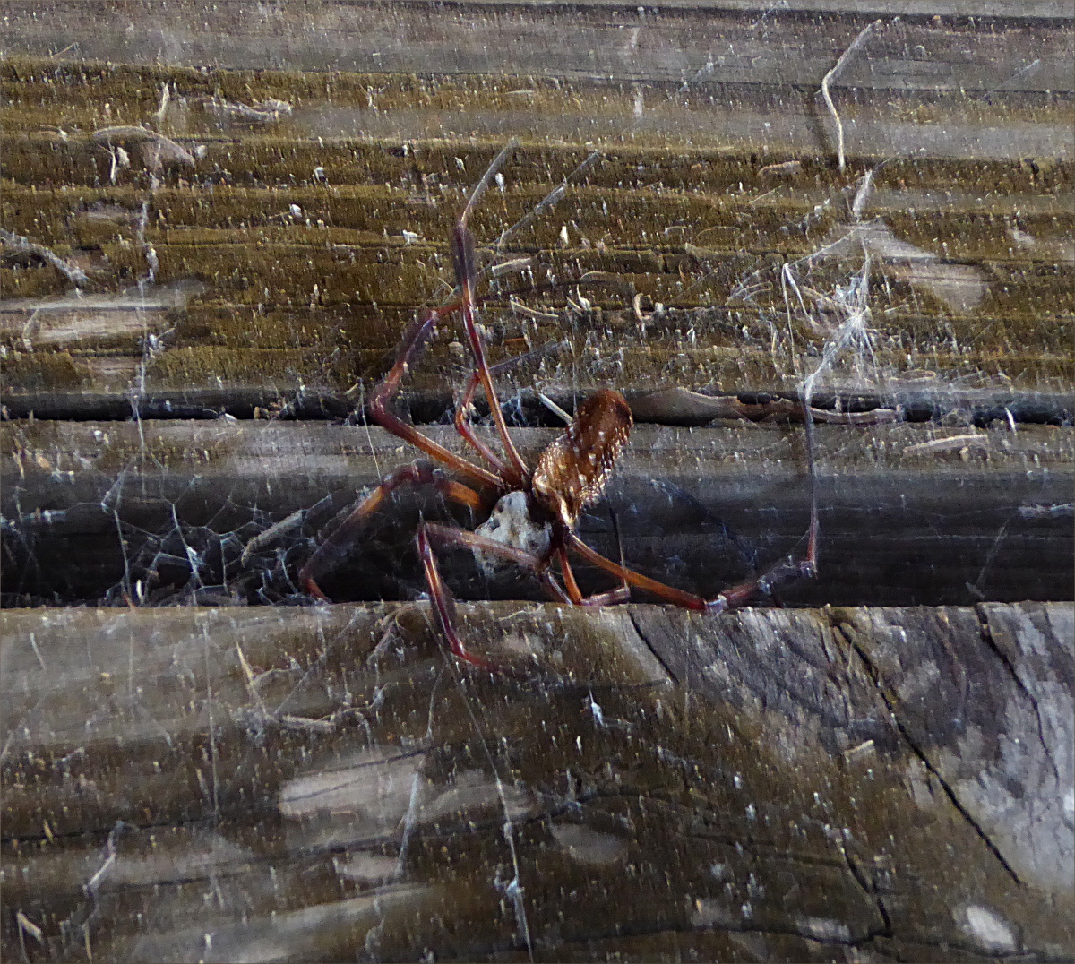
We arrived late the first day, leaving us only three hours of paddling before it was time to set up camp. A campground provided a convenient place to spend the night. Rustic, it had no water or electricity, although there was a pavilion, bonfire pit, porta-johns, an elaborate, four-grill barbecue and a dumpster. The porta-john was green with lichen and neither Gauthier nor I dared to go in it. I was afraid of what it might smell like, but Gauthier was afraid of what we might find in it.

The ceiling of the pavilion was covered in spider webs and mud dauber nests. Spider carcasses made it look like a macabre scene from a movie. I was terrified and transfixed. Gauthier wanted to set our tent up under the pavilion, but didn’t argue when I suggested that we set it up under the stars instead.

Gauthier made moong dal and couscous with harissa for dinner, and southern hospitality supplied us with sweet potato pudding. Shortly after we arrived, a truck pulling a trailer drove up and a man in his 50s stepped out. Walking over to us, he introduced himself as Martin and asked us how we were doing. He was talkative and told us the park was built and maintained by the company he worked for, Mosaic. I told him I recognized the name because a sign in the entrance to the park said that the park was dedicated to all the people from Mosaic who had donated their time and labor to the construction and upkeep of the park. That made him smile. He said the park was built 40 years ago and had suffered greatly during the 2005 hurricane, but that everyone had chipped in to restore it.

I asked him about the spiders and he said they were harmless, that they called them “house spiders” (I later learned that they are called neoscona domiciliorum or spotted orb weaver). He said the mud daubers wouldn’t hurt you unless you crushed one, which was unlikely to happen unintentionally.
Before he left, he said he and his two children would be camping on the other side of the campground and that we wouldn’t hear from them again, and insisted that we have some of his home made sweet potato pudding, still warm. It’s easy to regard the Mosaic phosphate mining company as the enemy – breaking EPA laws and decimating the landscape – but it was hard not to like Martin.
Mosquitoes made it necessary to stay inside the tent, but there was a full moon and a clear sky and it was warm, but not humid, and we left the rainfly off the tent so that it was flooded with moonlight. I woke up several times throughout the night; every time I woke up the moon had traveled a little further across the sky, reminding me that we are all just floating in space.


Breakfast was scrambled eggs with fresh green onion, followed by pita bread filled with Nutella, peanut butter and honey. After sticking my foot in a fire ant’s nest, we returned to the river around 9:30 AM.
The river widened near Wauchula. As we approached the city we expected to see other kayakers, and were very surprised when we didn’t. The only other boat we saw was a fishing boat with a trawler. There was one man inside the boat and another chest deep in the water outside the boat. The man in the boat yelled to us in a delightful, southern accent, “Did you see that alligator over there?! It’s 12 feet long!” The man in the water smiled and nodded his head and pointed in the direction of the alligator. And there you have it. If a local fisher is not afraid to be up to his chest in the water with a 12 foot alligator nearby, I am not afraid of alligators either. Well, not very afraid.

It was the most peaceful paddling imaginable; effortless in a gently moving current that guided us around bends and islands. We took tiny sips of aromatic heirloom whiskey by Widow Jane.
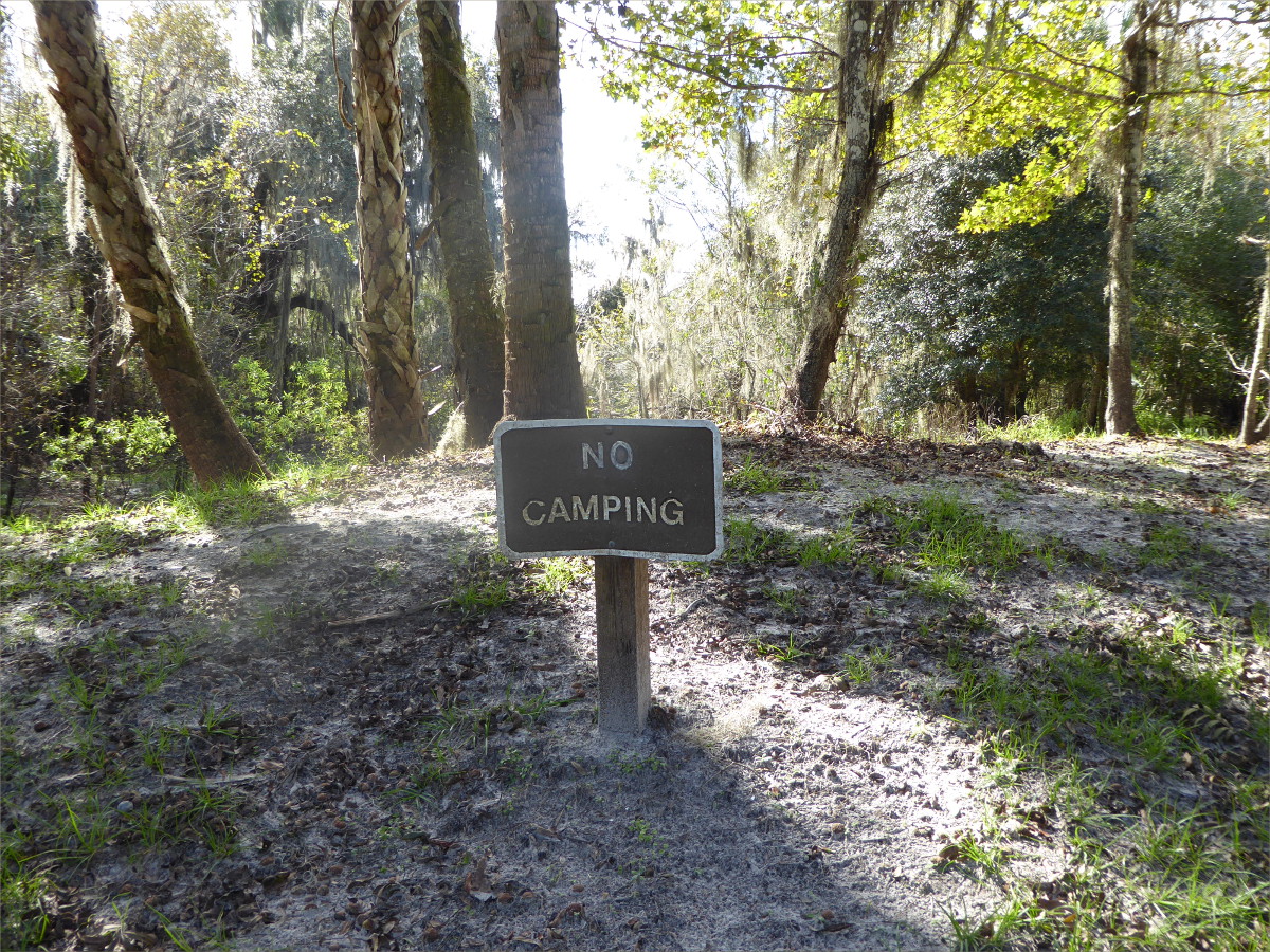
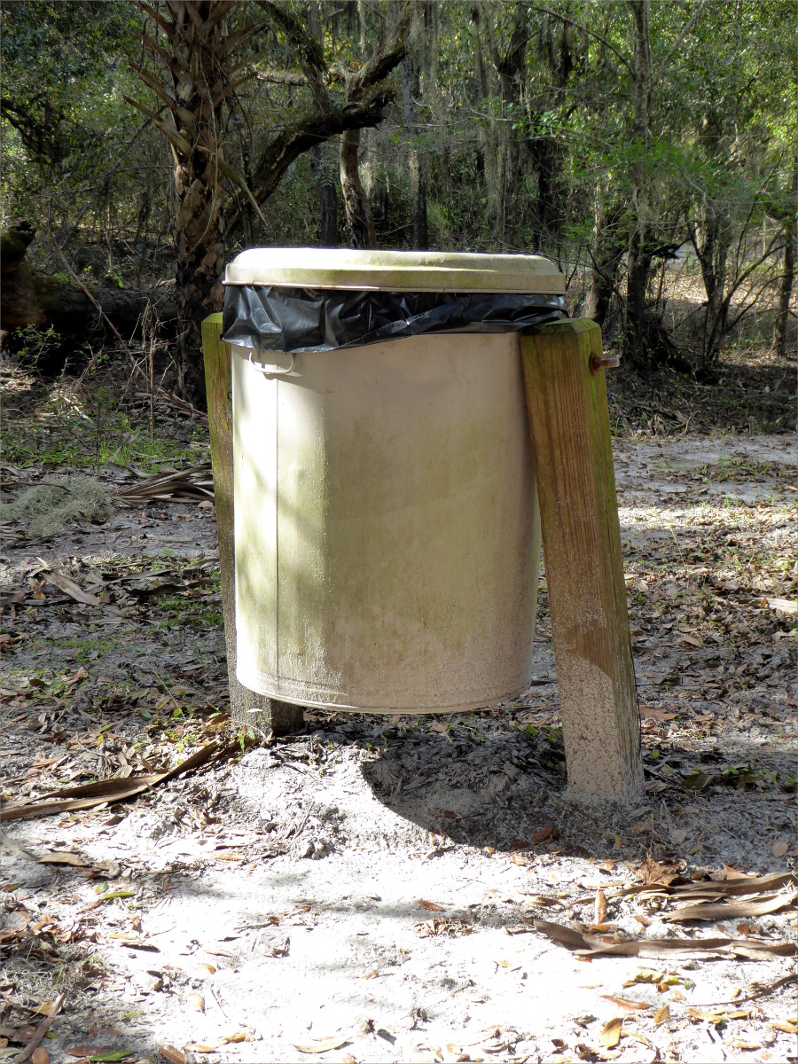
We stopped for lunch at Paynes Creek Historic State Park where we were welcomed by a “No Camping” sign. I wondered why they needed swinging trash cans. Did they prevent raccoons from making a mess?

Come 4:00 it was time to start looking for another place to camp. A lovely field on a high bank seemed safe from unsuspecting alligators. We had mashed potatoes and pouched tuna followed by split pea soup for dinner.
That night, something large and solid rustled in the bushes nearby. An auroch, Gauthier said it was. But Ollie and I weren’t fooled. We knew it was an armadillo.
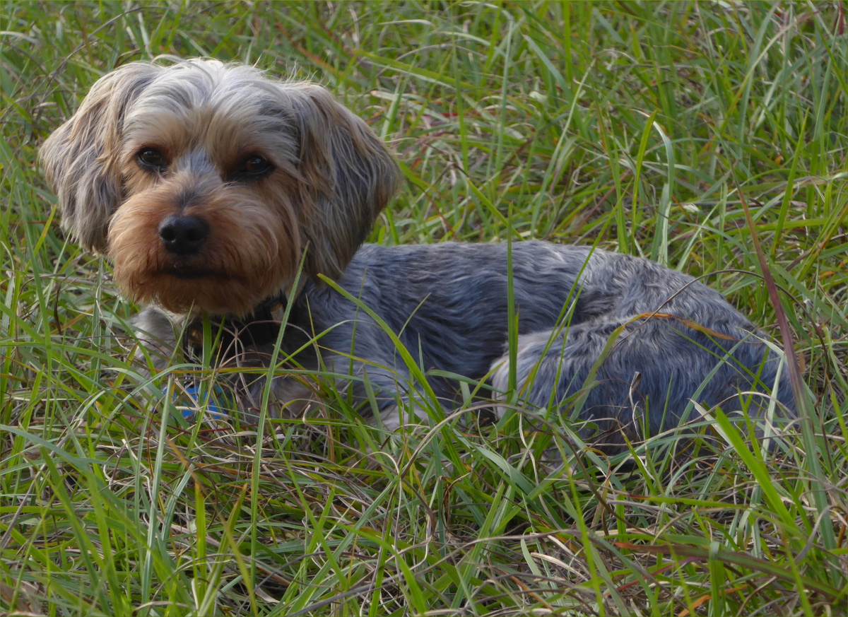
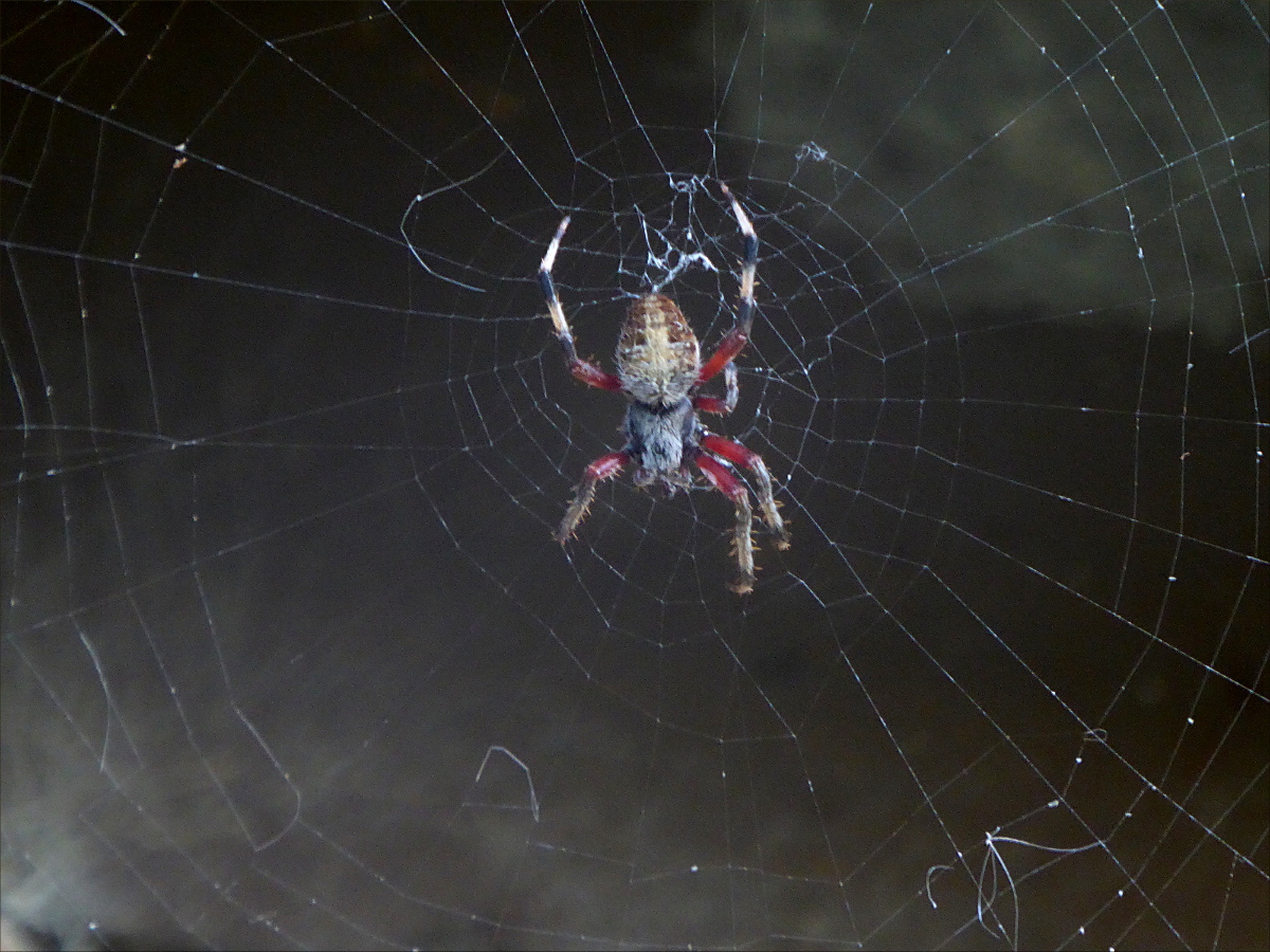
In the morning, dew-drenched grass sparkled in the sunlight and revealed many tiny spider webs – orb and three dimensional – suspended from blades of grass. Ollie and I explored the webs for a while until we discovered a tick. Thankfully it was the only tick we saw. It was an all-black specimen, not like the red dog ticks we have around Miami.
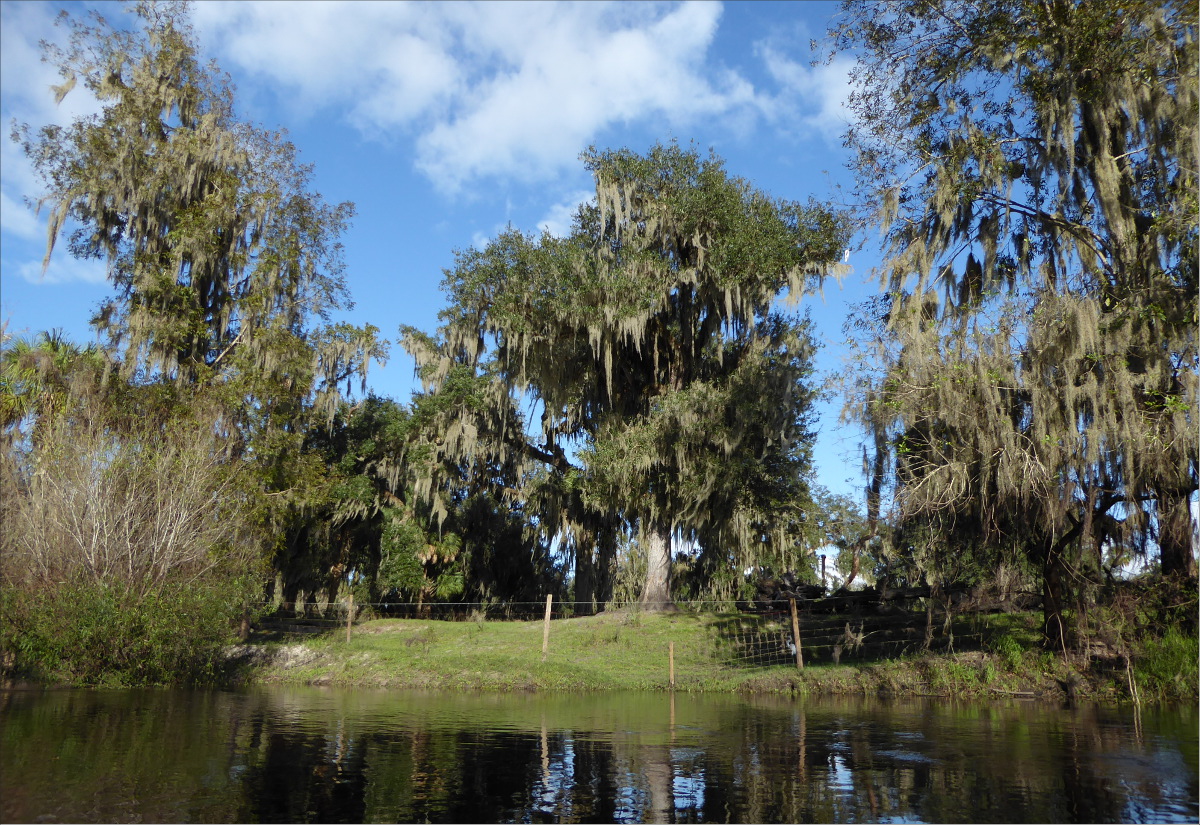
Between Wauchula and Zolfo Springs we passed many ranches and private homes. We saw confederate flags, enormous live oaks, and sable palmettos clinging to the river bank with roots that looked like hair. Once, we heard the sound of human voices interspersed with gun fire a little too close for comfort.
Just before Zolfo Springs boat launch at Pioneer Park, you learn why it’s called Zolfo Springs. Gurgling up into the river, springs cause the tiniest bit of white water. I was very sorry to reach Pioneer Park, although the prospect of a shower tempered my disappointment.
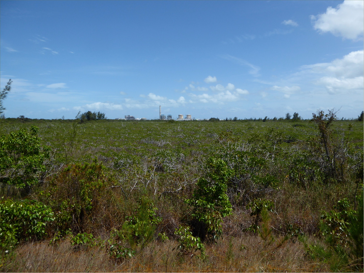
On the way home we stopped for lunch at Wheeler’s in Arcadia and browsed the antiques on sale in the stands that line the street every Saturday. An amazing traveling companion, Gauthier drove us through some very unique landscapes on the way home. Although we couldn’t go in the Archbold Biological Station to explore the unique Florida scrub because we had Ollie with us, we drove through it on Old State Route 8.

We also drove by a pine tree plantation. On one side of the road was a vast forest of pines trees growing in eerie rows, and on the other side was the muddy and desolate remains of a harvested forest.
We traveled through Florida flatlands that reminded Gauthier of the south of France, and alongside massive orange groves, and around gigantic ranches with “Beef, it’s what’s for dinner!” signs hung outside. The Brahman cattle with their humped backs were a sight to see.
Closer to home, near Lake Okeechobee, they were harvesting sugar cane in the cane plantations. Bright lights lit up the fields like fire flies.
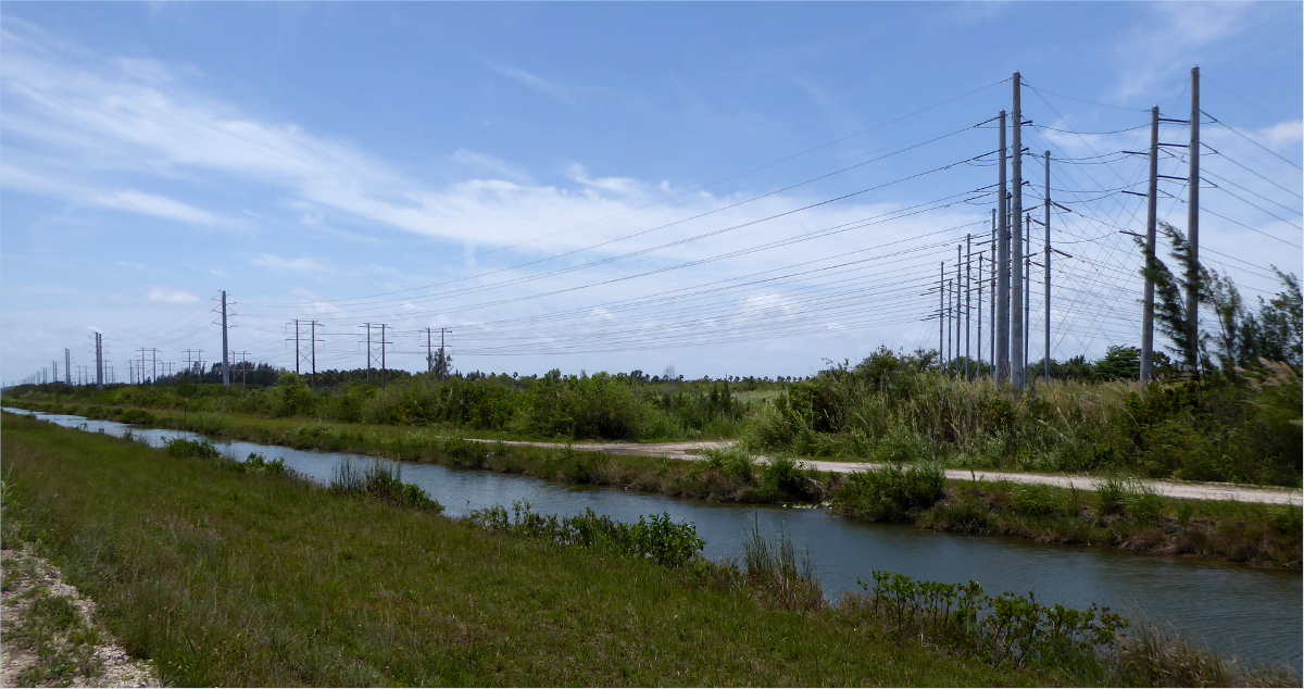
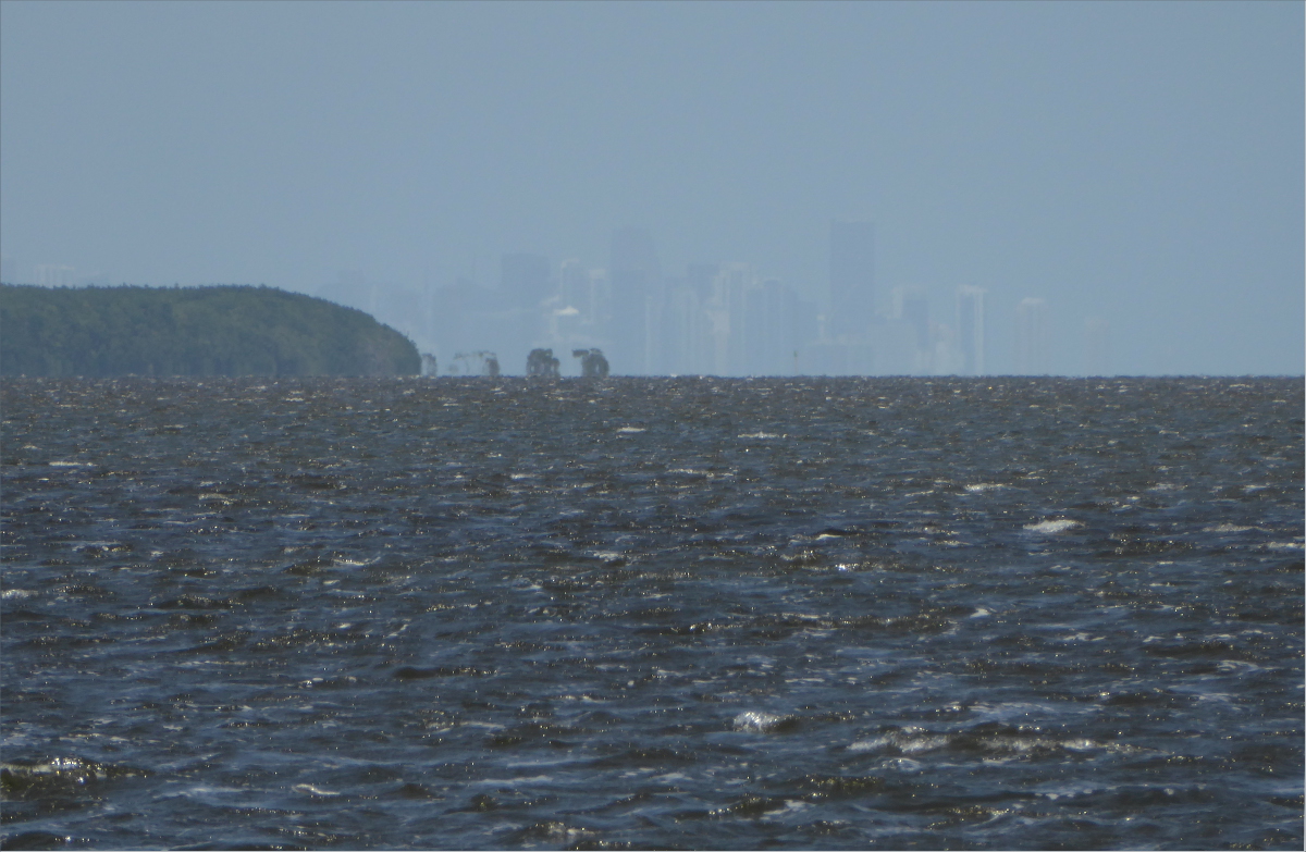
John Pennekamp Coral Reef State Park
(305) 451-6300
25°11’38.86″N 80°20’45.26″W elev 4 ft
Gauthier had spent days reading maps, so I knew he was planning another adventure. The spot he picked this time was John Pennekamp Coral Reef State Park. The launch site he selected was near Basin Hills, Key Largo.
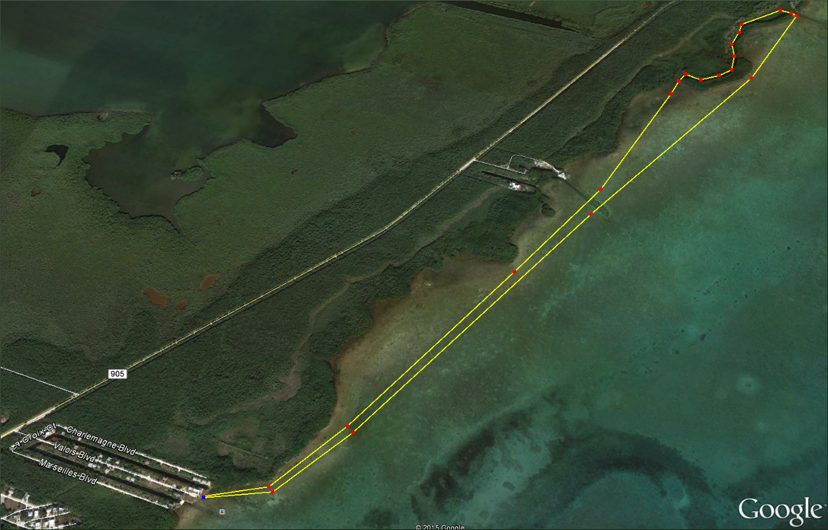
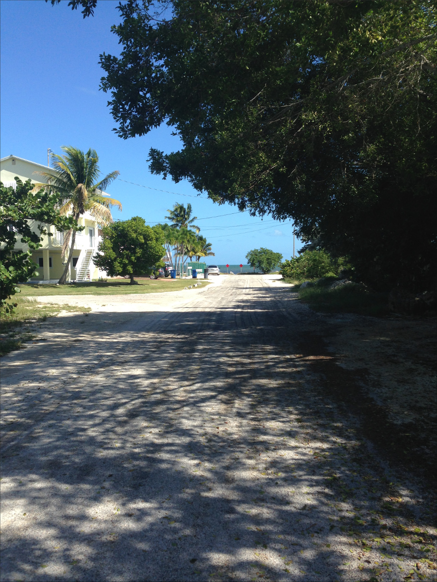
It’s easy to find on a map because of the street names; they’re all French: La Croix Ct, Charlemagne Blvd, Valois Blvd and Marseilles Blvd.

There’s a somewhat public boat dock and launch site at the end of Valois Blvd.

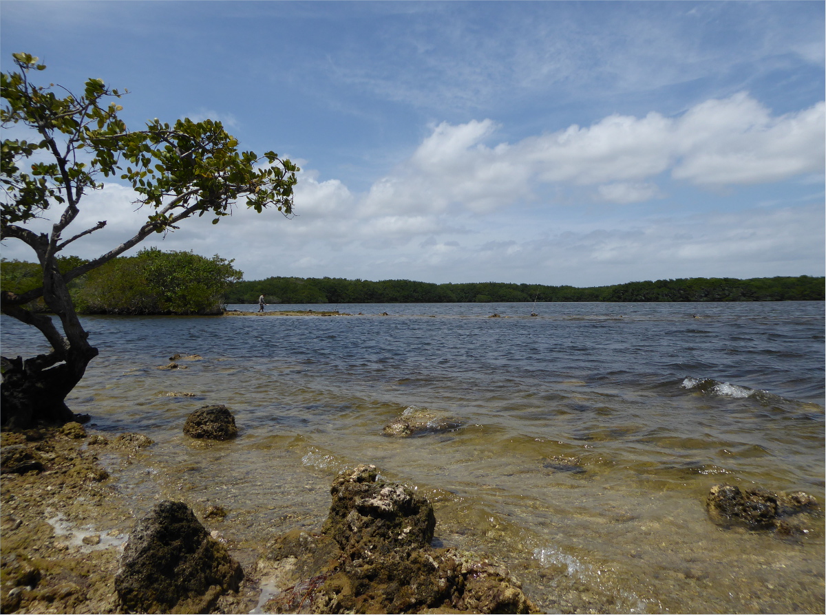
A half hour paddle takes you to a secluded channel fringed on one side by a mangrove swamp and on the other by a rockland hammock.


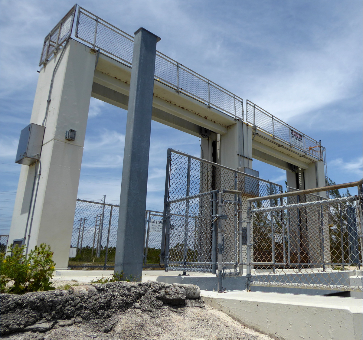
Wooden poles prevent all but the smallest of water vessels from passing into it.
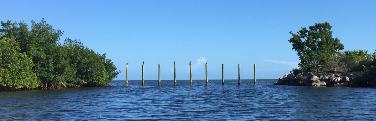

The shallow channel was obviously dredged, but whether it was dredged during the early part of the last century by developers to build houses or after the Cuban Missile Crisis by the government to transport nuclear missiles, we couldn’t say.
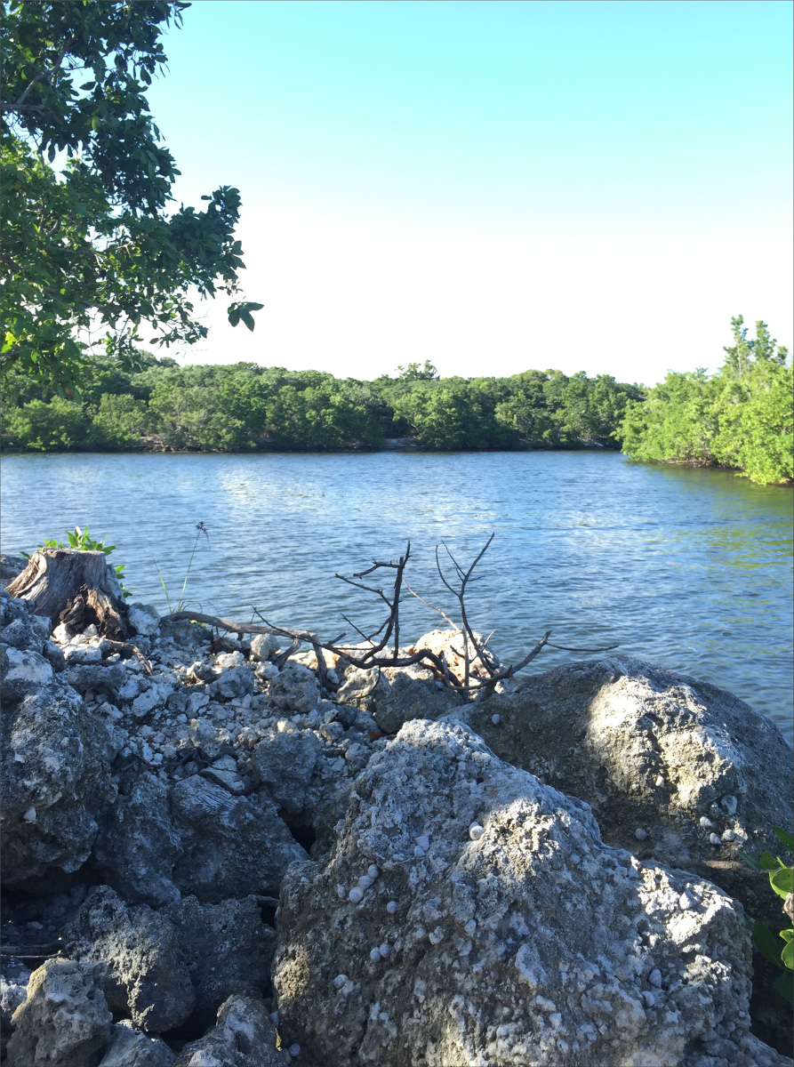
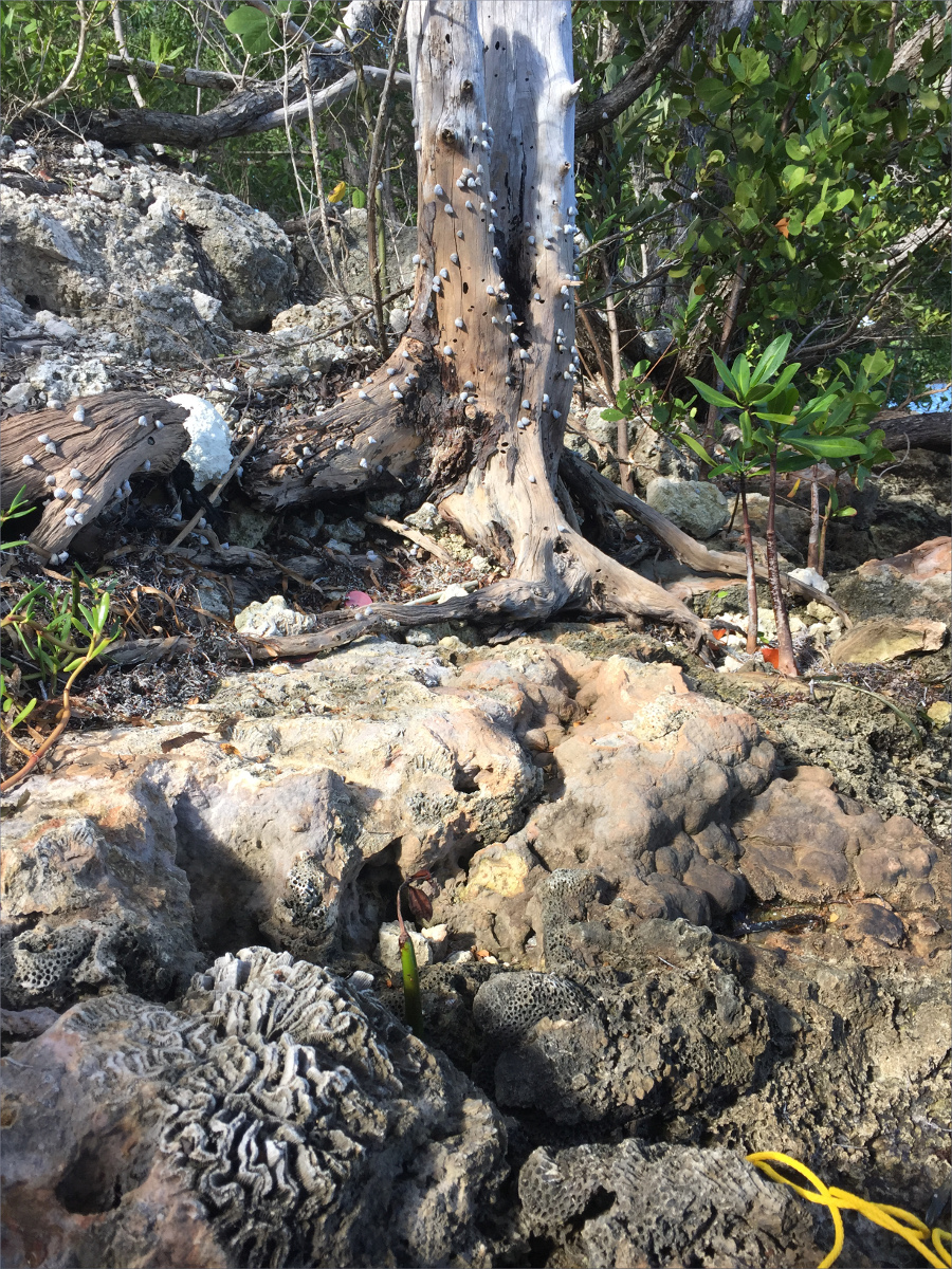
What looked like a crumbled concrete slab stretched along much of the rockland hammock. We saw many birds – cormorants, pelicans, egrets and herons – but my favorite find was chitons.

Chitons are a primordial animal and have the sharpest teeth on the planet, and some species have evolved into carnivores. We were also impressed by the blown up chunks of keystone coral.

A mound of logs laid horizontally piqued our curiosity.

On our way home we stopped at Alabama Jack’s.

